Terrain Simple Mode
Function Description: Terrain Simple Mode combines SubSample, SOR Filter, Classify Ground Points, Point Cloud to DEM, Point Cloud to DSM, and Point Cloud To Contour into a single workflow. Select the functions required for the current task and configure the input point cloud and parameters; the software then automatically runs the selected processing steps.
Steps
- On the Terrain page, select the functions to include in the current workflow.

Terrain workflow function selection
The Terrain workflow provides the following optional functions:
- SubSample: Reduces the number of points and the processing load of subsequent steps.
- SOR Filter: Removes outlier noise from the point cloud.
- Classify Ground Points: Classifies ground points from the input point cloud.
- Point Cloud to DEM: Generates a DEM image from point cloud data.
- Point Cloud to DSM: Generates a DSM image from point cloud data.
- Point Cloud To Contour: Generates contour vectors from point cloud data.
Each function can be selected or cleared independently. Only selected functions are included in the current run, and the parameter dialog displays pages only for those functions.
- After selecting the functions, click Run on the Ribbon to open the parameter dialog. On the input point cloud page, select the point cloud data to process.
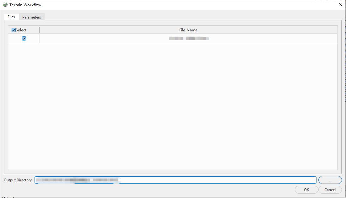
Input point cloud settings
- Open the Parameters tab. Select a function on the left and configure its parameters on the right.
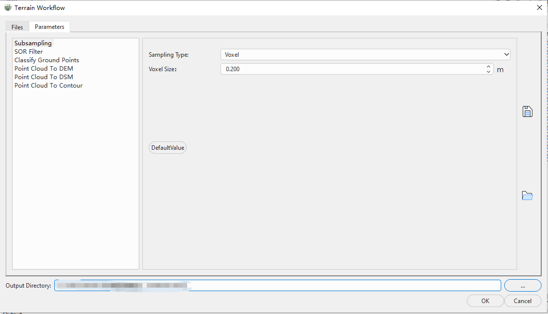
Workflow parameter settings
The parameter area lists all functions selected on the Ribbon. For detailed parameter descriptions, refer to the function pages linked in Step 1.
- After confirming the input point cloud and all parameter settings, click OK. The software automatically runs the selected workflow functions.