Tunnel Section Measurement Calculation
To avoid noise points on the generated ground surface, point cloud classification can be performed beforehand.
Prerequisite: Click the Tunnel Section ![]() button to enter the road section calcul
button to enter the road section calcul
Only when the road section is activated will subsequent calculation buttons be available. During activation, switching projects via the directory and adding/deleting/modifying design data are not allowed.
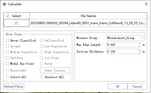
Calculate Measurement Data
1.Click the Calculate Measurement Data ![]() button to open the settings dialog.
button to open the settings dialog.
Calculate Measurement Data
Parameter Description
- Measurement Group: Select the group of measurement data to be calculated.
- Maximum Edge Length: Edges larger than this threshold will be split into shorter edges.
- Section Thickness: The width of point cloud data used to generate the measurement longitudinal section.
- General
- Source Category: The point cloud category used for section generation. Choosing the correct source category is critical; otherwise, the generated result may be incorrect.
Result Example:
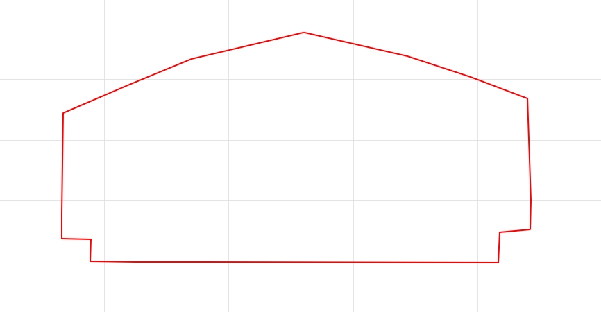
Result Example
The red line represents the generated measurement section. The result is calculated automatically; if it does not meet expectations, manual editing can be performed in the 2D cross-section editor.
Note: Tunnel sections currently only support geometric calculation and section export. For other details, refer to Road Section.
Two Section Comparison
Steps
1.Click the Two Section Comparison ![]() button to open the dialog.
button to open the dialog.

Section Comparison
2.After calculation, the generated tunnel reference section and the tunnel design section will be compared, and the filling/excavation area and total filling/excavation volume will be calculated. Filling and excavation areas are displayed in different colors (customizable).
The total filling/excavation volume is calculated as: half the distance between the previous and next mileage stakes multiplied by the filling/excavation area of the current stake. The start and end mileage stakes only calculate half of the respective distances.
Example: If the mileage stake is K0+80 with filling/excavation area S, the previous stake is K0+72, and the next stake is K0+90, then the volume V = ((80-72)/2 + (90-80)/2) * S. Summing the volumes of all mileage stakes yields the total filling/excavation volume.

Section Comparison Result
3.Click the Export Report button.
Export Section
1.Click the Export Section ![]() button to open the parameter dialog.
button to open the parameter dialog.
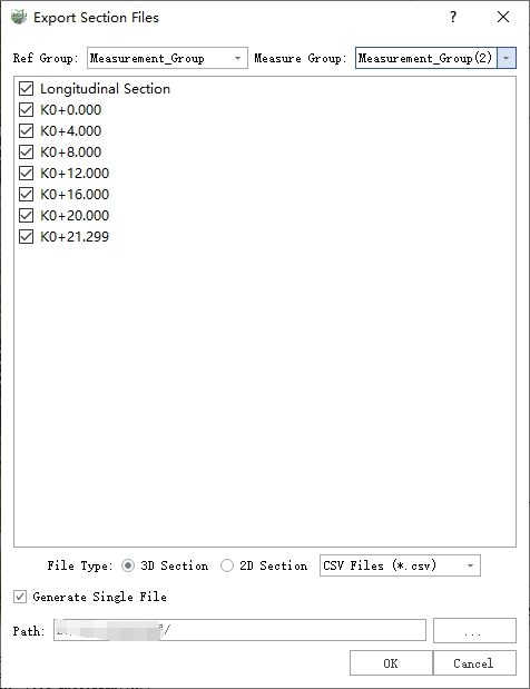
Export Section
Parameter Description
csv: A universal format used internally by the software. Design section imports are read in as .csv section data.
dxf, .shp: Two vector formats that can be imported into third-party software such as AutoCAD to view section results and related data.
Example: Generating a .dxf file, parameter settings are shown below. After setting the output path, click OK to export.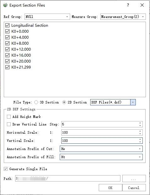
Export Section
Export PDF

Export PDF