Image-based Distress Detection
Function Description: Uses deep learning to detect pavement distress in road images and back-projects the 2D results into 3D point cloud space, creating distress vectors for verification, PCI calculation, and report statistics. It supports six surface distress types: transverse cracking, longitudinal cracking, alligator cracking, potholes, patching, and raveling.
Input Data
Point Cloud Data: Provides the 3D location for the image detection results. If ground classification is available, use the ground class for processing
Image Data: Load photos and an image list file (
*.imglist) matched to the point cloud. Panorama and planar cameras are supported
Photos, the image list, and the point cloud must be correctly matched; otherwise, the back-projected distress position may be offset.
Detection Settings
Operation Steps
1.Click Image-based Distress Detection to open the settings dialog
2.Select the point cloud and source class, and set the detection model, camera, and detection range parameters
3.Select the distress types to detect, and click Detect to run distress detection
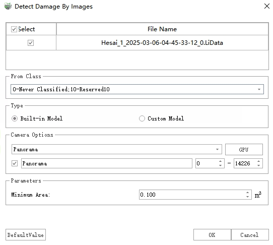
Image-based Distress Detection
Parameter Settings
| Parameter | Description |
|---|---|
| Point Cloud File | Select the point cloud file used for back-projection and distress attribute output |
| Source Class | Select Ground Points when the point cloud is classified. Otherwise, all classes can be selected, but non-pavement points may affect the result |
| Type | Built-in model or custom model (JSON result file) |
| Camera Options | Select a panorama or planar camera and optionally use image IDs to limit the image range included in detection |
| Maximum Distance to Image | Filters distress areas that are too far from the image, where back-projection error may be larger |
| Minimum Area (Area Distress) | Filters area distresses smaller than the specified area. Area distresses include alligator cracking, potholes, patching, and raveling |
| Minimum Length (Linear Distress) | Filters linear distresses shorter than the specified length. Linear distresses include longitudinal cracking and transverse cracking |
| Detection Type | Select the distress types to detect |
Detection Results
Output Results
Vector Polygons: Stored in the "Distress" layer, recording distress type, severity, area, and other information for Distress Verification and PCI calculation
Point Cloud Additional Attributes: Distress point height values are written to the "DistressHeight" attribute
After detection, use Distress Verification to review the results by confidence, remove false detections, modify the type or severity, and add distress missed by automatic detection.
Severity Level Classification (Longitudinal Cracks)
| Level | Crack Width |
|---|---|
| Low | < 10 mm |
| Medium | 10 mm–75 mm |
| High | ≥ 75 mm |
Result Check
Check whether distress polygons fall on the actual pavement, whether distress types are correct, and whether the image and 3D positions are consistent. If the results are globally offset or distress locations are clearly incorrect, first check that the point cloud, photos, and image list are correctly matched.