Point Cloud to DSM
Note: Use all point cloud data or other required point cloud categories to generate the DSM.
Steps
- Click the Point Cloud to DSM
 button.
 - The Point Cloud to DSM dialog box appears. Select the input point cloud and source classes, then configure the tiling method and related parameters according to the output requirements.
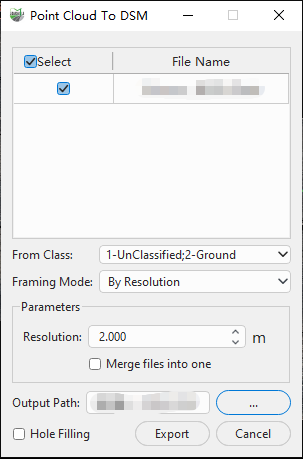
By Resolution Parameters
Parameter Description:
From Class: Select the point cloud classes used to generate the DSM. A DSM represents the elevations of the ground surface and objects above it. Select all point cloud data or multiple required classes according to the output requirements.
Framing Mode: Specifies how the DSM output is organized and tiled. Two modes are available:
- By Resolution: Generates the DSM at the specified spatial resolution. In this mode, you can set the resolution and choose whether to merge multiple input point clouds into one output file.
- By Scale: Organizes and outputs the DSM according to the map sheet rules associated with the specified scale. Available scales are 1:500, 1:1000, 1:2000, and 1:5000.
Resolution(m): Sets the output DSM pixel size in meters. A smaller value produces a higher spatial resolution, while also increasing the output data volume and computational load.
Merge into One File: This parameter is available when By Resolution is selected. When checked, DSMs generated from multiple input point clouds are merged into one output file. When unchecked, separate DSM files are generated.
Note: When outputs are merged, the software processes all input point clouds together. Projects with a large coverage area or high data volume may require substantial memory. Use this option according to the computer configuration and data size.
When By Scale is selected, the dialog box displays the scale, resolution, and buffer parameters.
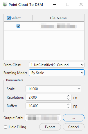
By Scale Parameters
Scale: Sets the target scale used for tiled output. Available options are 1:500, 1:1000, 1:2000, and 1:5000. This parameter is displayed only when By Scale is selected.
Buffer(m): Sets the buffer distance used for scale-based tiling, in meters. This parameter is displayed only when By Scale is selected.
Hole Filling: During the scanning process, occlusion by objects may create internal gaps in the point cloud. When this option is checked, the software automatically fills small gaps.
Output Path: The save location for the output image.
Result: The output files include the .tif image itself and the corresponding .tfw coordinate file.
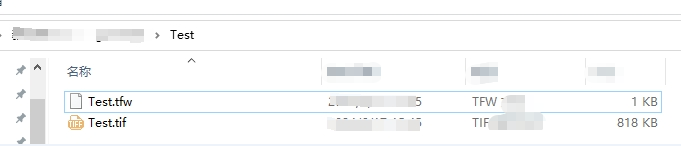
Result Files