Classify by Min Elevation Difference
Summary
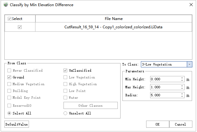
For each point in the data, this function calculates the elevation difference between the lowest point within a specified radius around it and itself. If the elevation difference is between Min Elevation Difference and Max Elevation Difference, that point will be marked as Target Class.
Usage
Click Classify > Classify by Min Elevation Difference.
Settings
- Input Data:The input file can be a single point cloud data or a point cloud data set, which must be opened in the LiDAR360MLS software.
- From Class:Source class(es).
- To Class:Target class.
- Min Elevation Difference (m, default value is"0"):Threshold for the minimum elevation difference.
- Max Elevation Difference (m, default value is"1"):Threshold for the maximum elevation difference.
- Radius (m, default value is"5"):The radius of the area needs to be classified at the current point, which needs to be classified.
- DefaultValue:Click this button to set all parameters as default.