Point Cloud-based Distress Detection
Function Description: Analyzes pavement geometry in high-precision single-line laser point clouds and detects height changes relative to the pavement surface. It supports seven geometrically deformed distress types: rutting, depression, potholes, bumps, swell, corrugation, and shoving. This method does not require road imagery and is suitable for depressions, protrusions, and continuous deformation that can be accurately represented by the point cloud.
Input Data
Point Cloud Data: The point cloud should cover the target road and preserve sufficient pavement detail. Classify ground points first to reduce interference from vehicles, roadside facilities, and other non-pavement points
Lane Line Data: A Lane Line vector layer is required. It is used with lane width and lane counts to define the detection range; without Lane Line data, the road area cannot be accurately limited
Detection Settings
Operation Steps
1.Click Point Cloud-based Distress Detection to open the settings dialog
2.Select the point cloud and source class, and select a Lane Line as the road line
3.Set lane width, left and right lane counts, tolerance, and minimum area according to the road, and click OK to run distress detection
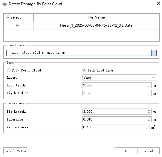
Point Cloud-based Distress Detection
Parameter Settings
| Parameter | Description |
|---|---|
| Point Cloud File | Select the point cloud file covering the target road |
| Source Class | Select Ground Points when the point cloud is classified. Otherwise, all classes can be selected, but classification is recommended to reduce non-pavement interference |
| Road Line | Select a Lane Line vector and use it with lane width and lane counts to define the actual detection range |
| Lane Width | Width of one lane |
| Left Lane Count | Number of lanes on the left side of the road line, based on the line direction from start point to end point |
| Right Lane Count | Number of lanes on the right side of the road line, based on the line direction from start point to end point |
| Tolerance | Depth or height threshold used to identify pavement elevation anomalies. Areas exceeding the threshold are grouped as candidate distress |
| Minimum Area | Filters distress areas smaller than the specified area |
Detection Results
Output Results
Vector Polygons: Stored in the "Distress" layer, recording distress type, severity, area, length, width, height, and other information for PCI calculation and report statistics
Point Cloud Additional Attributes: The height of each distress point is written to the "DistressHeight" attribute. Negative values indicate depressions and positive values indicate protrusions. Point cloud-based results can also be used for fill and cut volume statistics in the report
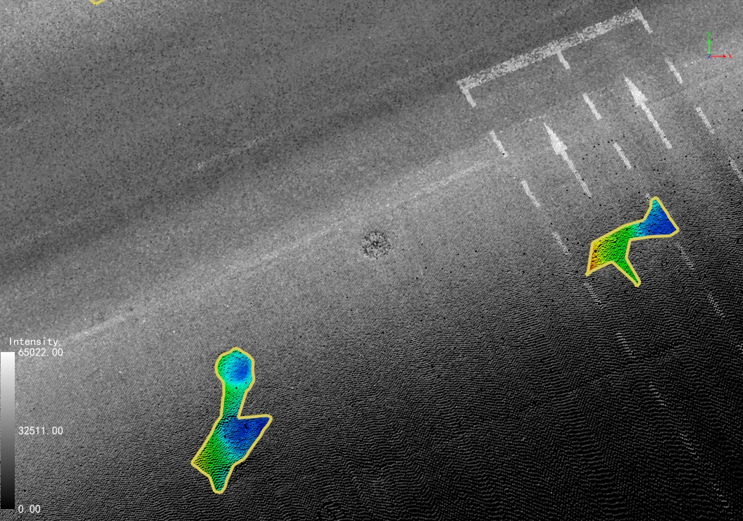
Road Distress Rendering
Result Check
Check whether distress in the "Distress" layer is within the target road and whether the shape and extent of rutting, depression, pothole, and protrusion distress are reasonable. If the coverage is incorrect, check the Lane Line, lane width, and left and right lane count parameters.