Point Cloud To Contour
Function Description: Generate contour vectors from point cloud data.
Note: It is strongly recommended to perform ground point extraction before processing, to avoid slow computation caused by high point cloud density.
Steps
- Click the Point Cloud To Contour
 button.
 - A dialog will pop up:
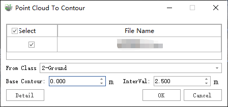
Dialog
Parameter Description:
- From Class: The point cloud category used in the calculation.
Strongly recommended to perform ground point extraction first, to avoid slow computation caused by high point cloud density.
- Base Contour: Default is 0 meters. Contours are generated starting from the base elevation; contour elevations are those differing from the base by integer multiples of the contour interval. Example: If base = 0 and contour interval = 10, the contour elevations will be 0, -10, -20, -30… and 10, 20, 30…
- Interval: Refers to the interval for intermediate contours by default; if unchecked, it refers to the interval for index contours, and so on. For example:
- If Minor contours are checked, "Interval" refers to Minor contour spacing.
- If only Basic contours are checked, "Interval" refers to Basic contour spacing.
- If only Major contours are checked, "Interval" refers to Major contour spacing.
- Detailed Settings:
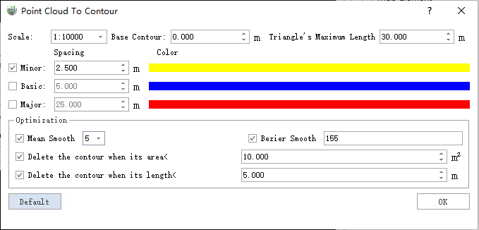
Detailed Settings
- Scale: Eleven scale options are available, each corresponding to a specific contour interval.
- 1:500
- 1:1000
- 1:2000
- 1:5000
- 1:10000 (default)
- …
- Base Contour: Starting elevation for generating contours. Same definition as above.
- Triangle's Maximum Length (m) (default "30"): In the TIN constructed from ground points, triangles with edges longer than this threshold will be ignored for contour generation. In the result, if point cloud gaps exceed this threshold, contours will break at these gaps. To avoid breaks, set this threshold larger than the maximum point cloud gap.
- Minor Contours (checked by default): Also called half-interval contours. Used when basic contours cannot sufficiently represent local terrain.
- Interval (m) (default "2.5"): Elevation difference between adjacent intermediate contours.
- Color (default Yellow): Color of intermediate contours.
- Basic Contours (checked by default): Contours drawn at the basic interval; the main contours used to depict terrain.
- Interval (m) (default "5"): Elevation difference between adjacent basic contours.
- Color (default Blue): Color of basic contours.
- Major Contours (checked by default): Also called emphasized contours. Drawn every 4 basic contours to make elevations easier to read.
- Interval (m) (default "25"): Elevation difference between adjacent index contours.
- Color (default Red): Color of index contours.
- Optimization Options: For smoothing and refining generated contours.
- Smoothing: Options include moving average (3, 5, 7 points) and iterative Bézier smoothing.
- Delete contour when area < (m²) (default "25"): Closed contours smaller than this area are deleted.
- Delete contour when length < (m) (default "5"): Open contours shorter than this length are deleted.
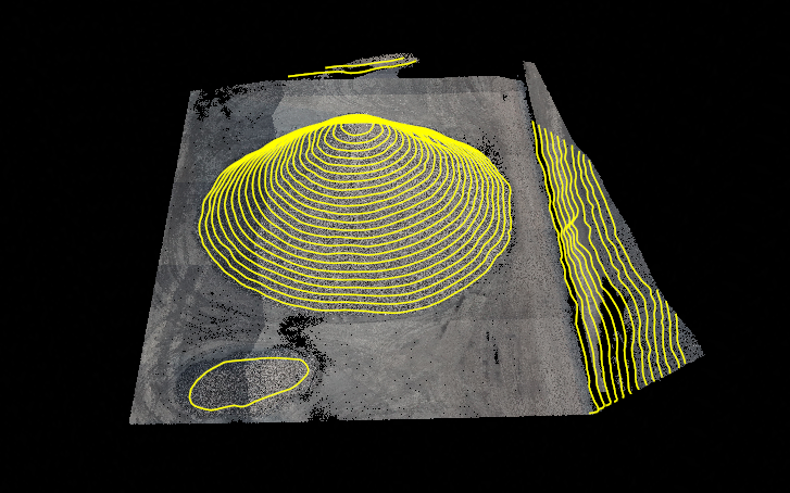
Result File