Ecological Landscape Analysis Based on Imagery
Function Description: Reads the image list in the current project, allows selecting images for analysis, and writes the results into the "Ecological Landscape Analysis" layer after completion.
Camera Select
1.Click Image-based Ecological Landscape Analysis in Urban Forestry 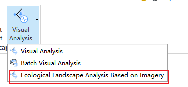 .
This will open the analysis page, as shown below:
.
This will open the analysis page, as shown below:
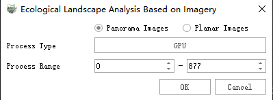
Panoramic Camera Selection
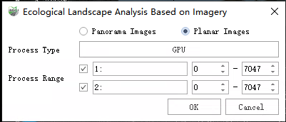
Planar Camera Selection
2.After setting the processing range and processing mode, click OK to start analyzing the images within the specified range. Once the analysis is completed, the results will be written into the Ecological Landscape Analysis layer, as shown below:
GVR: Green View Ratio BVR: Building View Ratio SVR: Sky View Ratio
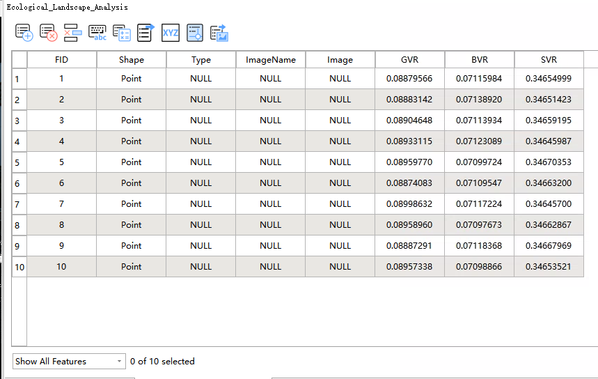
Calculation Result