Online Map
Add XYZ Map
- Click the Map
 button in the Tools panel to open the map settings window, as shown below:
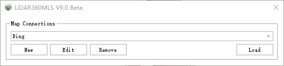
Online Map Settings
- In the window above, select XYZ, then click the New button in the settings page. This will open the detailed setup page for creating a new map, as shown below:
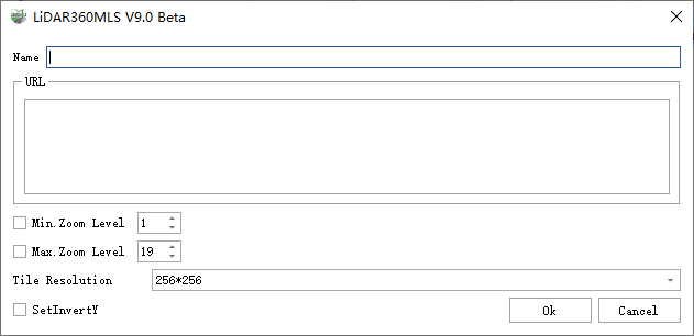
Create New Map
In the interface above:
- Name: The name of the new map.
- URL: The URL address of the online map service.
- Max/Min Zoom Level: The maximum and minimum zoom levels supported by the online map tiles. Higher zoom levels display clearer map details. (The tile zoom level is also limited by the online map service itself, in addition to user settings.)
- Tile Resolution: Set the resolution of tile textures. Currently supports 256×256 and 512×512. (The tile resolution may also be limited by the online map service.)
Invert Y-axis: Some online tile services provide maps with an inverted Y-axis. If the loaded map appears abnormal or fails to align properly with the point cloud, you can check this option.
In the map settings page, click the Edit button to open the window for editing the current online service, as shown below:
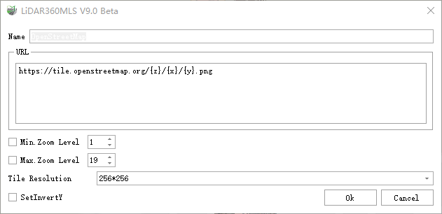
Edit Online Map Service
In the interface above, the settings are the same as when creating a new map. You can modify the options as needed.
Click the Remove button in the map settings page to delete an online map service that is no longer needed.
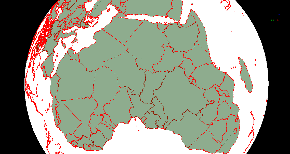
After configuring the map, click the Add button in the map settings page. The online map will then be displayed in the view, as shown below:
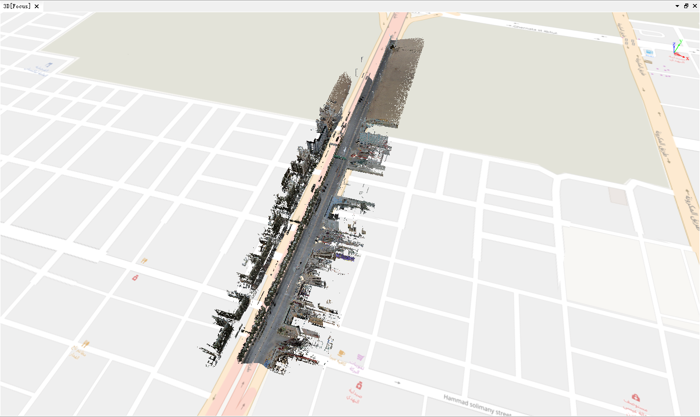
Map Displayed in View
Simultaneously, the currently set map service will appear in the software's directory tree, as shown below:
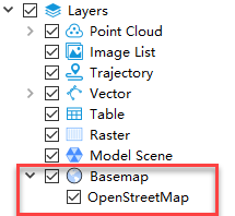
Map Node in Directory Tree
Currently, the URL field has built-in URLs for Bing, Google, Mapbox, OpenStreetMap, and Tianditu online services. Note that Bing, Mapbox, and Tianditu require applying for a token on their respective official websites. Online maps are supported in surveying projects and processing projects, and can be displayed in both the Gaussian and orthophoto windows. Once an online map is successfully configured and displayed, it will be automatically loaded and shown the next time the project is opened.
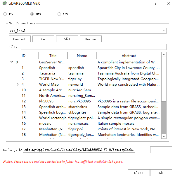
Add WMS Map
- The function activation, map creation, and process are the same as for the XYZ map. After creating the map, click Connect to display a list of all layers supported for loading under the current URL, as shown below:
Map Layer List
- Select the map layer you wish to display, then click the Add button. The online map will be displayed in the view, as shown below:
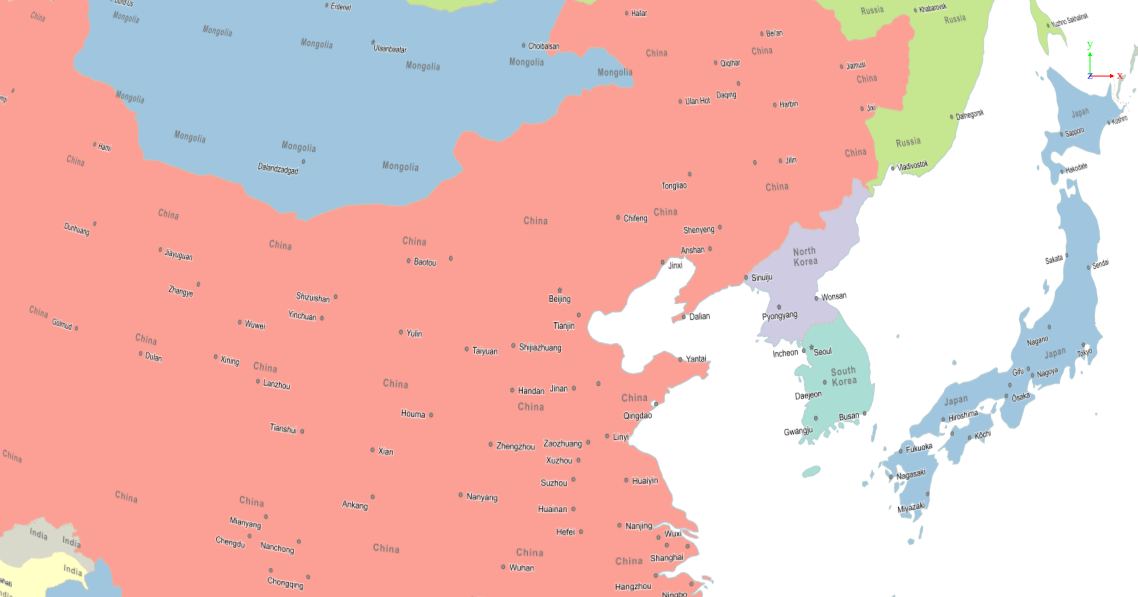
Map Displayed in View
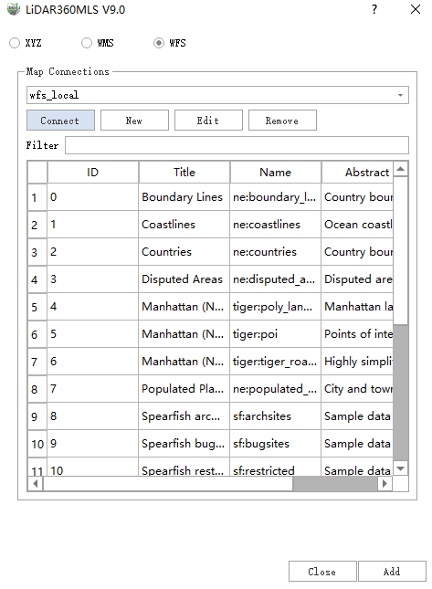
Add WFS Map
- The function activation, map creation, and process are the same as for the XYZ map. After creating the map, click Connect to display a list of all layers supported for loading under the current URL, as shown below:
Map Layer List
- Select the map layer you wish to display, then click the Add button. The online map will be displayed in the view, as shown below:
Map Displayed in View