TIN To DEM
Note: Image generation is only performed in areas with TINs
Steps
1.Click TIN To DEM button.
- The TIN To DEM dialog box appears. Select the TIN used to generate the image and the output type, then configure the tiling method and related parameters according to the output requirements.
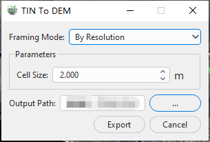
By Resolution Parameters
Parameter Description:
TIN: Select the TIN data in the current project that will be used to generate the image. The software generates the image only within the area covered by the selected TIN.
Output Type: Select the output image type. The screenshot shows DEM selected.
Framing Mode: Specifies how the TIN-generated DEM output is organized and tiled. Two modes are available:
- By Resolution: Generates the image at the specified spatial resolution.
- By Scale: Organizes and outputs the image according to the map sheet rules associated with the specified scale. Available scales are 1:500, 1:1000, 1:2000, and 1:5000.
Resolution(m): Sets the output image pixel size in meters. A smaller value produces a higher spatial resolution, while also increasing the output data volume and computational load.
When By Scale is selected, the dialog box displays the scale, resolution, and buffer parameters.
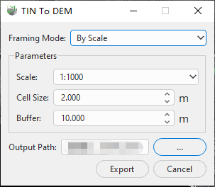
By Scale Parameters
Scale: Sets the target scale used for tiled output. Available options are 1:500, 1:1000, 1:2000, and 1:5000. This parameter is displayed only when By Scale is selected.
Buffer(m): Sets the buffer distance used for scale-based tiling, in meters. This parameter is displayed only when By Scale is selected.
Output Path: where the image is saved.
Results: results files, including the image itself in .tif format, and the corresponding tfw coordinate files
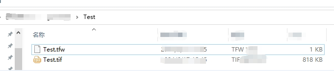
Outcome document