Hybrid Adjustment
Functional Overview
The hybrid adjustment function of image and navigation data can perform joint adjustment by combining the imported aerial triangulation results while conducting strip adjustment of point cloud, reducing errors between point clouds and aerial triangulation results.
Usage
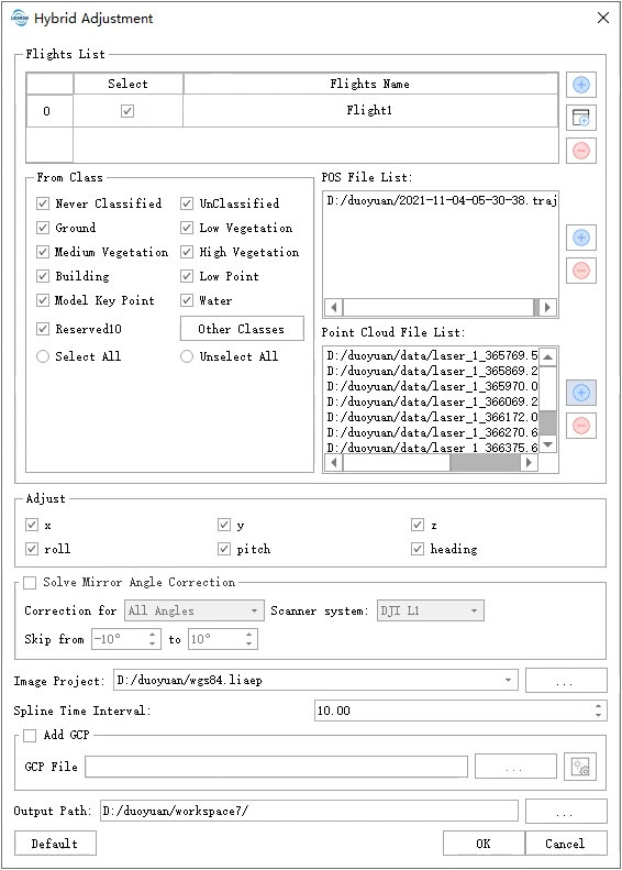
The operations of inputting flight data, trajectory, point cloud and setting parameters (adjustment, time interval, mirror error), control points, etc. for joint image strip adjustment are the same as those for single-strip adjustment in Trajectory Adjustment function. You can refer to that function for settings.
Note: Joint image strip adjustment only supports a single strip participating in the adjustment and does not support setting multiple strips.
Joint image strip adjustment supports selecting categories of point clouds involved in the adjustment by default with all options checked.
In the Image Project column, select the image project (*.LiAep) that needs to participate in the adjustment.
Note: Only image projects containing connection point information can perform joint adjustments.
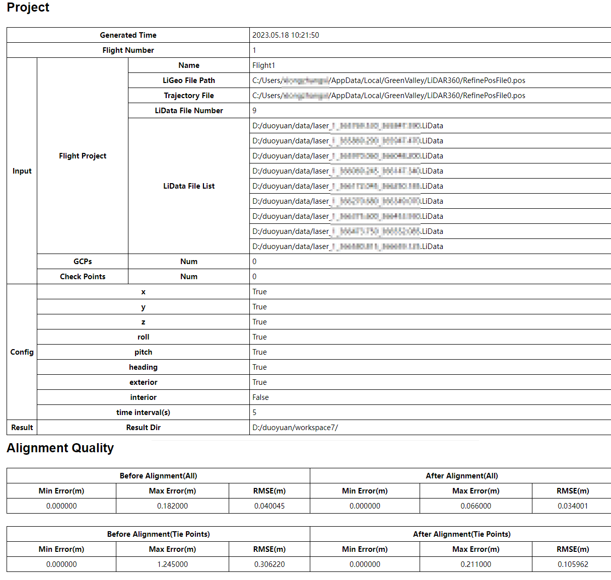
The output path is where result files will be stored after running this function. The result files include corrected point clouds, corrected flight trajectories, corrected aerial triangulation results and statistical quality HTML reports.
After adding all data, click "Confirm" button and software will automatically perform strip adjustments and correct point cloud data.
Once correction is completed, software will generate an HTML accuracy report which you can open by clicking on it.