Flow Direction
Functional Overview
This tool creates a raster of flow direction from each cell to its steepest downhill neighbor using the D8 method. The D8 flow direction method models the flow direction from each cell to its steepest downhill neighbor. The output of the Flow Direction tool running with D8 flow type is an integer raster with values ranging from 1 to 255.
Notes:
If a cell is lower than its eight adjacent cells, it will be assigned the lowest value of its neighbors, and the flow direction will be defined toward this cell. If multiple adjacent cells have the same lowest value, the cell is still assigned this value, but the flow direction is determined using one of the methods described below. This can be used to filter single-cell sinks considered as noise.
If a cell's z-value changes equally in multiple directions and the cell is part of a sink, its flow direction will be considered undefined. In this case, the cell's value in the output flow direction raster will be the sum of these directions. For example, if the z-value changes equally to the right (flow direction = 1) and downward (flow direction = 4), the cell's flow direction will be 1 + 4 = 5. This tool can be used to mark cells with undefined flow directions as sinks.
If a cell's z-value changes equally in multiple directions and the cell is not part of a sink, a lookup table defining the most probable direction will be used to assign the flow direction. See Greenlee (1987).
Principle Description
One key aspect of deriving hydrological characteristics from a surface is determining the outflow direction from each cell in the raster. This is accomplished using the Flow Direction tool.
The tool takes a surface as input and outputs a raster showing the outflow direction from each cell. Flow direction is determined by the steepest descent direction or maximum drop direction from each cell. The flow direction calculation is as follows: maximum_drop = change_in_z-value / distance * 100 The distance is calculated between cell centers.
If the cell size is 1, the distance between two orthogonal cells is 1, and the distance between two diagonal cells is 1.414 (square root of 2). If multiple cells have the same maximum drop direction, the neighborhood is expanded until the steepest descent direction is found. Once found, the output cell is encoded with a value representing this direction.
If all neighboring cells are higher than the processing cell, the processing cell is treated as noise and filled with the lowest value of its neighbors, with flow direction toward itself. However, if a single-cell sink is near the actual edge of the raster or has at least one NoData cell as a neighbor, it cannot be filled due to insufficient neighborhood information. For a cell to be considered a true single-cell sink, all neighborhood information must be present.
If two cells flow into each other, they are both sinks and have undefined flow directions. This method of deriving flow direction from a Digital Elevation Model (DEM) is described in Jenson and Domingue (1988).
Usage
Click Terrain > Hydrologic Analysis > Flow Direction.

Parameter Settings
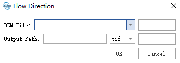
- Input File: Select the path to the raster data for analysis (.tif file).
- Output Path: Select the output file path. This output raster shows the flow direction from each cell to its steepest downhill neighbor using the D8 method. The output is integer type.
References
@inproceedings{
    author={Greenlee, D. D.},
    title={Raster and Vector Processing for Scanned Linework},
    booktitle={Photogrammetric Engineering and Remote Sensing},
    year={1987},
}

@inproceedings{
    author={Qin, C., Zhu, A. X., Pei, T., Li, B., Zhou, C., & Yang, L},
    title={An adaptive approach to selecting a flow partition exponent for a multiple flow direction algorithm},
    booktitle={International Journal of Geographical Information Science},
    year={2007},
}