Fill Sinks
This tool removes small imperfections in data by filling sinks in digital terrain model rasters. Sinks are cells with undefined watershed direction where all surrounding cells are higher. The output data type is fixed as float, and the output NoData value is fixed as -99999.
Principle Description
The Fill Sinks tool uses functionality equivalent to focal flow, flow direction, sink, watershed, and region filling tools to locate and fill sinks. The tool executes iteratively until all sinks within the specified z-limit are filled. While filling sinks, additional sinks may be created at the boundaries of filled areas, which will be removed in subsequent iterations.
Usage
Click Terrain > Hydrological Analysis > Fill Sinks.
Parameter Settings
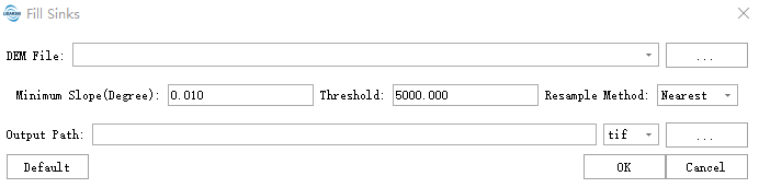
- DEM File: Select the path to the DEM file for analysis. Supports TIFF, TIF, IMG, and DAT formats. Should be a single-band file.
- Minimum Slope (Degree): Maintains a minimum slope between adjacent cells to avoid creating completely flat areas (which may cause flow direction calculation failures). Typically set between 0.01 (default) and 0.1, depending on DEM resolution. High-resolution DEMs (e.g., 1m LiDAR DEM) can use smaller values (e.g., 0.001), while low-resolution DEMs (e.g., 30m SRTM) require larger values (e.g., 0.05).
- Threshold: Adjusts the precision of hydrological analysis. Default value: 5000. Higher thresholds yield more accurate results but slower processing speeds. Higher thresholds (e.g., above 5000) make the algorithm process data more precisely, reducing errors but increasing computation time. Can be reduced to 2000-3000 for quick preview results.
- Resampling Method: Options include nearest neighbor sampling, bilinear sampling, and cubic convolution approximation.
- Output Path: Select the output directory path. The output raster represents the surface raster with filled sinks.
References
@inproceedings{
    author={Planchon, O., Darboux, F.},
    title={A fast, simple and versatile algorithm to fill the depressions of digital elevation models},
    booktitle={Catena},
    year={2002},
}

@inproceedings{
    author={Tarboton, D. G., R. L. Bras, I. Rodríguez-Iturbe},
    title={On the Extraction of Channel Networks from Digital Elevation Data},
    booktitle={Hydrological Processes},
    year={1991},
}