Sky View Factor
Function Overview
The Sky View Factor is commonly used to assess the degree of sky obstruction by buildings in complex urban environments. It is an important indicator in urban morphology.
Usage
Click on Terrain > Sky View Factor.
Parameter Settings
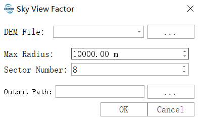
- Input DEM File: The input DEM file. For information on generating a DEM, see DEM Generation. This input provides the topographic elevation data used for analysis, which is the foundation of all calculations. Terrain undulations are the cause of sky obstruction.
- Max Radius: Defines the search radius within which the algorithm looks for potential terrain that might obstruct the sky. The default value is 10000 m. Setting it too small will ignore distant high mountains, leading to inaccurate results; setting it too large will drastically increase computation time and may include irrelevant terrain. Suggestion: Set it to 1.5 to 2 times the scale of the largest mountain or terrain feature in your study area. For example, when studying a valley, the radius should be greater than the valley’s width.
Sector Number: Refers to how many equal-angle sectors the full horizon (360 degrees) is divided into, and then the obstruction is calculated independently in each sector. The default value is 8. A smaller value (e.g. 8) results in faster computation but coarser results, suitable for quick previews or very smooth terrains. A larger value (e.g. 32 or 64) results in slower computation but more accurate results, better capturing obstructions in complex terrains (such as narrow valleys). It is recommended to start with 16 to balance accuracy and speed.
Resampling: Performs resampling processing based on the raster pyramid. Different pyramid levels and resolutions are determined by the specific data characteristics, with each successive layer downsampled at a 2:1 ratio.
- Resolution: The resolution of the raster. For raster data with fewer than 1000 rows or columns, lower resolution levels will not be displayed. Higher selected resolutions yield more accurate results but may cause processing failures due to insufficient hardware resources.
- Resampling Method: The method used for raster resampling.
Output Path: Specify the output path for the results.