Leaf Area Index
Summary
The Leaf Area Index (LAI) is one of the most basic parameters that characterizes the forest canopy structure. It is defined as half of the surface area of all leaves projected on the surface area of a unit(Chen et al.,1991). LAI can be calculated from the normalized LiDAR vegetation points.
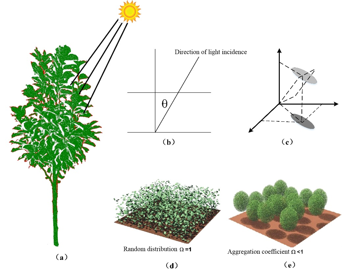
(a) Direction of light incidence, (b) the zenith angle refers to the angle between the incident ray and the vertical direction, (c) the projection of the leaf in the vertical direction, (d) describes the extinction coefficient, and (e) describes the aggregation coefficient.
Principle Description
LAI value is calculated using the following equation:

The average scan angle is calculated from LiDAR points using the following equation:

The Gap Fraction (GF) is calculated using the following equation:

Usage
To generate the LAI, navigate to ALS Forest > Forest Metrics > Leaf Area Index.
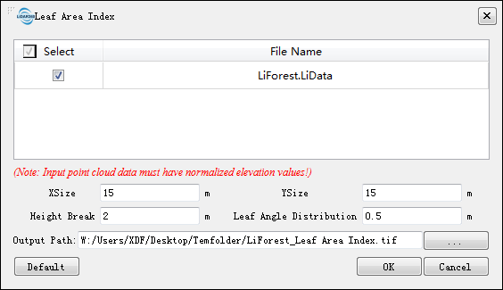
Settings
- Input Data: Ensure that each input point cloud data is Normalize by DEM or Normalize by Ground Points. The input file can be a single file or multiple data files. Point cloud data should be opened in LiDAR360 before being processed.
- XSize (meter)(default value is "15"): The length of a grid size should be greater than an individual tree crown width. For most forest types, the grid size should be greater than 15 meters.
- YSize (meter)(default value is "15"): The width of a grid size should be greater than an individual tree crown width. For most forest types, the grid size should be greater than 15 meters.
- HeightBreak (meter)(default value is "2"): Usually, it is desirable to ignore points below a particular elevation to avoid influence low vegetations (e.g., grass and shrub). The "HeightBreak" parameter can be set in many ALS forestry tools, allowing users to ignore points below a specified height (a value of 2 m is commonly used).
- Leaf Angle Distribution: A mathematical expression of leaf probability distribution in three-dimensional space, which is related to vegetation type, leaf angle, and beam direction. According to the empirical formula, the user can determine the value of leaf angle distribution according to the actual situation of the forest. Studies have shown that the elliptic distribution of leaf angle, which has a leaf angle distribution value of 0.5, may be applicable to the actual situation.
- Output Path: Path of the output file. A corresponding raster file (*.tif format) will be generated for each input point cloud data.
- DefaultValue: Restore the default parameters.
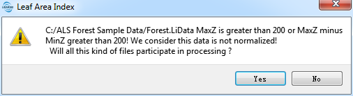
Note: Only when the point cloud data is loaded in the software can you use the Leaf Area Index function; otherwise, the message "There is no point cloud data meeting the conditions of calculation!" will pop up. If the maximum Z value of the point cloud is greater than 200 m or the maximum Z minus the minimum Z is greater than 200 m, the data is not considered to have been normalized, and the prompt information shown in the figure below will pop up. Click “YES” to keep using this type of data in the operation; otherwise, click "NO" and reselect the input data file.
    @inproceedings{
        author={Chen J M and Black T A},
        title={Measuring leaf area index of plant canopies with branch architecture},
        booktitle={Agricultural and Forest Meteorology,57(1-3): 1-12},
        year={1991}
    }
    @inproceedings{
        author={Richardson J J},
        title={Modeling approaches to estimate effective leaf area index from aerial discrete-return LiDAR},
        booktitle={Agricultural and Forest Meteorology, 149 (6): 1152-1160},
        year={2009}
    }