Geology and Mineral Index Calculator
Function Overview
This function is based on the combination of surface reflectivity of two or more wavelengths to highlight the specific characteristics of the land object, which includes the spectral index of geology and minerals.
Usage
Click Spectral > Spectral Index > Geological and Mineral Index Calculator.
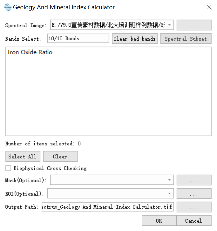
Click the Spectrum Subset button to select the band of the hyperspectral image, and the spectral index it supports to calculate will also change accordingly.

Parameter Settings
- Input hyperspectral image data: Input the hyperspectral image data file. The format supports tif, tiff, img, dat. The data must have wavelength information.
- Band Selection: Select the band of the hyperspectral image.
- Supported spectral index: Automatically match the calculated spectral index according to the wavelength information of the selected band.
- Biophysics Cross-test: The process of verifying the correlation between the spectral index and the actual biophysical parameters of the land objects to ensure the scientificity and reliability of the index results. It is not checked by default.
- ROI: After selection, only the minimum external rectangle in the ROI area is calculated exponentially.
- Mask: Only the effective area of the mask is calculated exponentially after selection.
- Output path: The generated tif path.