Calculate Forest Metrics by Forest Stand (TLS)
Functional Overview
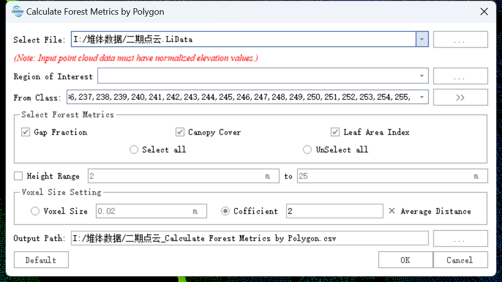
Calculates forest parameters for point cloud data within a forest stand range, including Gap Fraction, Canopy Cover, and Leaf Area Index; a single CSV file will be generated.
Usage
Click TLS Forestry > Calculate Forest Metrics by Forest Stand
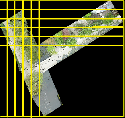
As shown in the figure, each point cloud is divided by a yellow grid along the X, Y, and Z directions (Z direction not shown); grids with and without point clouds are both included in the statistics.
Parameter Settings
- Input Data: Ensure every input point cloud is Normalized; the input can be a single file or a dataset, and must be opened in LiDAR360.
- Select Forest Metrics: Supports Gap Fraction, Canopy Closure, and Leaf Area Index.
- Height Range (m) (Unchecked by default, 2m to 25m): Only point clouds within this Z-value range participate in the calculation; this only applies to Canopy Cover.
- Grid Size Settings:
- Grid Size (m) (Default "0.25"): The size of the 3D grid used to divide the point cloud within the statistical unit.
- Factor (Default "2"): A factor to automatically calculate the 3D grid size based on average point spacing (Grid Size = Factor * Average Point Spacing).
- Output Path: The output directory; a CSV file containing point cloud locations, names, and calculated metrics will be generated.