3D Tiles Reprojection
Functional Overview
Convert the coordinates of 3D Tiles data, mainly used to transform models from non-WGS84 Earth-Centered, Earth-Fixed coordinate systems to the coordinate system supported by the 3D Tiles standard format (default EPSG:4978).
Usage
Click Data Management > Projection and Coordinate Transformation > 3D Tiles Reprojection
Parameter Settings
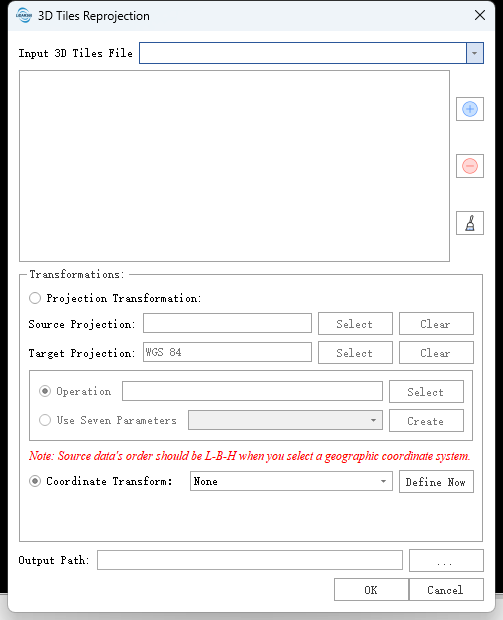
- Input 3D Tiles File: Input 3D Tiles data file.
- Coordinate Transformation
- Projection:
- Source Projection: Set the coordinate system of the input data.
- Target Projection: Select the coordinate system for the output data, default is EPSG:4978.
- Transformation Method: Optional Operation and Seven Parameters, refer to Reprojection.
- Coordinate Transformation: Users can define and apply coordinate transformation relationships such as Seven Parameters, Four Parameters, 3D Affine Transformation, XYMultiply, Linear Transformation, etc. for the point cloud. Refer to Create Transformations.
- Projection:
- Output Path: Output the converted 3D Tiles data to the specified path.