Panorama
Function Overview
The context menu for panorama data in the layer management tree provides data import and removal functions, and operations for individual panorama data, such as information display, opening the containing folder, renaming, zooming to layer, opening the panorama window, and removal.
Data Type Context Menu
Import Data: Imports panorama data. LiDAR360 supports the
*.imglistpanorama list format. The import workflow is basically the same as the tool on the project toolbar. See Add Data.
Remove All: Removes all panorama data from the software.
Data Context Menu
Information: Displays basic information of the
imglistfile, including the data path, minimum and maximum X/Y/Z coordinates, and resolution.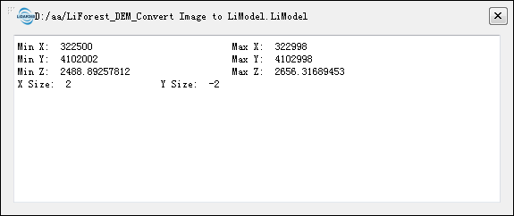
Open Containing Folder: Opens the folder where the file is located.
Rename: Renames the file.
Zoom to Layer: Calculates the bounding box of the current panorama data and zooms all windows that have opened this data to the bounding box extent.
Open Panorama Window: Opens the panorama window to browse the panorama image data.
Remove: Removes the selected panorama data from the software and closes the corresponding panorama display window.
Note: Except for Import Data and Remove All, the other context menu functions apply to all windows that have loaded the panorama data.