Flow Accumulation
This tool creates a raster of accumulated flow for each cell. Flow accumulation helps identify areas of surface water convergence, enabling the extraction of river networks. By setting flow thresholds, the starting points and paths of rivers can be determined. The tool supports three flow direction modeling algorithms while calculating accumulated flow: Eight Directions (D8), Multiple Flow Directions (MFD), and D-Infinity (Dinfinity) methods.
Principle Description
The Flow Accumulation tool calculates the accumulated flow, which is the accumulated weight of all cells flowing into each downhill cell in the output raster. The accumulation is based on the total number or fractional proportion of cells flowing into each output raster cell. The currently processed cell is not included in the accumulation. Output cells with high flow values indicate concentrated flow areas that can identify stream channels, while output cells with zero flow represent local topographic highs that can identify ridges.
Usage
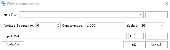
Click Terrain > Hydrologic Analysis > Flow Accumulation.
Parameter Settings
- DEM File: Select the path to the DEM file for analysis. Supports TIFF, TIF, IMG, and DAT formats. Should be a single-band file.
- Update Frequency: Defines the frequency of synchronizing intermediate results between threads during parallel computation. It specifies how many cells are accumulated before performing a global synchronization of the shared "flow accumulation values." Default value: 0 (no updates if set to 0).
- Higher values (e.g., 500→1000): Reduce synchronization frequency, improve computation speed (suitable for large datasets), but may slightly reduce accuracy.
- Lower values (e.g., 100→10): Increase synchronization frequency, yield more accurate results, but computation is slower (useful for error correction in complex terrain).
- Convergence Threshold: Defines the precision criterion for stopping iterative calculations, i.e., the maximum allowable change in flow accumulation values between iterations.
- Smaller values: Require higher precision, increase iteration count, and lengthen computation time.
- Larger values: Allow greater error tolerance, faster computation, but reduced accuracy. Minimum value: 0, Default value: 1.1.
- Output Path: Select the output file path for the raster representing accumulated flow per cell.
Note:
1. If the input flow direction raster is not created using the Flow Direction tool, the defined flow may form loops. If the flow direction contains loops, the flow will be trapped in an endless infinite cycle.2. Cells with undefined flow directions will only receive flow; they will not generate any downstream flow. For input D8 flow direction rasters, cells with values other than 1, 2, 4, 8, 16, 32, 64, or 128 are considered to have undefined flow directions.
References
@inproceedings{
    author={Schenk, S. K., J. O. Domingue},
    title={Extracting Topographic Structure from Digital Elevation Data for Geographic Information System Analysis},
    booktitle={Photogrammetric Engineering and Remote Sensing},
    year={1988},
}

@inproceedings{
    author={Tarboton, D. G., R. L. Bras, I. Rodríguez-Iturbe},
    title={On the Extraction of Channel Networks from Digital Elevation Data},
    booktitle={Hydrological Processes},
    year={1991},
}