Spectral Angle Classification
Function Overview
This function is a remote sensing image classification method based on spectral similarity, and determines the geographic category by calculating the angle between the cell spectrum and the reference spectrum. There are two modes: one is to use the 360 built-in defined spectral library or imported spectral library as the reference spectrum, and the other is to use the ROI region to extract the average spectrum of the ROI region as the reference spectrum.
Usage
Click Spectrum > Spectral Angle Classification.
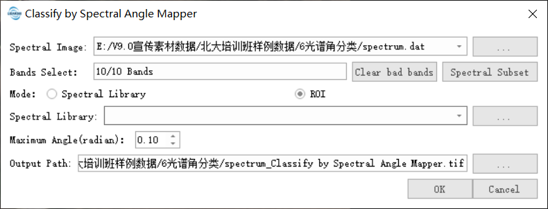
Click the Spectrum Subset button to select the band for spectral angle classification calculation.

Parameter Setting
- Input hyperspectral image data: Input the hyperspectral image data file. The format supports tif, tiff, img, dat.
- Band Selection: Select the band to participate in the calculation.
- Mode: Choose to use the spectral library or ROI area.
- Spectral Library: Import the spectral library or ROI's gpkg. ROI supports importing xml files exported by ENVI. In the GPKG file, each layer represents a feature class, and the layer name serves as the category name for the features.
- Maximum Spectral Angle: Set the maximum spectral angle, which is smaller than this angle and is considered to be the same category.
- Output path: The generated tif path.