Classify Top Surface
Functional Overview
The Top Surface Classification function is designed to reclassify points in a point cloud that represent the highest elevation at each location. This classification is essential for generating accurate Digital Surface Model(DSM), which are commonly used in various applications such as urban planning, environmental assessment, and mapping projects.
Usage
Click Classify >Classify Top Surface。
Parameter Settings
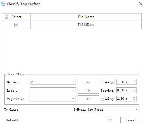
- Input Data:The input file can be a single point cloud data file or a point cloud dataset. The data to be processed must be opened in LiDAR360 software.
- Ground:The point class representing ground points to be classified.
- Roof:The point class representing building roof points to be classified.
- Vegetation:The point class representing vegetation points to be classified.
- Spacing:The point spacing used for classifying points from different source classes into the target class.
- To Class:The target class for classification.