Generate DSM from Image Project
Function Overview
If the collected aerial triangulation data does not contain LiDAR point clouds, this function can generate a DSM from the image project for subsequent DOM mosaicking.
Usage
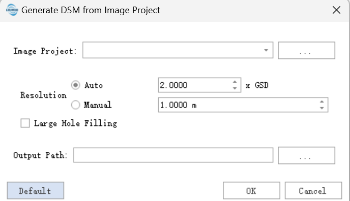
- Click Generate DSM from Image Project. In the dialog box, select the image project to process.
- The resolution parameter determines the spatial resolution of the output DSM in meters. Automatic resolution is used by default. When the collected images contain large weak-texture areas, such as water bodies, select the large-hole filling parameter to preserve DSM completeness in weak-texture areas.
- After confirming the parameters, click OK to run Generate DSM from Image Project.
Note: Only image projects that have completed image alignment can run Generate DSM from Image Project.