ASCII Data Reprojection
Summary
Transform the X, Y, Z information stored in the ASCII data to other Coordinate System. All the other attributes in ASCII file will be kept.
Usage
Click Data Management > Projections and Transformations > ASCII Data Reprojection.
Settings
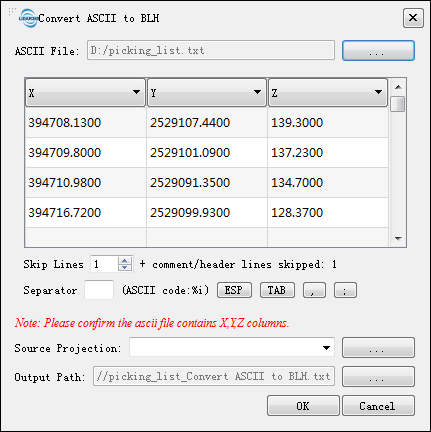
- Input ASCII Data: Input an ASCII file. The supported formats include .txt and .CSV.
- Coordinate System of Current Data: Select the coordinate system of current point cloud file
- Skip Lines: The number of lines that need to be skipped for the currently selected ASCII data (usually description information or column headers).
- Separator: The separator of each component of the selected ASCII data.
- Source Projection: Projection information of the selected ASCII data.
- Output Path: Output the converted file to the specified path.