Convert Point Cloud to 3D Tiles
Overview
The Convert Point Cloud to 3D Tiles tool allows users to convert LiData point clouds to the 3D Tiles format.
Usage
Navigate to Data Management > Conversion > Convert Point Cloud to 3D Tiles and click the option.
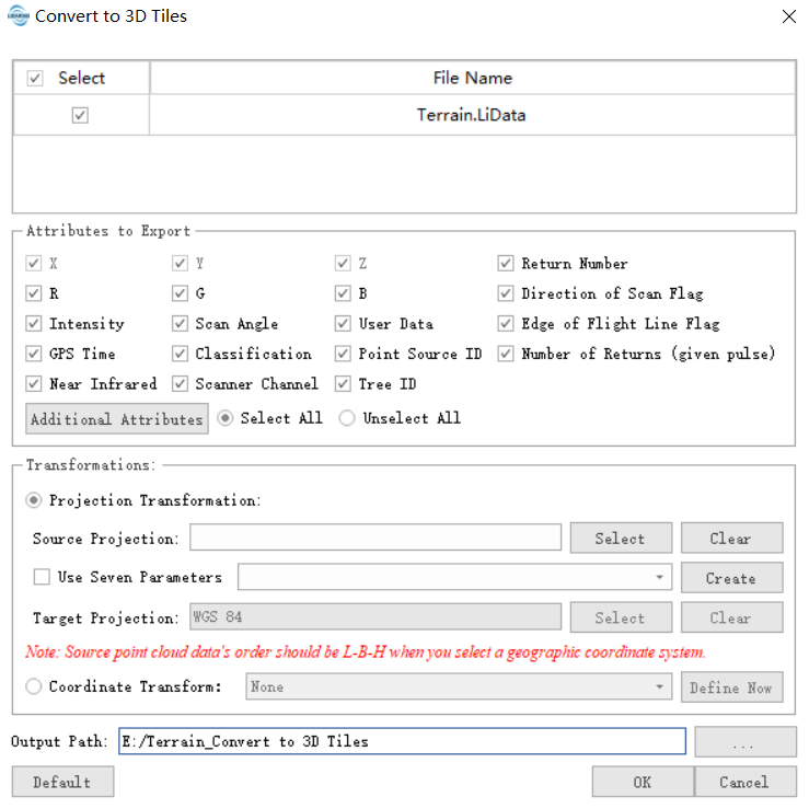
Parameter Settings
- Input Data: The input file can be a single point cloud file or multiple files. Supported file format: *.LiData.
- Exported Attributes: Users can select the attributes to be exported, including basic and additional attribute types.
- Coordinate Transformation: Refer to Importing Data for more details.
- Output Path: The folder path where the converted files will be saved after execution.