Define Projection
Function Description:The projection definition tool supports standardized modification of the Well-Known Text (WKT) metadata for spatial reference systems stored in the Gaussian model file header. A detailed introduction will be provided below.
Steps:
1.Upon clicking the Define Projection button, the parameter configuration interface will be displayed.
2.Interface:
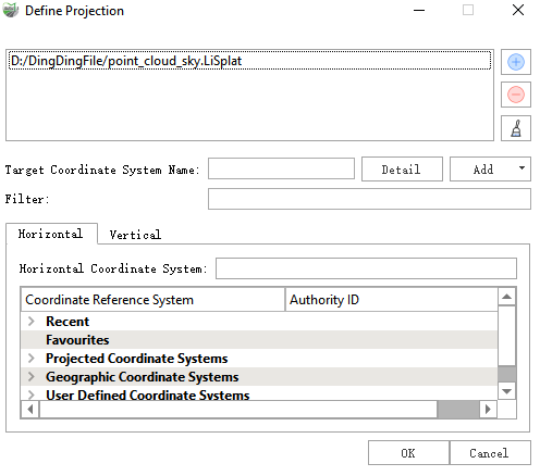
Parameter Setting
- Input Data: Select the Gaussian model file(s) requiring projection definition. The tool supports input of individual or multiple files with .xml or .LiSplat extensions.
- Target Coordinate System Name: The selected Well-Known Text (WKT) definition of the spatial reference system stored in the input Gaussian model file header will be processed, and upon execution, the target coordinate system metadata will be written to the designated location in the source data file header.