Raster To Contour
Function Description: Contours are closed curves on a topographic map that connect points of equal elevation. Generating contours from raster means connecting the positions in raster data (grid data) that share the same elevation value, thereby forming contours.
Note: "Raster" here refers specifically to elevation
.tiffiles generated by the Point Cloud to DE(S)M or TIN to DE(S)M functions.
Steps
- Click the Raster To Contour
 button.
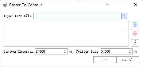
 - A dialog will pop up:

Dialog
Parameter Description:
- Input Tiff File: The input DEM file in
.tifformat. You can select already-loaded Tiff data via the dropdown menu.- Click (+) to load a Tiff file.
- Click (−) to delete a loaded file.
- Clear all loaded files.
- Contour Interval (m) (default "10"): Elevation difference between adjacent contours.
- Contour Base (default "0"): Starting elevation for generating contours. Contours will be created at elevations differing from the base by integer multiples of the interval. Example: If base = 0 and interval = 10, contour elevations will be 0, −10, −20, −30… and 10, 20, 30…

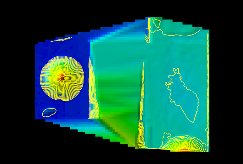
Result