Point Cloud to DEM
Note: If the point cloud has already been classified, you can generate the DEM using only the ground-class points.
Steps
- Click the Point Cloud to DEM
 button.
 - A dialog box will pop up:
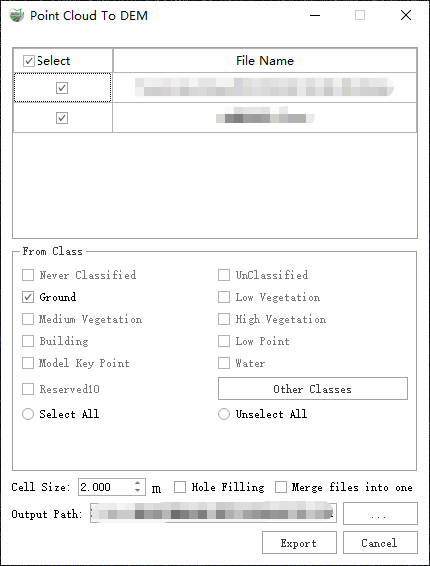
Dialog Box
Parameter Description:
Cell Size: The resolution of the output image.
Hole Filling: During the scanning process, non-penetrable surfaces may cause internal gaps in the point cloud. Checking this option will automatically fill small gaps.
Merge files into one: If checked, all point clouds will be merged into a single DEM image; if unchecked, each point cloud will generate its own image.
Use with caution. If the point cloud coverage is too large, it may cause memory overload and lead to failure. Only check this option when processing a small amount of point cloud data within a reasonable extent.
Output Path: The save location for the output image.
Result: The output files include the .tif image itself and the corresponding .tfw coordinate file.
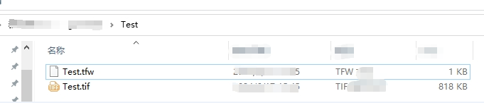
Result Files