Subscribe

Volume Measurement of Sand Piles Based on LiGrip H300

-- 23 Jan 2024 --

Project Background

In traditional sand pile volume measurement, commonly used methods include manual measurements by personnel and the use of instruments such as total stations. These traditional methods require a significant amount of manpower and time investment, and they are easily influenced by external factors like weather and terrain. This can result in unstable data collection, limiting the efficiency and accuracy of the measurements.

Laser scanners, on the other hand, have the advantages of being fast, highly accurate, and non-contact. They can quickly capture a large range of three-dimensional point cloud data in a short amount of time. In sand pile volume measurement, laser scanners can scan the surface of the sand pile to rapidly generate high-density point cloud data without the need for human intervention. This significantly improves the efficiency and accuracy of sand pile volume measurement.

Volume Measurement of Sand Piles based on LiGrip H300

Technology Process

Data Collection

LiGrip H300 is a handheld SLAM (Simultaneous Localization and Mapping) 3D laser scanner developed by GreenValley. It is equipped with various sensors, allowing for the rapid capture of large-scale scene data. It supports multiple platforms and modes of operation such as backpack, vehicle, and UAV kit. LiGrip H300 supports multiple high-precision mapping methods, including PPK-SLAM, RTK-SLAM, and SLAM, enabling quick acquisition of point cloud data with absolute coordinates. It features a panoramic camera and utilizes 32-line point cloud scanning technology, offering improved lighting effects and a scanning frequency of up to 640,000 points per second. The device can achieve a maximum absolute accuracy of 5 centimeters.

Volume Measurement of Sand Piles based on LiGrip H300


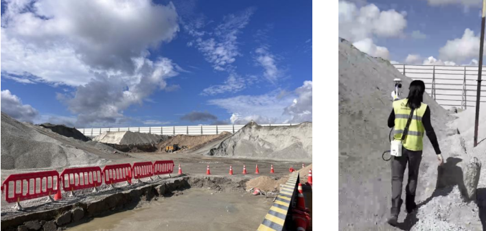
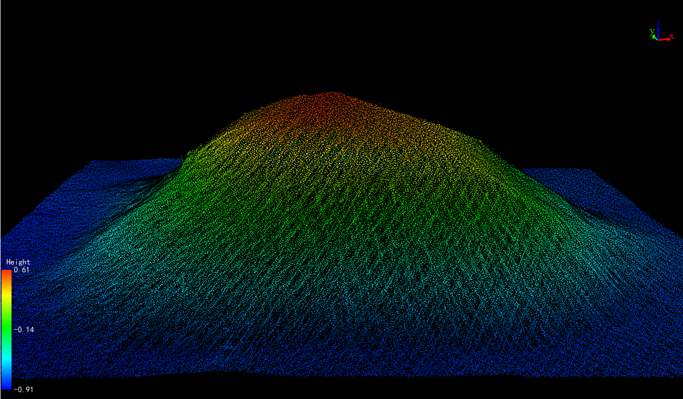
Before data collection, it is important to plan the travel route properly. Measurement personnel can use the LiGrip H300 laser scanner for sand pile measurements. The starting and ending points should maintain a 3-5m overlap distance to ensure that the collected point cloud data covers the entire sand pile.
Volume Measurement of Sand Piles based on LiGrip H300


Volume Measurement of Sand Piles based on LiGrip H300


Volumetric Calculation

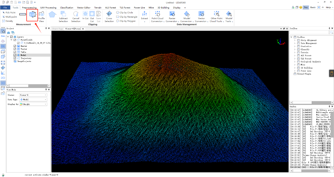
LiDAR360 is a point cloud data processing and analysis software developed by GreenValley. It features over 10 advanced point cloud processing algorithms and can handle more than 300G points of cloud data simultaneously. The platform includes various vector editing tools and automatic point cloud classification functions.

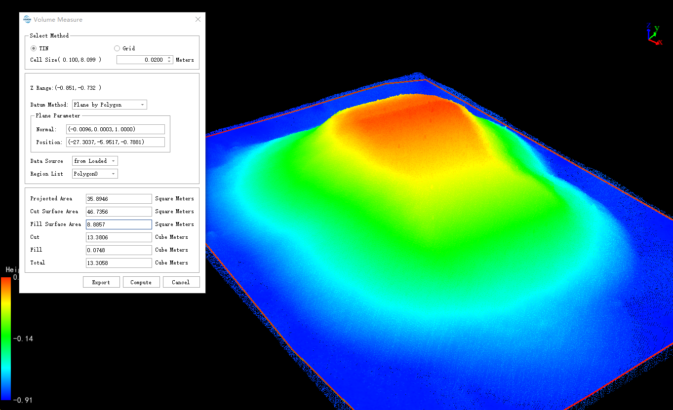
The volume measurement function in LiDAR360 allows users to select measurement reference planes interactively either by choosing data from files or by mouse clicks. It calculates the volumes of earthwork, cut, fill, and cut-fill relative to a certain height. Using this function, the volume of the sand pile was calculated to be 13.3058 cubic meters.
Volume Measurement of Sand Piles based on LiGrip H300

Volume Measurement of Sand Piles based on LiGrip H300

Accuracy Verification

To further validate the accuracy and feasibility of laser volume measurement, the sand material is first weighed, and then its weight is calculated using the density and measured volume. The two values are then compared for accuracy verification.

①According to the weighing system, the weight of the sand material is determined to be 18.92 tons.

②Knowing that the density of the sand material is 1.4 tons/m³, and using laser scanning, the volume of the sand material is measured to be 13.3058m³. This allows for the calculation of the weight of the sand material to be 18.628 tons.

③Comparing the calculated result with the weight obtained from weighing, an error of 1.54% is observed. This indicates the feasibility and high precision of this approach in practical applications.

Volume Measurement of Sand Piles based on LiGrip H300


Conclusion

Based on the volume measurement of the sand pile using the LiGrip H300 laser scanner and LiDAR360 point cloud processing software, satisfactory results were obtained. By employing modern laser scanning technology and advanced point cloud data processing tools, we have developed a high-precision and automated method for measuring the volume of sand piles. This method significantly improves the efficiency and accuracy of volume measurement, reduces labor costs, and adapts better to various complex conditions. The introduction of this technology not only makes volume measurement more intelligent and automated but also provides a feasible solution for the modernization transformation in the mining industry.


Recommended Articles

HOW CAN WE HELP YOU?
Message us your questions and contact information.
We’ll get back to you right away!