Subscribe

Characteristics and Applications of UAV lidar LIAIR X3-H

-- 18 Dec 2023 --

LiAir X3-H is a new generation of light-weight UAV LiDAR system developed by GreenValley International. It integrates light-weight LiDAR scanner, selfdeveloped inertial measurement unit, 26MP high-resolution mapping camera and high-performance computing platform. It can be mainly used for topographic mapping, forestry surveying, power inspection, etc. With the LiPlan, LiGeoreference, LiDAR360 software developed by GreenValley International, it can provide users with complete surveying and mapping solutions.
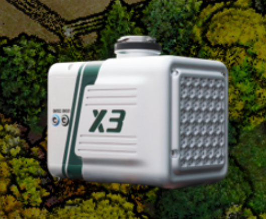
 
Characteristics and Applications of UAV lidar LIAIR X3-H

The LiAir X3-H system integration is comprised of multiple technologies, including:

1. A dynamic differential GNSS receiver for measuring the spatial position of the reference point of the laser signal transmission.


2. Attitude measurement equipment for measuring the attitude parameters, namely inertial measurement unit (IMU).


3. Laser ranging equipment used to measure the distance between the laser  signal emission reference point and the ground point, that is, the core part of the entire integrated system, the laser scanner.


4. The storage control system, which is used for data storage and device control, receiving the signals transmitted from the ground to the airborne, and controlling the parameters adjustment, data acquisition and downloading.


5. Power supply and management unit.

The biggest feature of LiAir X3-H is:

1.Lightweight & Simple

Integrated simple yet rugged design, allowing for protection against the elements with an IP64 rating. The operation interface is straightforward,  allowing one-touch operation for maximum efficiency.


2.26 Megapixels Camera

Built-in new high-resolution custom mapping camera, the image resolution is upgraded from 24 Megapixels to 26 Megapixels, allowing for high-quality true-color point clouds as well as orthophotos for photogrammetry.


3.LiPlan Flight Assistance Software

LiPlan supports real-time point cloud display, parameter adjustment, and status monitoring. It can be directly installed on the M300 RTK remote controller and used in conjunction with the X3 to help operators control the site conditions in real-time.


Recommended Articles

HOW CAN WE HELP YOU?
Message us your questions and contact information.
We’ll get back to you right away!