Subscribe

Hardcore Case! LiDAR360 Saved 98 Square Kilometers of Terrain Data in Just 6 Steps!

-- 28 Sep 2023 --

LiDAR pulses can penetrate the gaps in vegetation and directly reach the ground, quickly obtaining high-precision terrain and topographic data from forest, mountain, and other areas with dense vegetation. With its efficiency and high accuracy, it has been favored by customers in fields like terrain surveying, geological monitoring, disaster analysis, etc. in recent years.

However, due to various complex operating environments and the performance of laser scanners, point cloud data usually contains various types of noise, including random noise, isolated points, surface noise of objects (caused by high reflectivity objects), etc., affecting the quality of terrain products. Therefore, before producing terrain, it is usually necessary to remove noise and extract ground points to obtain high-quality terrain features.

For most data, LiDAR360 can automatically obtain ground points with one click. However, in the actual production process, there are cases where the noise characteristics under extreme conditions are too complex, severely affecting the noise removal and ground point extraction effects, as shown in the figure below.
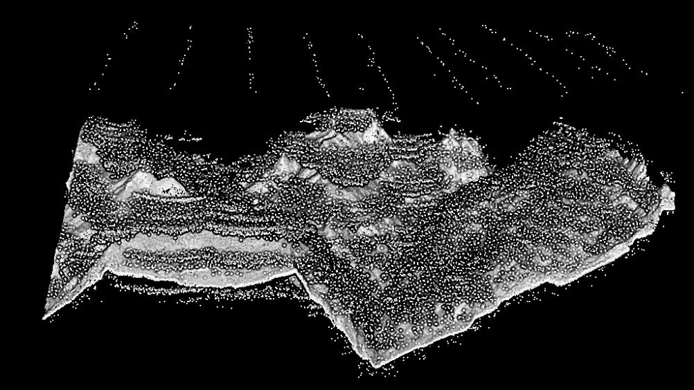
图片1.png 
Original Point Cloud Data


Recently, GreenValley International (GVI) was commissioned by the customer to analyze and process LiDAR data of a natural disaster risk point located somewhere in the southwest China.

The data was collected by a large airborne LiDAR, covering an area of up to 98 square kilometers. The data contains abnormally severe noise, and the number is large and the form is complex, interspersed in the terrain point cloud. The customer hopes to extract ground points from the data and has tried to use several software such as TerraSolid to process the data. However, the automated functions of these software tools failed to generate usable data for production; manual editing is difficult, inefficient, and difficult to control the project cycle. Various schemes will cause losses to customers.

Therefore, the customer contacted GVI and hoped that the company could analyze the data and provide a production plan that is easy to operate, high in processing efficiency, and high in automation.

For this data, GVI's R&D personnel designed an automated processing workflow based on GVI's self-developed point cloud post-processing and industry application software—LiDAR360. The test showed that for this extreme data, without any human intervention, a single device completed the extraction of ground points for a total of 98 square kilometers in less than 30 hours!

The specific data processing workflow is as follows:

1. Subsampling

Due to the existence of many completely overlapping noise points in the data, which affects the noise removal effect, the "Subsampling" function can be used to sample the data according to the minimum point spacing to eliminate duplicate points and make the data more uniform overall.

2. Classify by Return Number

After analysis, the R&D personnel of GVI found that the noise is mainly caused by multiple returns. There are obvious differences when the terrain points are displayed by "Number of Return". Among them, the point cloud with a return number of 1 has the most ground points and the fewest abnormal points below the ground. Therefore, the point cloud can be classified according to the number of returns, and the point cloud with a return number of 1 can be extracted for subsequent processing.
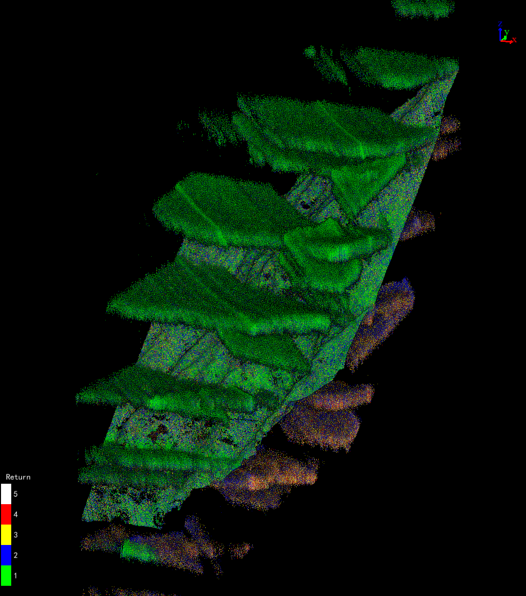
1695885598122251.png
 Display Point Cloud by Number of Return


图片3.png
1695885640210783.png 
Extract Point Cloud with a Return Number of 1


3. Isolated Point Denoising

Observing the point cloud with a return number of 1, it can be found that the abnormal points below the ground are relatively sparse, so the "Classify Isolated Points" function can be used to eliminate the influence of these abnormal points. If there are still a large number of isolated points, the "Classify Isolated Points" function can be used again to remove them. If there are many air noise points, they can be removed by "Classify Air Points" function.
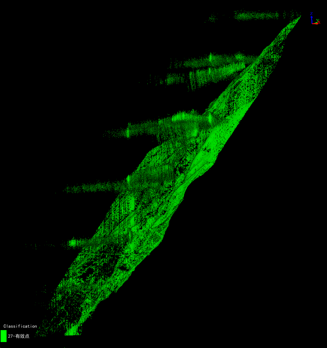
1695885674312662.png

 Point Cloud after Removing Isolated Points


4. Initial Ground Point Classification

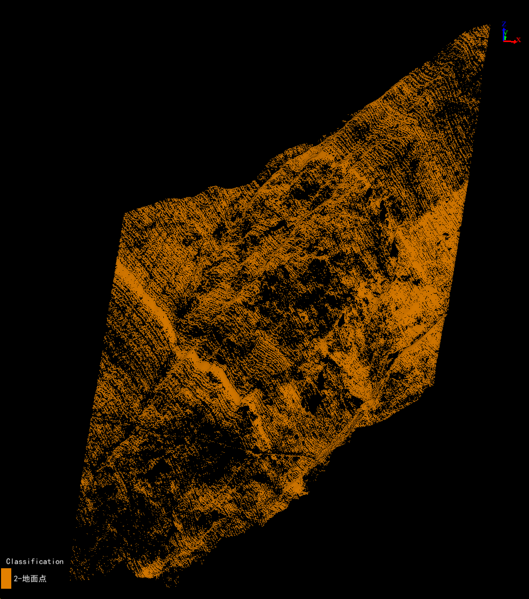
After isolated point denoising, the noise points below the ground have been eliminated. At this time, the "Classify Ground Points" function can be used to classify the more ideal ground points. For subsequent analysis and processing needs, the customer have a high demand for ground point density. To meet customer needs, ground points need to be densified for classification.
1695885699152433.png

 Initial Ground Point Classification Results


5. Classification of Point Cloud above Ground

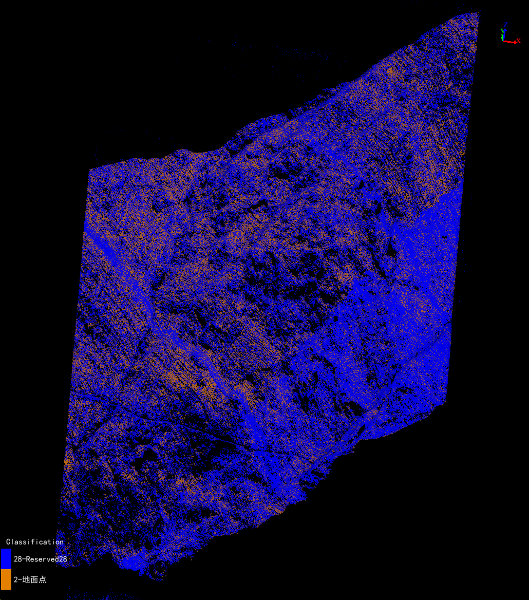
The point cloud that affects the classification effectiveness of ground points is typically abnormal points below the ground. Therefore, the "Classify by Height Above Ground" function can be used to add a portion of point clouds containing correct ground points from other returns to the data to be classified. This is done to densify the existing ground points.
 1695885758122962.png

Extract Point Cloud above Ground

6. Re-classification of Ground Points

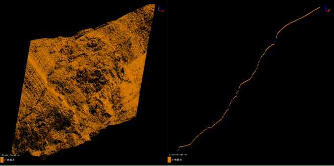
Based on the results of the previous step, the ground points can be classified again to obtain more ideal ground points.

 图片7.jpg

Final Ground Point Extraction Effect

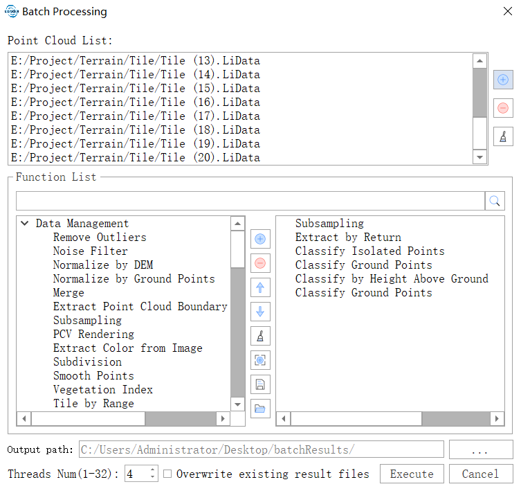
After verifying the feasibility of the processing workflow provided by GVI, the customer also used the "Batch Processing" function of LiDAR360 to string together the aforementioned steps into an automated processing workflow, enabling the batch processing of all project data.
图片8.png 

Batch Processing Function Interface

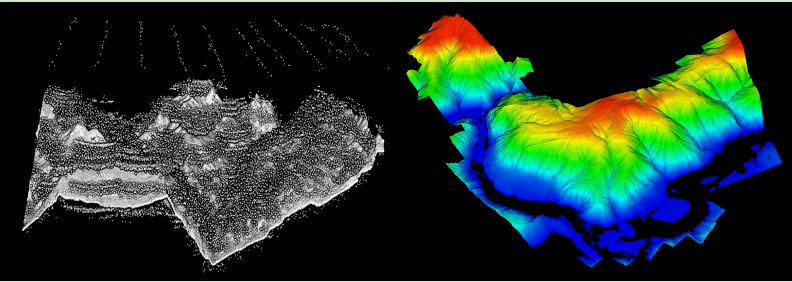
Based on LiDAR360's comprehensive and rich processing tools, highly automated functions, and customizable processing workflow, the customer completed all data processing in far less time and manpower than expected, and timely produced high-quality project results!
图片9.jpg 

Comparison of Original Data and Processing Results

LiDAR360 not only contains a variety of international leading point cloud processing algorithms, but also has more than 700 tools, which can perform comprehensive analysis and processing for all attributes and various features of the point cloud, solving problems under various complex scenarios and conditions, and meeting all your needs for point cloud data processing!

Welcome to use LiDAR360 and offer us your valuable needs and suggestions.


Recommended Articles

HOW CAN WE HELP YOU?
Message us your questions and contact information.
We’ll get back to you right away!