LiDAR360 is a professional application software for ALS, MLS, TLS point cloud and image processing. LiDAR360 providing TB-level data visualization and processing capabilities,which covers more than 700 tools across various industries, including Topographic Mapping, Forestry Survey and Management, Engineering Surveying, Mine Safety, Digital Twin, Geological Disaster Assessment, and Powerline Hazard Inspection. Offering one-stop solution to users in 137 countries and regions worldwide.
On September 25, 2024, LiDAR360 officially launches version 8.0, featuring new capabilities including image processing, distribute computing, and online data sharing. With 106 new features, this update provides you with a richer set of business outcomes and a completely new experience in intelligent data processing!
Highlights:
* The complete workflow for processing raw data of DJI L1/L2.
* Data upload & sharing online.
New Photo module supports aerial triangulation and orthophoto stitching for various types of airborne imagery, providing robust support for image production, feature extraction, and 3D modeling.
Target Detection & GCP automatically matching, improving image project quality and absolute accuracy by one click.
Camera Calibration, Image & Tie Point Filter, DOM Editor and so on, ensuring the generation of high-quality DOM.
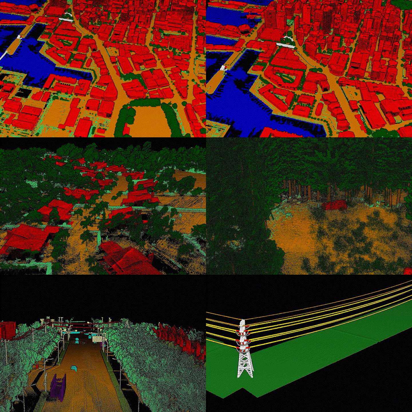
Classification module has been comprehensively upgraded, supporting automatic recognition and classification of 32 types of features from data across all platforms and scenarios.
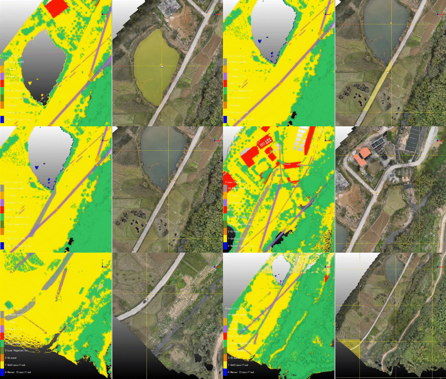
Combined with the Segment Anything Model, identify any land features from point clouds, dramatically increasing interactive classification efficiency!
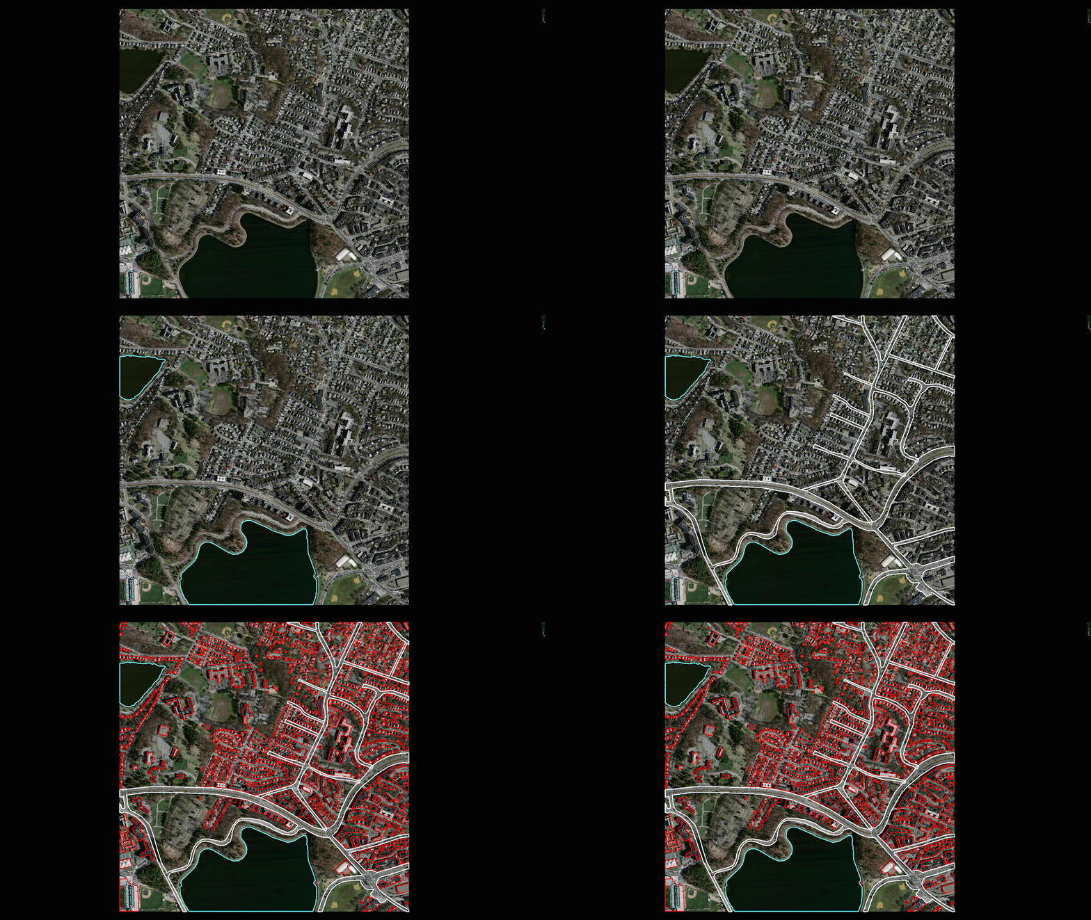
Train your deep learning model to recognize any features from image and automatically extract outlines.
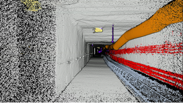
Built-in tunnel classification deep learning model.
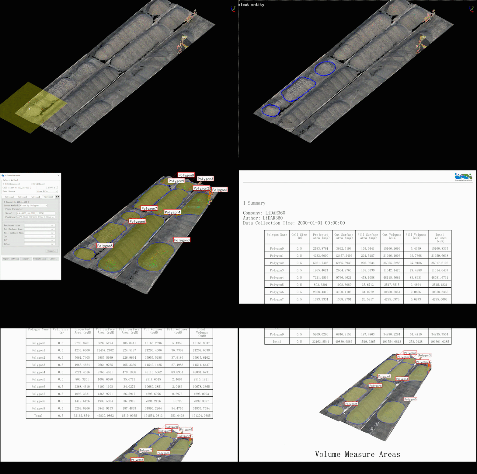
Vector module added various intelligent extraction tools, making engineering applications more precise and efficient.
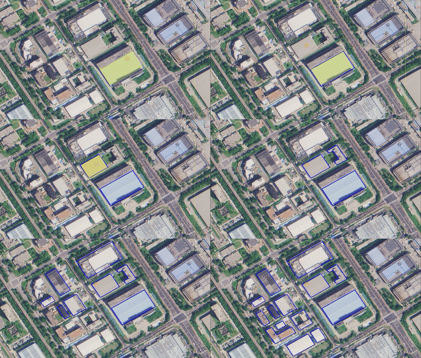
Deeply integrated with Segment Anything Model, effortlessly extract oulines of features, significantly boosting vector drawing efficiency.
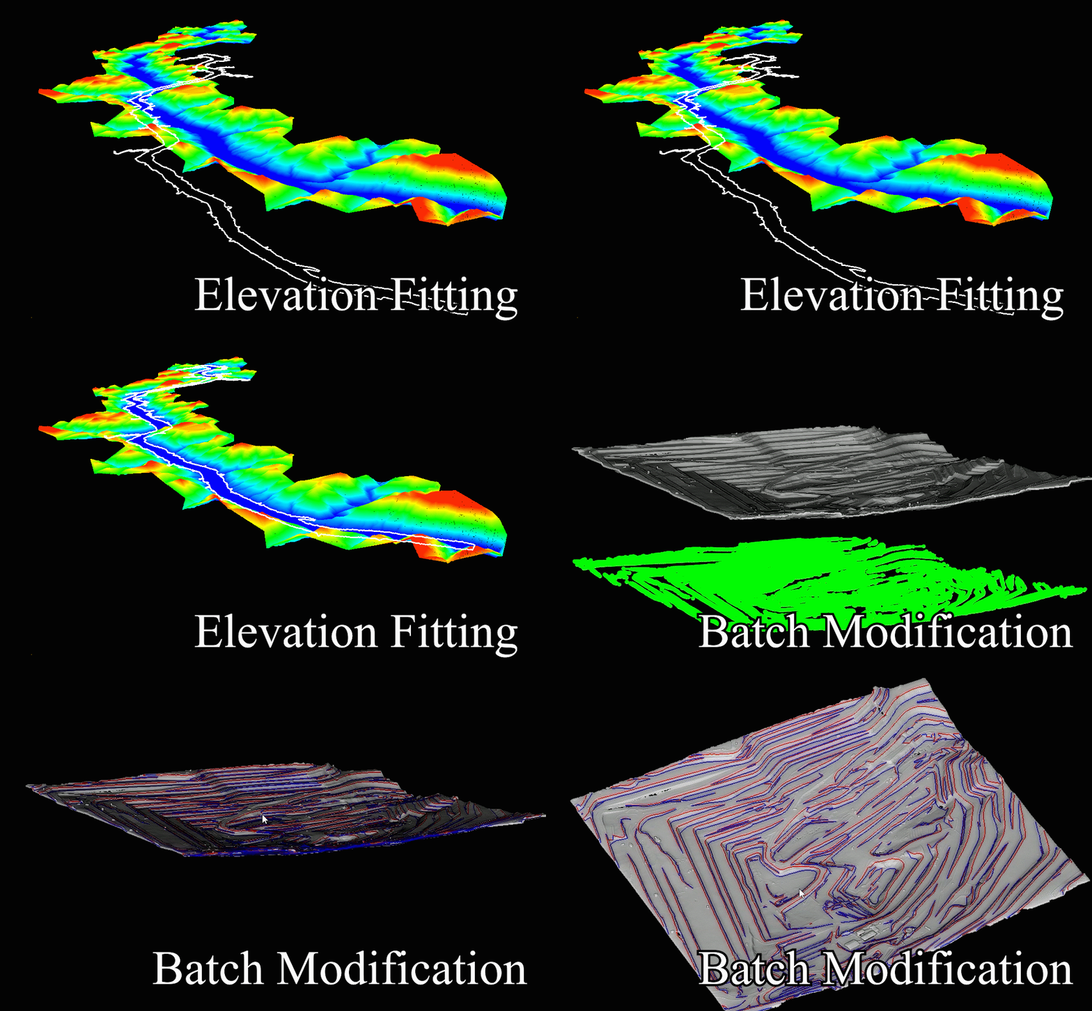
Optimized several vector tools and added operation prompts to make your vector production easier and more convenient.
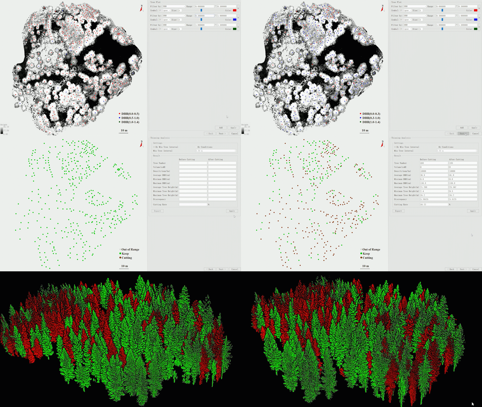
Forestry module has added various application results, providing comprehensive support for refined forestry survey and management.
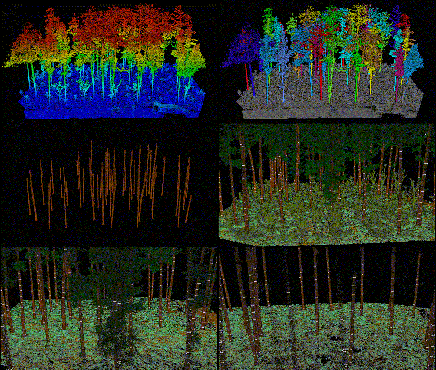
*Attribute calculations have been fully optimized, significantly improving the accuracy of attributes such as tree height, DBH and so on[1].
ID | Tree Height(m) | DBH(cm) | Measured DBH(cm) | Difference(cm) |
1 | 8.2 | 8.2 | 8.6 | -0.4 |
2 | 9.9 | 9.3 | 9.5 | -0.2 |
3 | 8.1 | 10.8 | 11.2 | -0.4 |
4 | 12.8 | 11.4 | 11.7 | -0.3 |
5 | 7.0 | 11.5 | 11.6 | -0.1 |
6 | 15.2 | 13.9 | 14.3 | -0.4 |
7 | 14.7 | 14.0 | 14.3 | -0.3 |
8 | 16.4 | 14.4 | 14.9 | -0.5 |
9 | 11.4 | 14.8 | 14.8 | 0.0 |
10 | 13.1 | 15.2 | 15.3 | -0.1 |
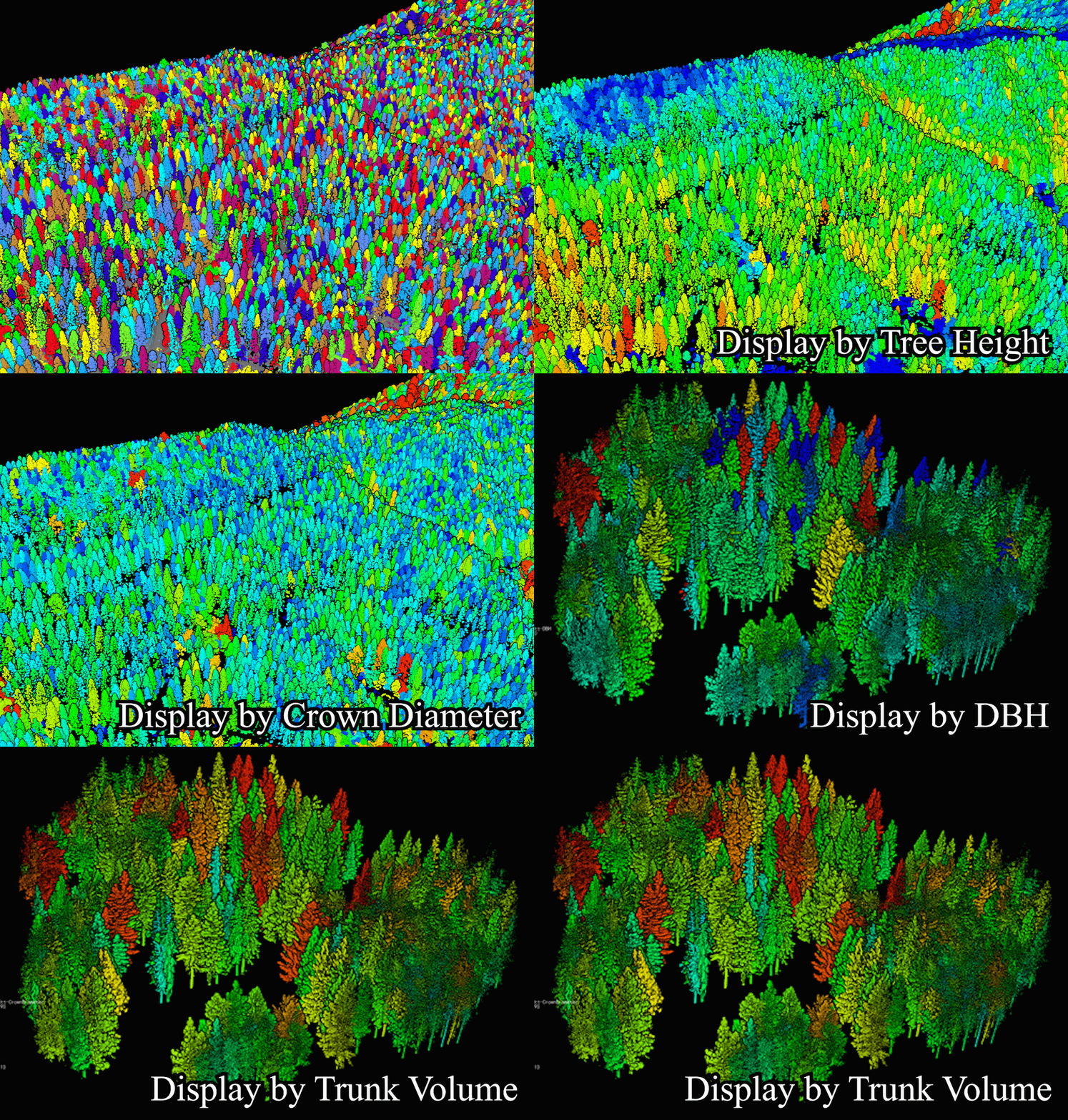
Forestry full-attributes rendering display makes analysis results more intuitive, allowing you to identify the tallest tree by a glance.
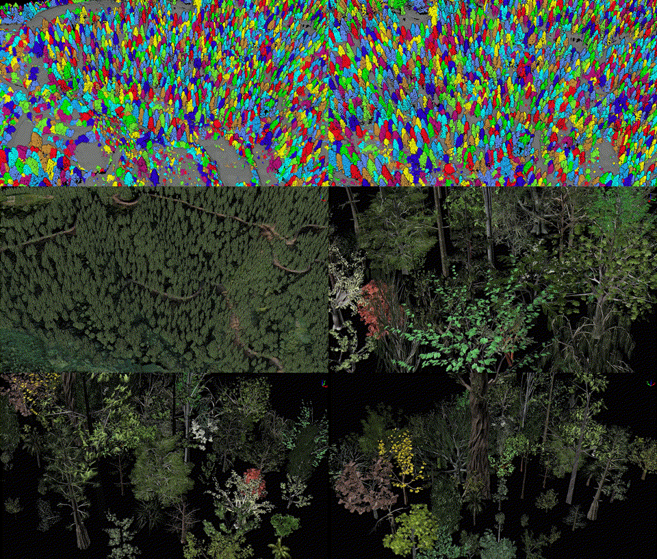
Generate Tree Model function included a built-in model library with 70 tree species.
Terrain module has been upgraded with various new features, providing more comprehensive results for spatial analysis.
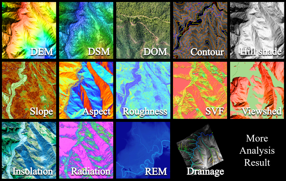
REM, drainage line analysis and flood analysis provide comprehensive support for hydrological.
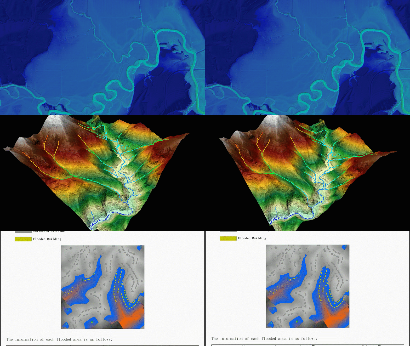
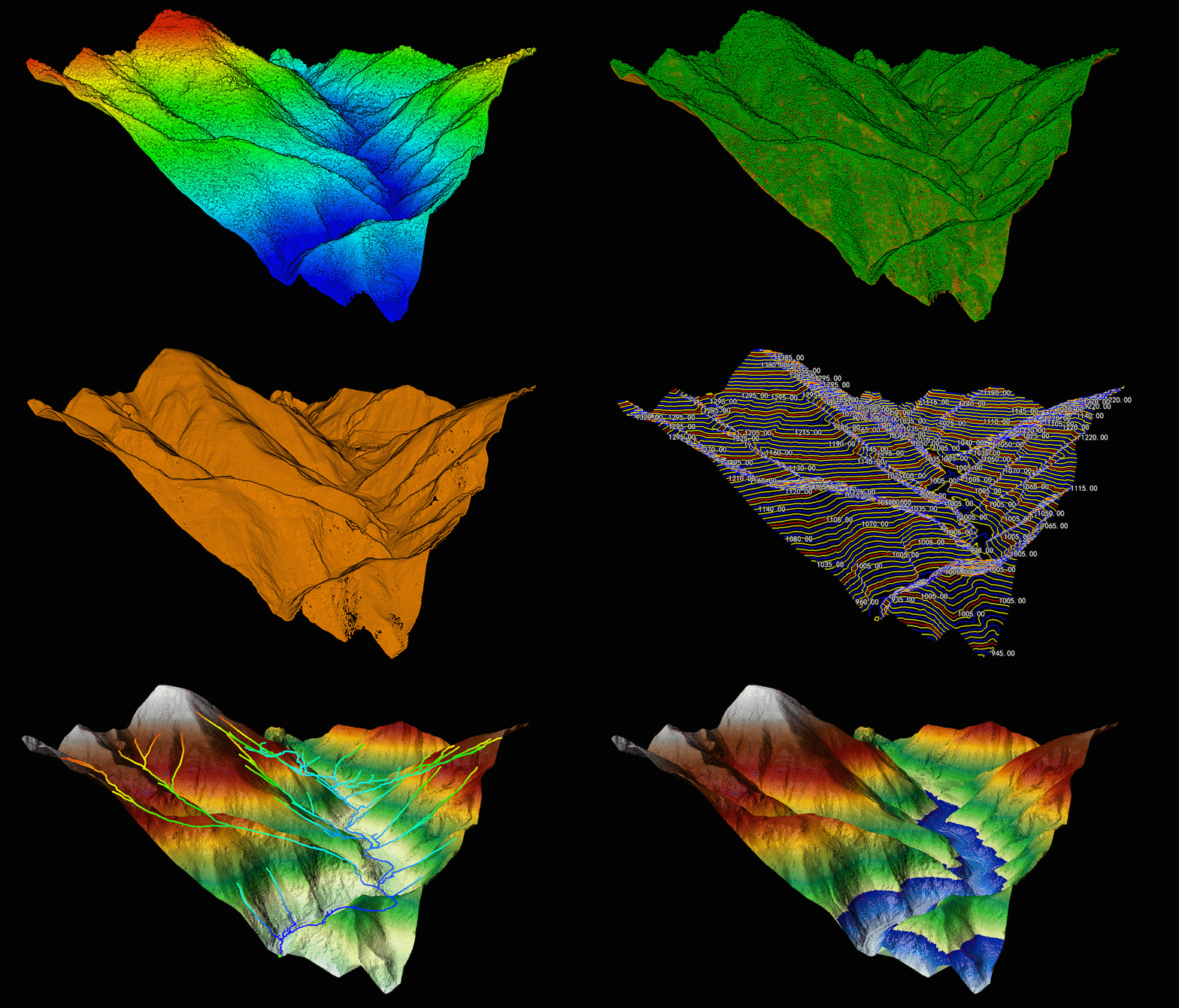
Optimized details of contour, DEM, and section analysis functions, making terrain production more hassle-free.
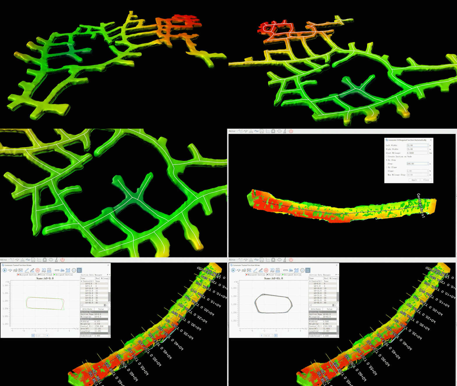
Mine module added tunnel centerline extraction and various tunnel analysis results, providing comprehensive support for mine tunnel operations.
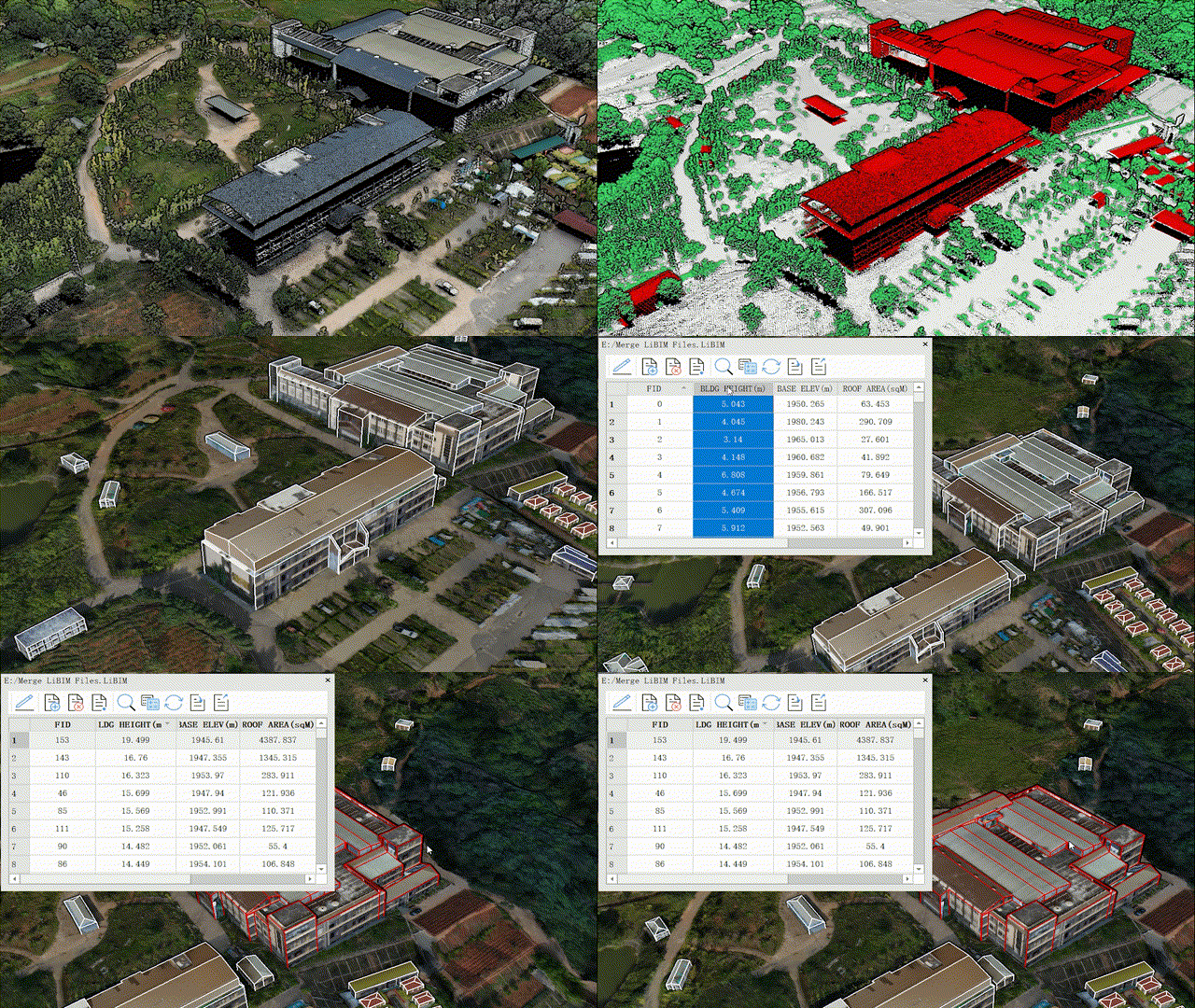
3D building module now includes attribute calculator and various attribute management tools, bringing you a step closer to intelligent urban management.
New Distributed computing module has been added, allowing multiple devices to process one set of data, significantly improving efficiency. The effectiveness can be referenced in the table below[2].
Device Configuration | Function | Data Size | Compute Nodes Number | Efficiency Improvement |
System:
Windows 10
CPU:
11th Gen Inter® i7
GPU:
NVIDIA RTX 3050 | Classify Air Points | 15GB | 3 | 123% |
4 | 137% |
Smooth+
Subsampling+
Remove Outliers+
Classify Ground Points | 30GB | 4 | 168% |
5 | 278% |
6 | 375% |
V8.0 authorization has been updated. Both new and existing customers can apply for a free trial authorization. We welcome you to download and experience it!
Release Note:
[1] The extraction accuracy of the coniferous forest data collected using station-based scanning equipment may vary due to differences in trunk shape and data collection precision.
[2] The efficiency of distributed cluster computing may vary depending on the configuration of network switches, bandwidth, and computing machines.
LiDAR360 is a professional application software for ALS, MLS, TLS point cloud and image processing. LiDAR360 providing TB-level data visualization and processing capabilities,which covers more than 700 tools across various industries, including Topographic Mapping, Forestry Survey and Management, Engineering Surveying, Mine Safety, Digital Twin, Geological Disaster Assessment, and Powerline Hazard Inspection. Offering one-stop solution to users in 137 countries and regions worldwide.
On September 25, 2024, LiDAR360 officially launches version 8.0, featuring new capabilities including image processing, distribute computing, and online data sharing. With 106 new features, this update provides you with a richer set of business outcomes and a completely new experience in intelligent data processing!
Highlights:
* The complete workflow for processing raw data of DJI L1/L2.
* Data upload & sharing online.

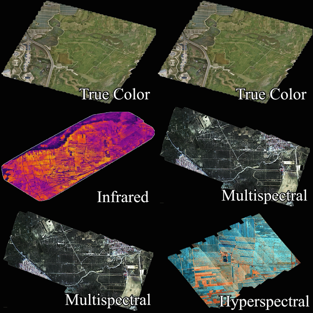
New Photo module supports aerial triangulation and orthophoto stitching for various types of airborne imagery, providing robust support for image production, feature extraction, and 3D modeling.

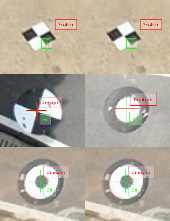
Target Detection & GCP automatically matching, improving image project quality and absolute accuracy by one click.

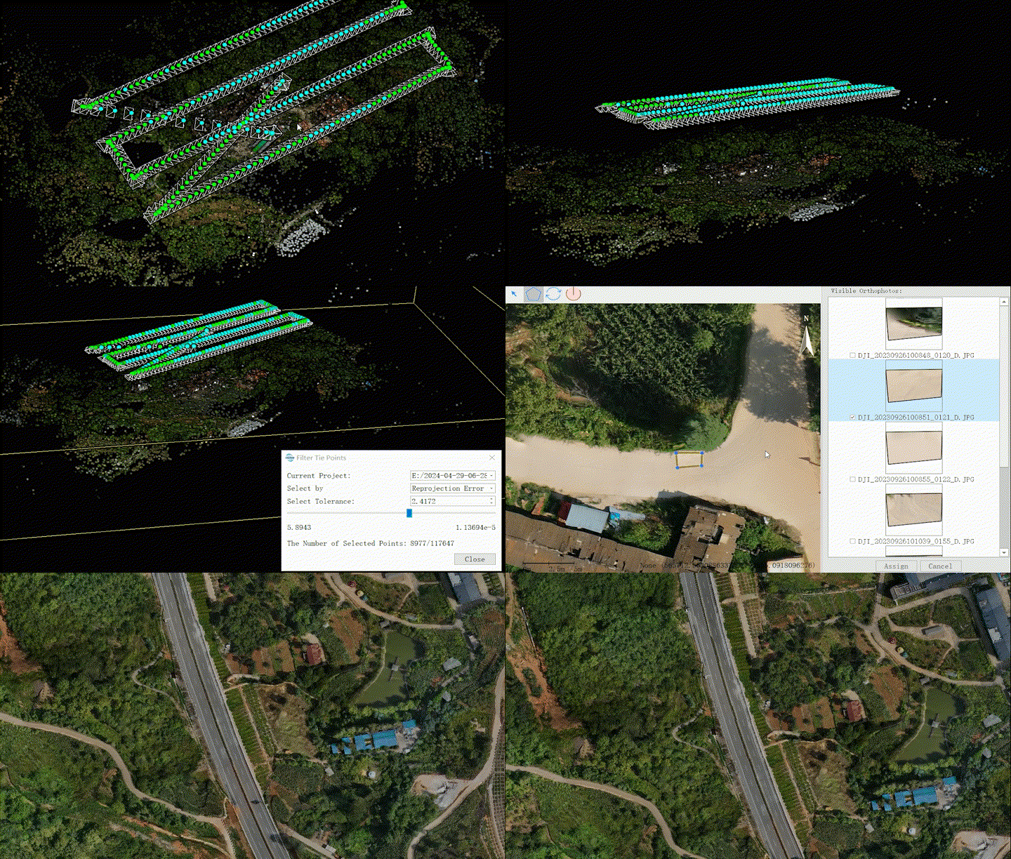
Camera Calibration, Image & Tie Point Filter, DOM Editor and so on, ensuring the generation of high-quality DOM.

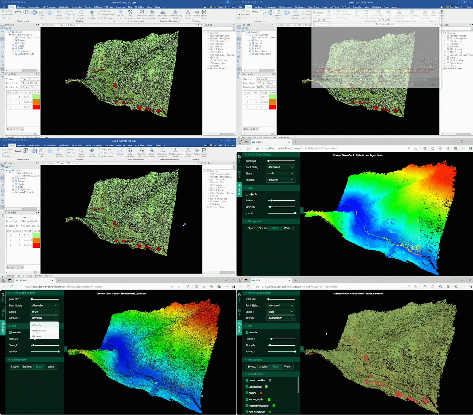
Classification module has been comprehensively upgraded, supporting automatic recognition and classification of 32 types of features from data across all platforms and scenarios.

Combined with the Segment Anything Model, identify any land features from point clouds, dramatically increasing interactive classification efficiency!

Train your deep learning model to recognize any features from image and automatically extract outlines.

Built-in tunnel classification deep learning model.

Vector module added various intelligent extraction tools, making engineering applications more precise and efficient.

Deeply integrated with Segment Anything Model, effortlessly extract oulines of features, significantly boosting vector drawing efficiency.

Optimized several vector tools and added operation prompts to make your vector production easier and more convenient.

Forestry module has added various application results, providing comprehensive support for refined forestry survey and management.


*Attribute calculations have been fully optimized, significantly improving the accuracy of attributes such as tree height, DBH and so on[1].
ID | Tree Height(m) | DBH(cm) | Measured DBH(cm) | Difference(cm) |
1 | 8.2 | 8.2 | 8.6 | -0.4 |
2 | 9.9 | 9.3 | 9.5 | -0.2 |
3 | 8.1 | 10.8 | 11.2 | -0.4 |
4 | 12.8 | 11.4 | 11.7 | -0.3 |
5 | 7.0 | 11.5 | 11.6 | -0.1 |
6 | 15.2 | 13.9 | 14.3 | -0.4 |
7 | 14.7 | 14.0 | 14.3 | -0.3 |
8 | 16.4 | 14.4 | 14.9 | -0.5 |
9 | 11.4 | 14.8 | 14.8 | 0.0 |
10 | 13.1 | 15.2 | 15.3 | -0.1 |
Forestry full-attributes rendering display makes analysis results more intuitive, allowing you to identify the tallest tree by a glance.

Generate Tree Model function included a built-in model library with 70 tree species.

Terrain module has been upgraded with various new features, providing more comprehensive results for spatial analysis.

REM, drainage line analysis and flood analysis provide comprehensive support for hydrological.

Optimized details of contour, DEM, and section analysis functions, making terrain production more hassle-free.

Mine module added tunnel centerline extraction and various tunnel analysis results, providing comprehensive support for mine tunnel operations.

3D building module now includes attribute calculator and various attribute management tools, bringing you a step closer to intelligent urban management.

New Distributed computing module has been added, allowing multiple devices to process one set of data, significantly improving efficiency. The effectiveness can be referenced in the table below[2].
Device Configuration | Function | Data Size | Compute Nodes Number | Efficiency Improvement |
System:
Windows 10
CPU:
11th Gen Inter® i7
GPU:
NVIDIA RTX 3050 | Classify Air Points | 15GB | 3 | 123% |
4 | 137% |
Smooth+
Subsampling+
Remove Outliers+
Classify Ground Points | 30GB | 4 | 168% |
5 | 278% |
6 | 375% |
V8.0 authorization has been updated. Both new and existing customers can apply for a free trial authorization. We welcome you to download and experience it!
Release Note:
[1] The extraction accuracy of the coniferous forest data collected using station-based scanning equipment may vary due to differences in trunk shape and data collection precision.
[2] The efficiency of distributed cluster computing may vary depending on the configuration of network switches, bandwidth, and computing machines.


