Subscribe

Success Story of the Topographic Survey | Loire Quarry Terrain Survey in France

-- 28 Mar 2024 --

This case study is a result of a successful collaboration between Inairtech, Isc Drone, and GreenValley International, demonstrating the power of LiDAR remote sensing techniques and our joint commitment to advancing the industry.

Background

Quarry refers to the place used for stone mining materials. In the collection and expansion of the quarry, it is often necessary to do a good topographic survey in advance, understand the information of the mining area and surrounding environment, and formulate safe and appropriate mining strategies, to improve the safety of the operation as far as possible and reduce the impact on the environment. Quarries mined under natural light are called open-pit quarries, which are usually divided into a certain level of layers, each forming a step for stripping and mining. Most of the existing open-pit quarry terrain survey is mainly surface manual survey and drone tilt photography.
 

The surface manual survey measures the surface through the total station, RTK and other measuring technologies and equipment, but this method is not only low efficiency but also requires high requirements and high risk; the UAV tilt photogrammetry is collected through the aerial camera and processed to obtain 3D model and terrain data within the measuring area. This method has high safety and efficiency, but the data processing is difficult and in complicated areas without complete terrain data.


Combined with airborne LiDAR mine terrain survey means by accepting active emission laser, not only is not affected by the environment, but also can obtain more real and accurate terrain 3d information, the quarry, and the surrounding global scan, while guaranteeing full coverage, with the contact, high precision, fast, mass information, full automation, convenient significant advantages, has become the mainstream of many fields, including open quarry terrain survey operation means.


Project Overview

Project Name: Topographic Survey of an Open-Pit Quarry

Location: Louvaines, France

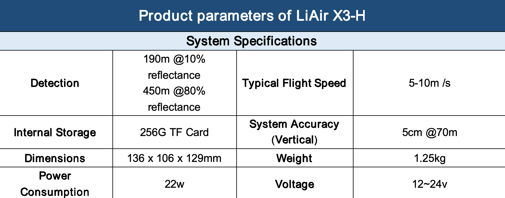
Equipment: LiAir X3-H

Survey Area: 434,643


Utilizing the characteristics of multi-echo and real-time ground following of LiAir X3-H, an airborne LiDAR device developed by GreenValley, together with high-definition camera, the project acquires complete point cloud data and image data under the vegetation cover of the quarry and the surrounding environment, combining with the PPK technology to make the point cloud reach centimeter-level absolute precision, and through the GNSS-RTK acquisition of control points to check the precision of the point cloud and make corrections.


Based on the above data, the topographic survey of the quarry and the surrounding environment is completed, and the results of the survey data will provide technical and material support for the assessment and management of the surrounding environment and the operation and management of the quarry.
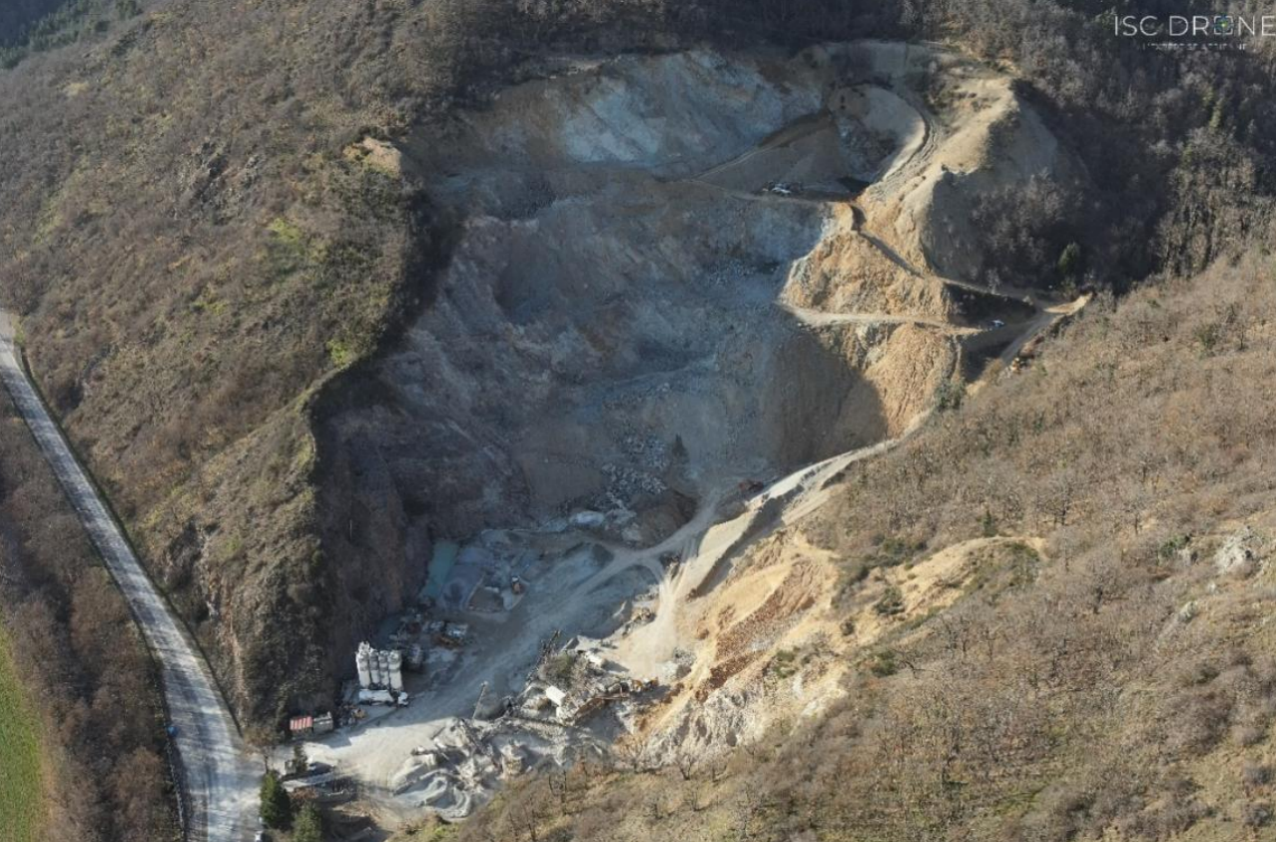
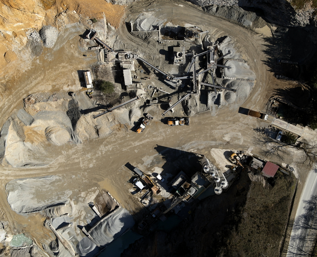

image.png


image.png

Aerial photo of the quarry

Project Difficulties

 ① Terrain height difference, high mountain road risk, dense vegetation, complex terrain;


② Only by manual investigation not only work intensity, low efficiency, some areas can not achieve;


③ It is difficult to obtain under forest terrain data.


Solutions


1. Equipment Introduction 

The project adopts LiAir X3-H for field data collection. LiAir X3-H is a light UAV lidar system developed by GreenValley. It adopts an integrated design style, integrates a high-resolution mapping camera and a high computing power edge computing platform, and has built-in AirPilot intelligent flight algorithm. It can fly autonomously on the ground in real time. With GreenValley flight aid, it can provide customers with software and hardware integrated mapping solutions for power inspection, forestry monitoring, topographic mapping and other fields.
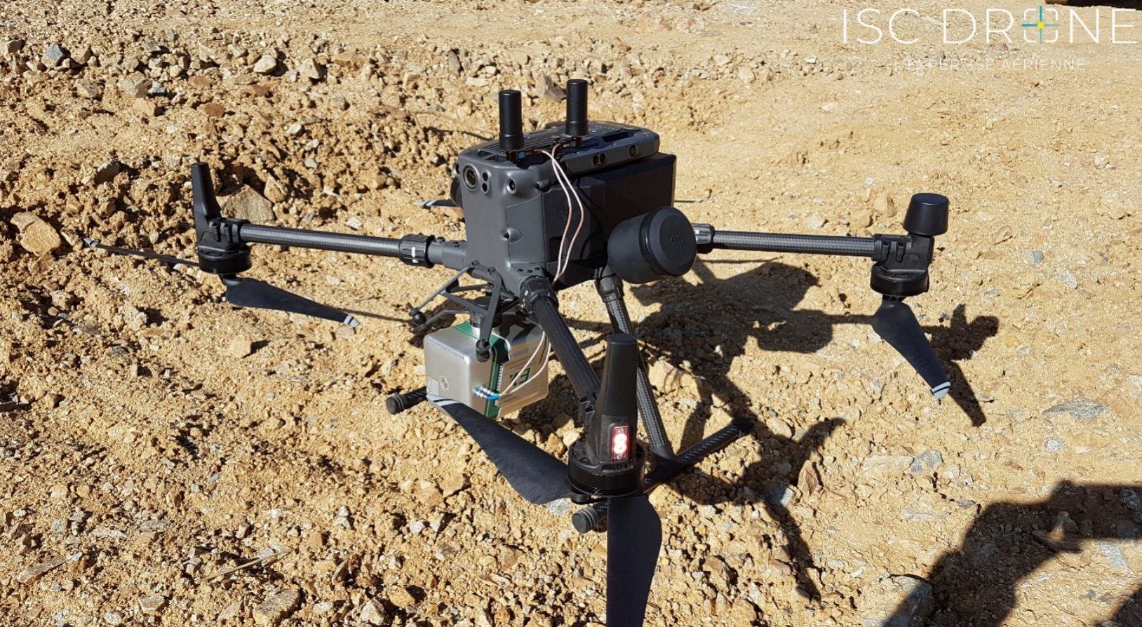
image.png

   LiAir X 3-H outside the real picture
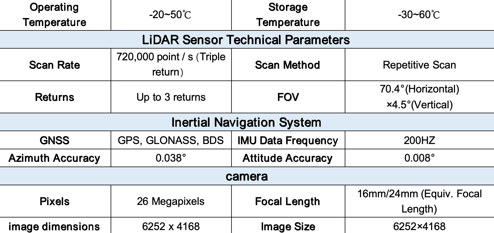

image.png


image.png


2. Software Introduction

LiGeoreference is a mobile measurement data processing and fusion software developed by GreenValley for the airborne LiDAR scanning system. The main functions of the software include high-precision point cloud processing, trajectory processing, point cloud data visualization and editing, as well as engineering management, projection conversion, quality inspection, and various commonly used functions such as point cloud cutting, measurement, and display.


LiDAR 360 is the point cloud post-processing and industry application software independently developed by GreenValley. The platform can process TB-level point cloud data, and has more than 10 kinds of internationally leading point cloud processing and AI algorithms to promote the multi-industry application of lidar. More than 700 powerful and flexible functions, solve the application problem of the last kilometer of users, and provide full life cycle services for topographic surveying, engineering survey, forestry survey, mine safety, real 3 D and other industry customers.


3. Work Flow Chart

image.png


1. Scheme Process

(1) Data Acquisition

Through the data collection of quarry and the surrounding environment, fully understand the survey area overview, information including remote sensing images, location, range, etc., and to analyze the collected data and field judgment, and collect control points, based on the above information, planning the airborne equipment acquisition route, the actual acquisition area should be greater than the test area, to ensure that the point cloud data integrity. After the completion of the route planning, the field data can be collected according to the prescribed route.
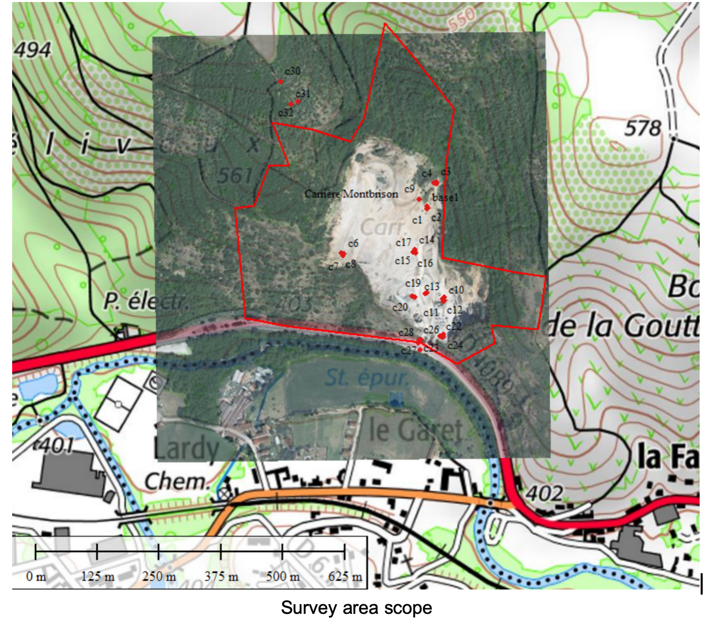
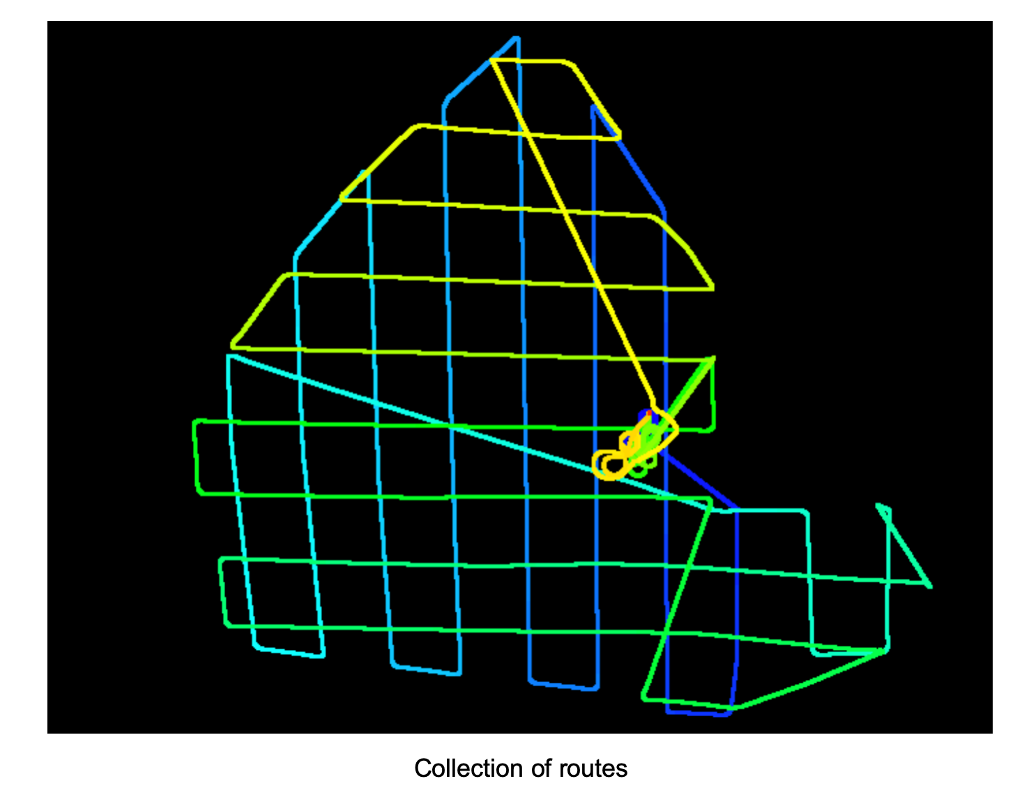

image.png


image.png

(2) Preprocessing


① Data processing


The raw data collected by the X3-H were processed using the LiGeoreference software.
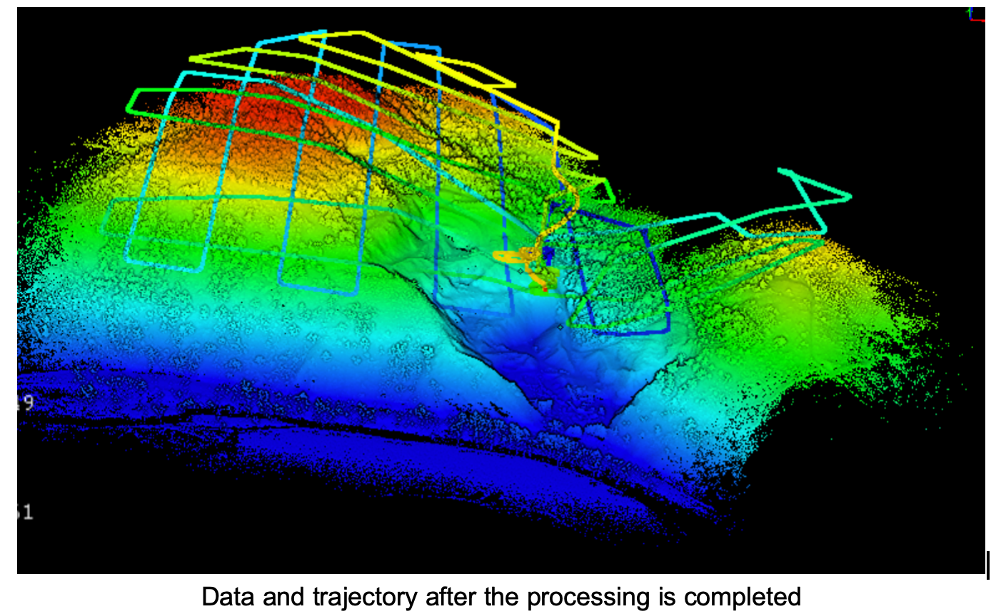

image.png


② Trajectory Adjustment

The LiDAR 360 trajectory adjustment function is used to eliminate the phenomenon of point cloud stratification between air zones. The point cloud is colored according to the belt and checked with the section. If there is a stratification phenomenon, the trajectory adjustment function can be used to eliminate the stratification.
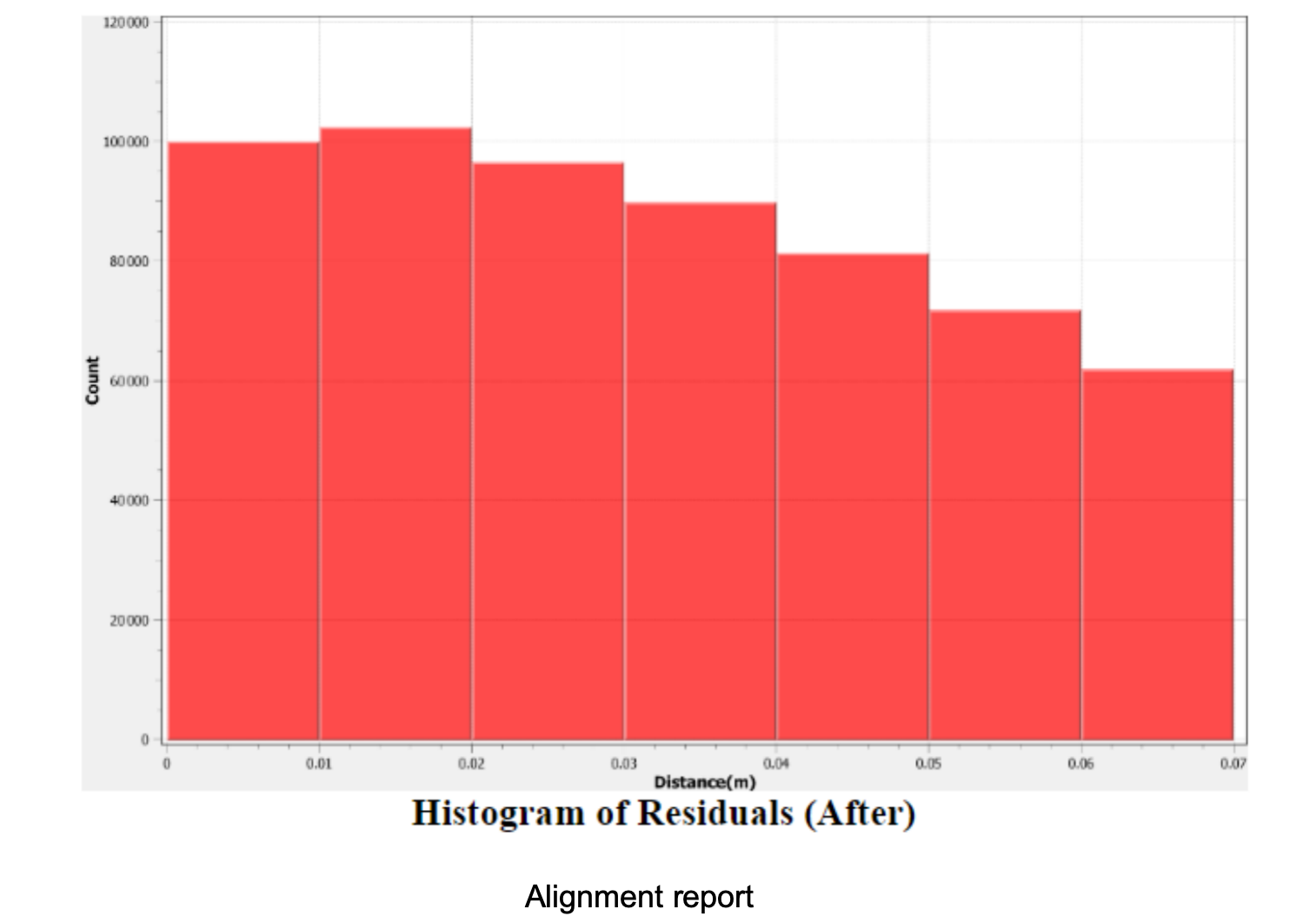


image.png


③ The Density and Quality Check


The LiDAR 360 density quality check function was used to evaluate whether the point cloud density distribution meets the project requirements.


④ Control Point Check


The control point reporting function in LiDAR360 can be used to check the elevation precision of the point cloud and use the calculated correction to improve the elevation precision of the point cloud.
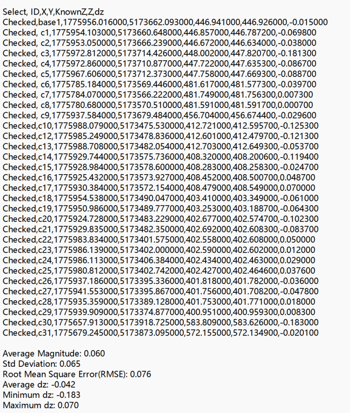

图片1.png

                                                                                                                                   Control point report


⑤ Point Cloud Data Display
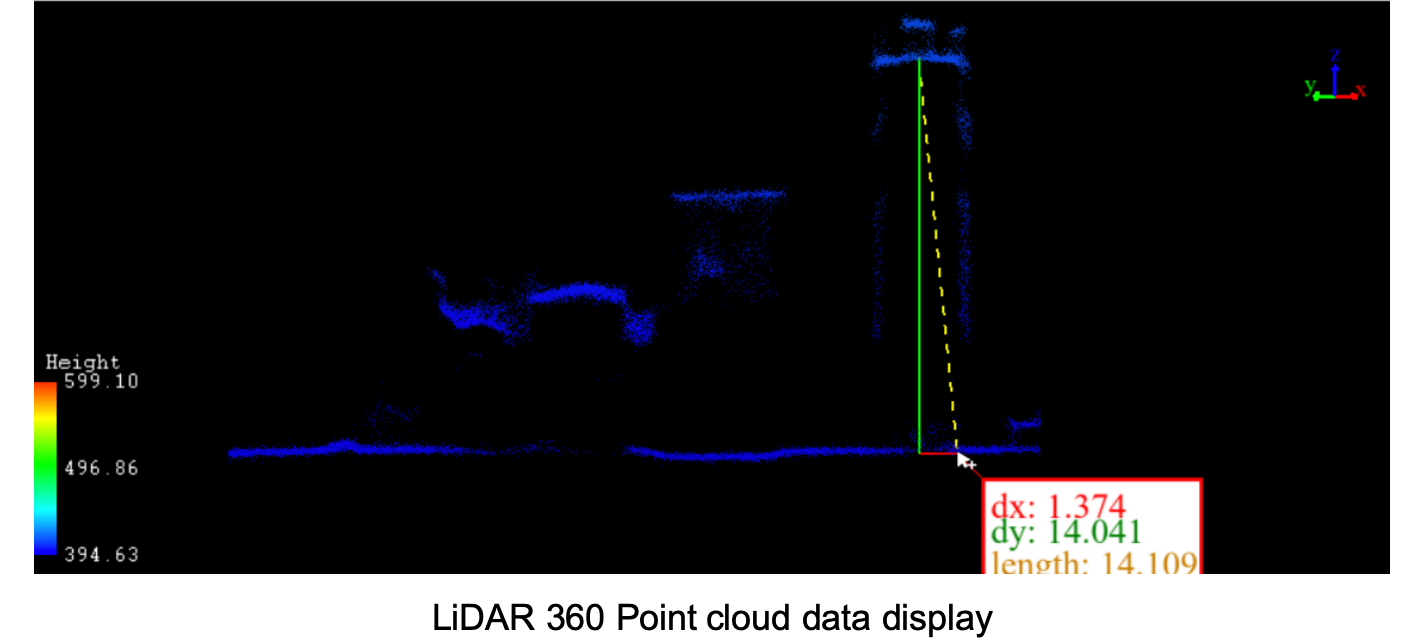

image.png

(3) Production of Topographic Data


Using LiDAR360 terrain module and mine module, high-precision DEM, DSM, DOM, contour line and other terrain products can be produced quickly and efficiently, and professional mine and terrain analysis can be conducted based on the above data.


(4) Data Storage


After the completion of the quarry survey and data production, the data results can be built and managed to provide complete standard and complete data support for the regional environment, planning and housing bureau.
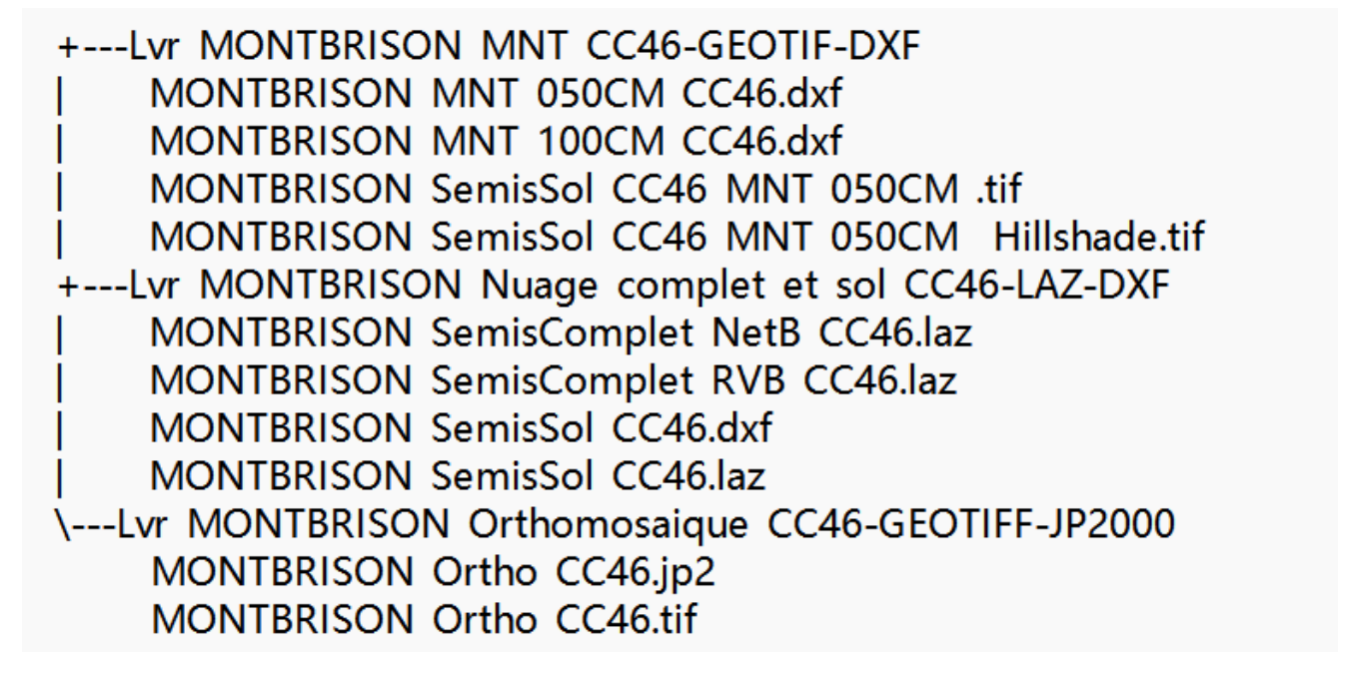

image.png


Project
Summary


LiDAR works mainly based on a combination of optical and LiDAR technology, using the laser as a signal source to obtain the object's 3D coordinates by sending a laser beam at the target and measuring the time of reflection back. It can be matched with the GNSS module to obtain the absolute coordinates of the ground, and with a high-definition camera to provide the point cloud with the real color of the ground.


LiAir X3-H has the function of independent ground imitation, which can independently adapt to areas with large relief and support three echoes, which can "penetrate" the surface vegetation to a certain extent and obtain the real topographic features of the ground. Through the comprehensive analysis of two-dimensional images and three-dimensional spatial data, the quarry terrain survey can be well completed to provide comprehensive data support for regional environmental management and quarry expansion planning.


Recommended Articles

HOW CAN WE HELP YOU?
Message us your questions and contact information.
We’ll get back to you right away!