How to: Generate Point Cloud in NAD83/NAVD88 or Other Horizontal/Vertical Coordinate Systems
Currently LiAcquire only supports WGS84 horizontal coordinate system and WGS84 ellipsoid vertical coordinate system for base station coordinates and trajectory. As a result, the output point cloud processed by LiAcquire is in the WGS84 horizontal coordinate system and ellipsoid vertical coordinate system. For users who need to generate point clouds in a different coordinate system, for example, users in United States who need to produce GIS data in North American Datum of 1983 (NAD 83) and North American Vertical Datum 1988 (NAVD 88), the official civilian horizontal and vertical datums for surveying and mapping activities in the United States, the following method and tools can be used to do coordinate system conversion.
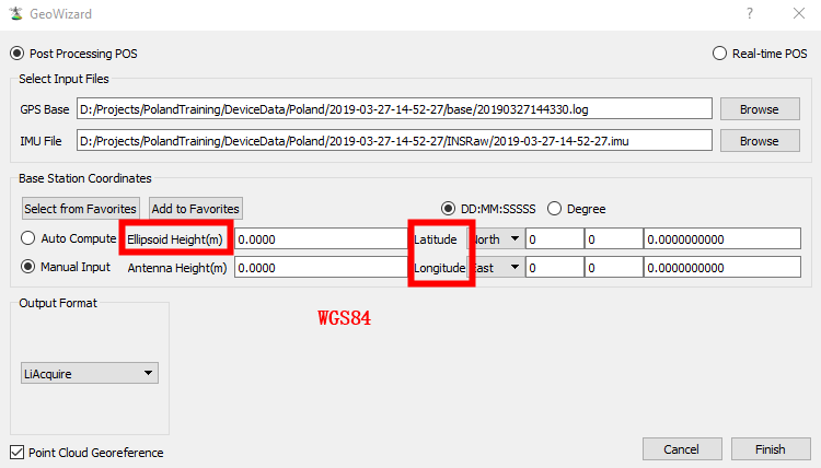
When georeferencing point cloud in LiAcquire, make sure the horizontal coordinates of your base station is in WGS84 and ellipsoid height is in WGS84 ellipsoid height.
By default, the coordinate system of the output point cloud is in UTM projection with WGS84 datum. If both horizontal and vertical coordinate systems would need to be converted, for example, to NAD83/NAVD88, leave the output coordinate system as default and set Output Format to LAS. If only the horizontal coordinate system would need to be converted and the target output vertical coordinate system would still be in ellipsoid height, use the Reproject function in LiAcquire to reproject the output point cloud into another horizontal coordinate system.
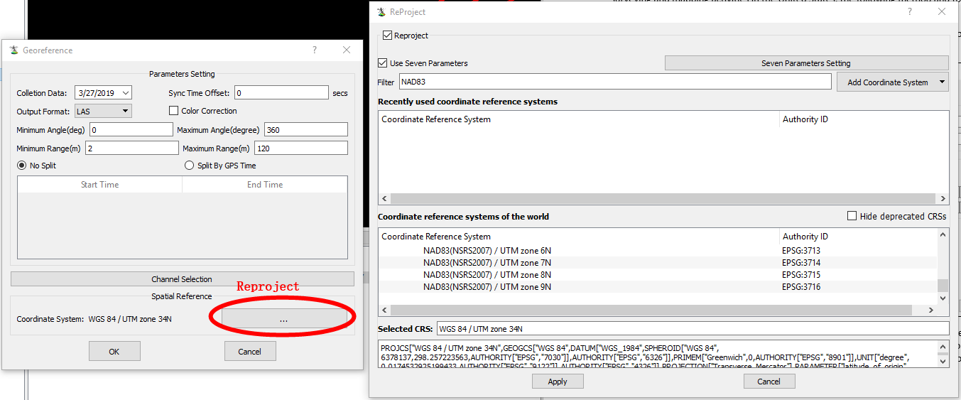
Note: The Reproject function in LiAcquire does not support converting point cloud into a non-ellipsoid vertical coordinate system.
NOAA provides a free datum transformation tool, VDatum, which allows users to convert their data from different horizontal/vertical references into a common system: https://vdatum.noaa.gov/welcome.html.
a. Follow NOAA’s guide to download and use VDatum:
• https://vdatum.noaa.gov/download.php
• https://vdatum.noaa.gov/docs/userguide.html
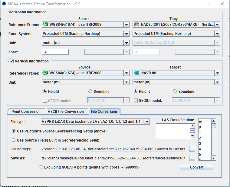
b. Use File Conversion option, and input the LAS point cloud file generated in LiAcquire.
c. Set Reference Frame for Source as WGS84(G1674) – use ITRF2008, Projected UTM, meter (m), and set its Zone according to the UTM zone of your point cloud (indicated in the Georeference window in LiAcquire), if the default output coordinate system was used in LiAcquire.
d. Set Target to your target coordinate system. Here is an example to convert from LiAcquire’s default coordinate system to NAD83/NAVD88.
e. Convert. The tool will generate a new point cloud LAS file in your target coordinate system.