Fully Autonomous Fine Inspection Solution for Substations
Learn how GreenValley supports substation inspection with autonomous data capture, intelligent analysis, and high-precision LiDAR workflows for electric utility operations.
Introduction
In substation inspections, drone technology has gained wide attention for its flexibility and efficiency. However, due to the complex environment, dense equipment layout, and high safety requirements of substations, drone-based inspections still face a series of challenges. To address these, it is essential for operators to conduct thorough surveys of both the internal equipment and surrounding environment. By using ground-based or UAV-mounted LiDAR systems to collect data, a 1:1 digital reconstruction of the substation can be achieved. This enables the creation of a high-precision 3D point cloud model, providing accurate data to support autonomous drone route planning, and facilitating fully automated, unmanned aerial inspections in substations. LiDAR technology offers advantages such as high acquisition efficiency, wide data coverage, high precision, and ease of operation. By using LiDAR to collect high-resolution point cloud data of substations and building 3D models, operators can plan and generate inspection flight paths and waypoints that meet drone mission requirements.
Hardware Selection
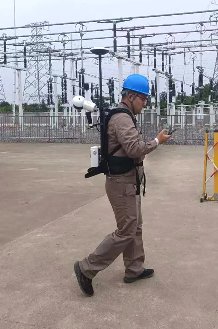
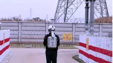
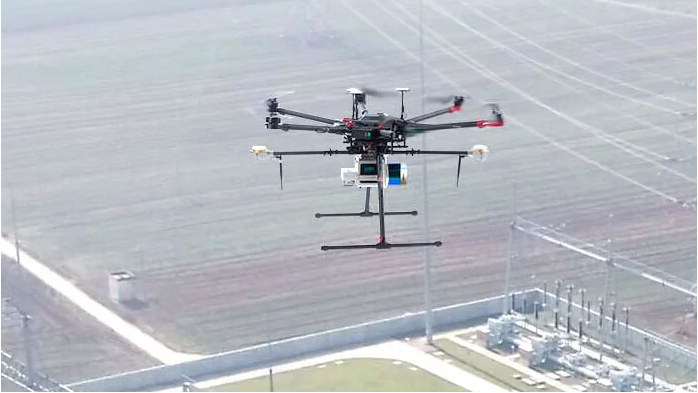
Considering the actual conditions in substations, a combined approach using GreenValley International's LiBackpack backpack scanner, LiGrip handheld rotating LiDAR system, and LiAir UAV-mounted LiDAR system is recommended for point cloud data acquisition. For areas closer to the ground, backpack or handheld LiDAR systems are used. For higher or more difficult-to-access areas, multi-rotor UAVs equipped with LiDAR sensors can supplement data collection.
Software Selection
LiPowerline is specialized software for power line inspection tasks. It integrates point cloud processing, power line model reconstruction, and inspection planning functions. LiDAR360 provides comprehensive point cloud processing and analysis tools, supporting data processing from multiple LiDAR platforms and formats, and offering powerful 3D modeling and analysis capabilities.
Workflow
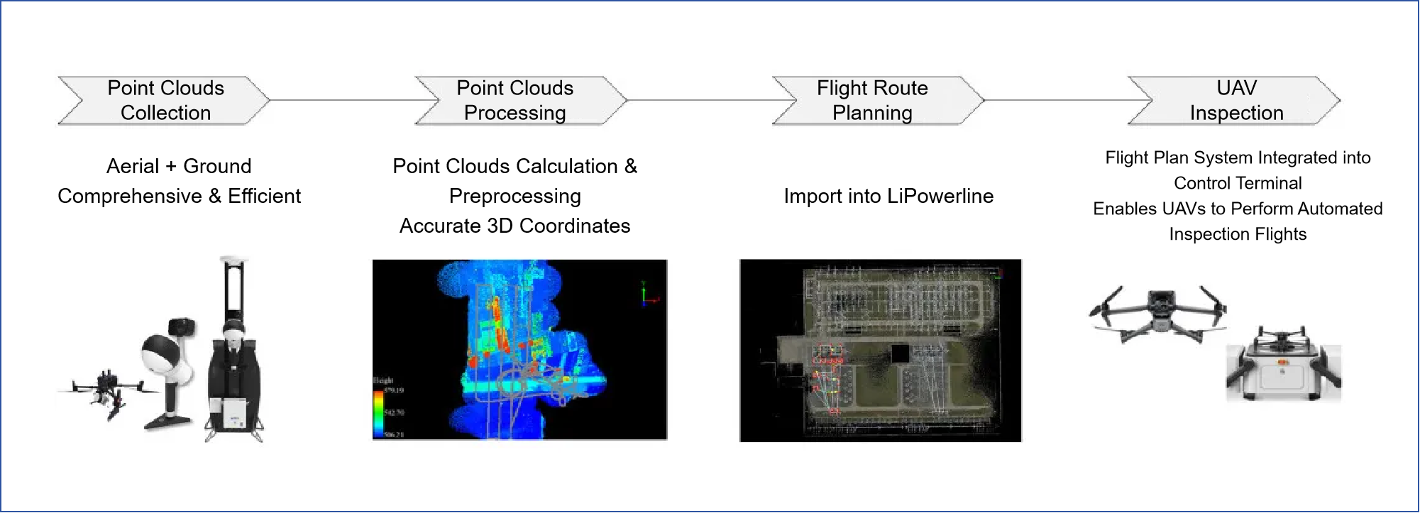
Workflow Overview
1. Point Cloud Acquisition
The acquisition process includes site survey, route planning, and scanning operations. As the quality of the LiDAR point cloud data directly impacts the accuracy of the 3D model and flight path planning, data collection must follow specific technical requirements to ensure data quality.
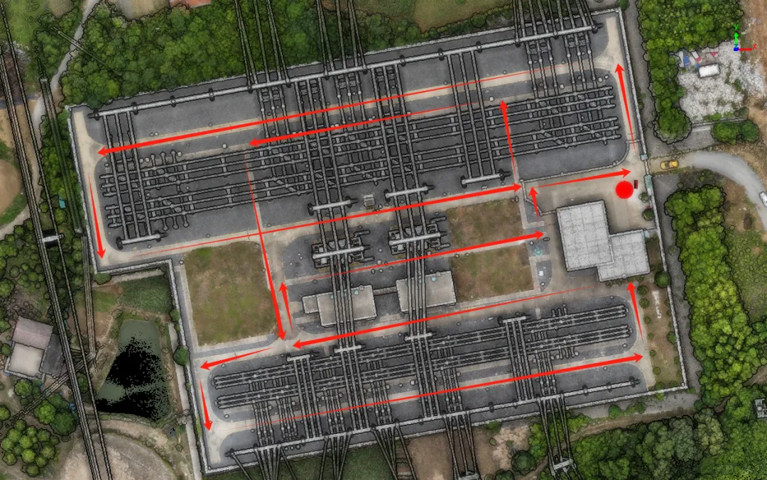
Substation LiDAR Point Cloud Acquisition
2. Point Cloud Processing
The processing workflow includes denoising, classification, and modeling. LiDAR360 can be used for denoising to remove outliers and noise points. The software's automatic classification function identifies and classifies point clouds into categories such as ground, vegetation, buildings, and power facilities. After classification, a high-precision 3D model of the substation is generated.
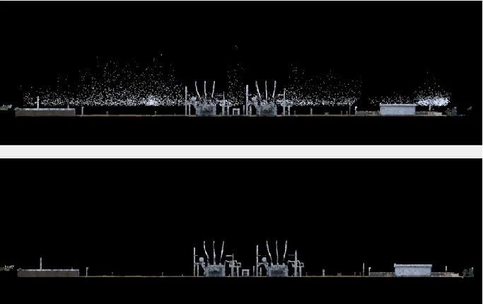
Denoising
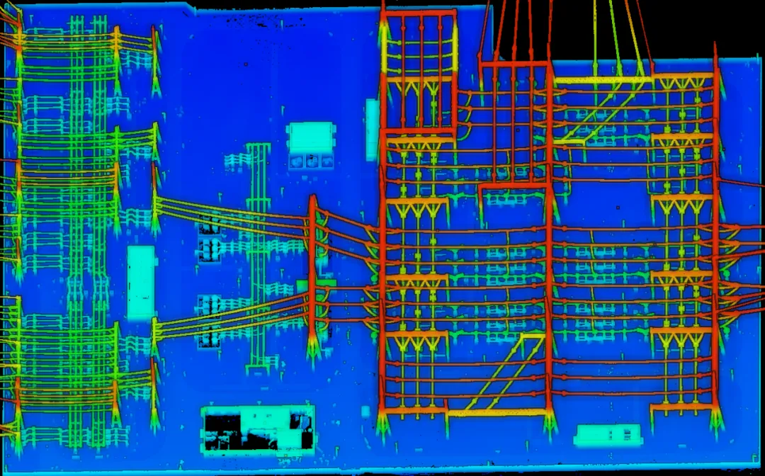
High-Precision Point Cloud Model
3. Flight Path Planning
Based on the high-precision 3D model, inspection flight paths are planned in LiPowerline. Part Points are added to indicate target areas for image capture. Four path generation modes are available: Standard, Boundary-based, Strip-based, and Connect to Main Path. Waypoints can be edited to adjust pitch, yaw, and distance, with image preview support. Finally, safety checks are conducted to verify obstacle clearance, distances between waypoints, and distance from ground or objects below.
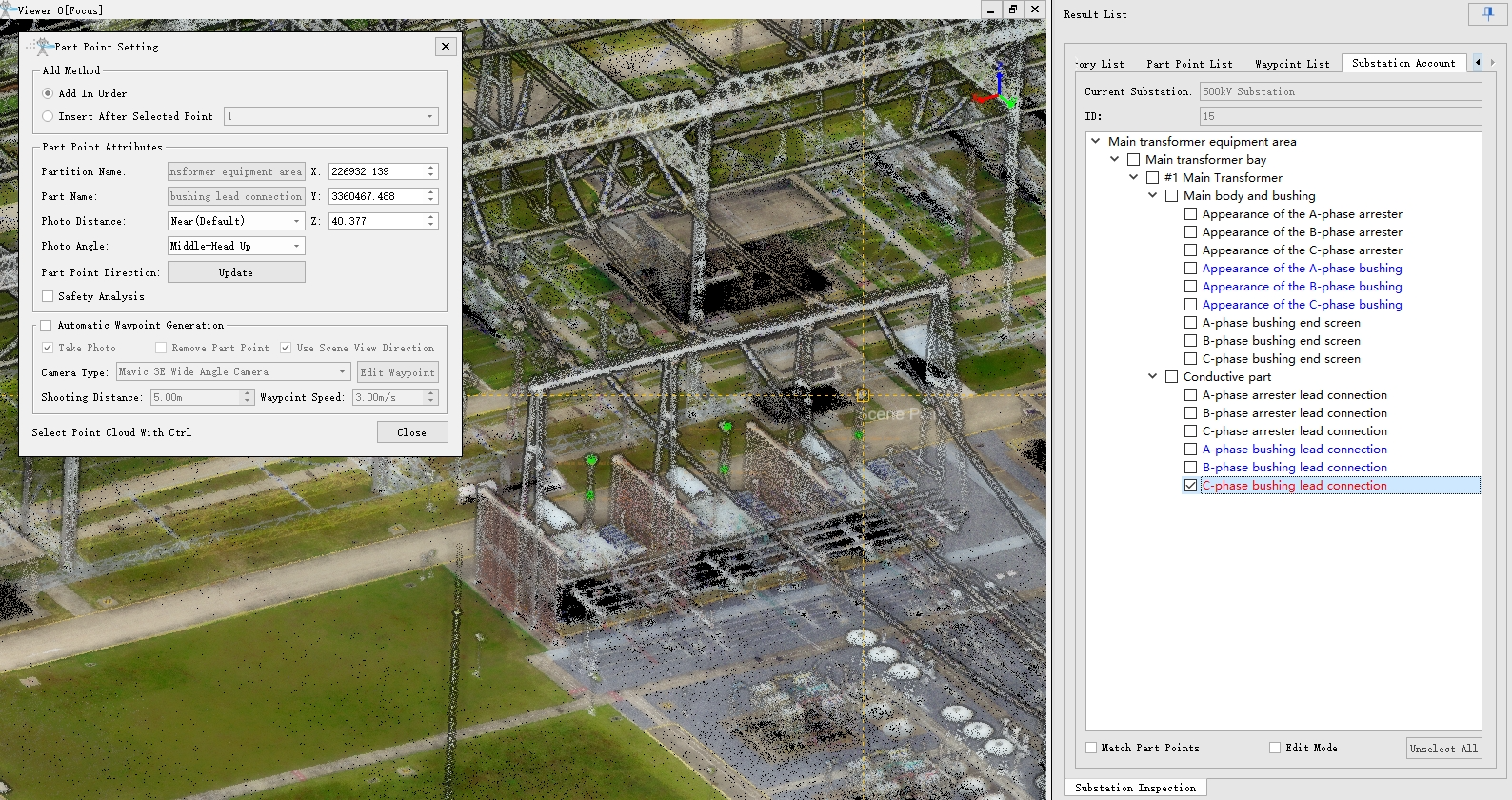
Add Part Points
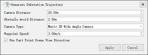
Generate Flight Paths
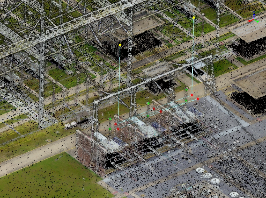
Generate Flight Paths
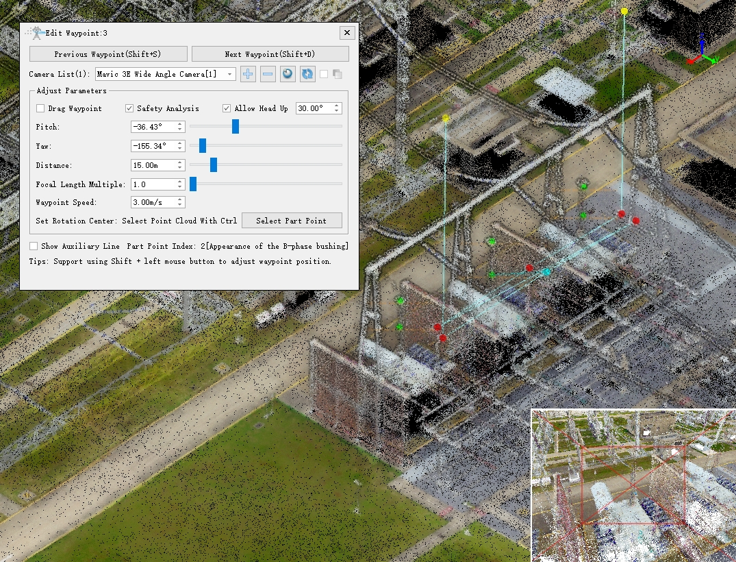
Edit Waypoints
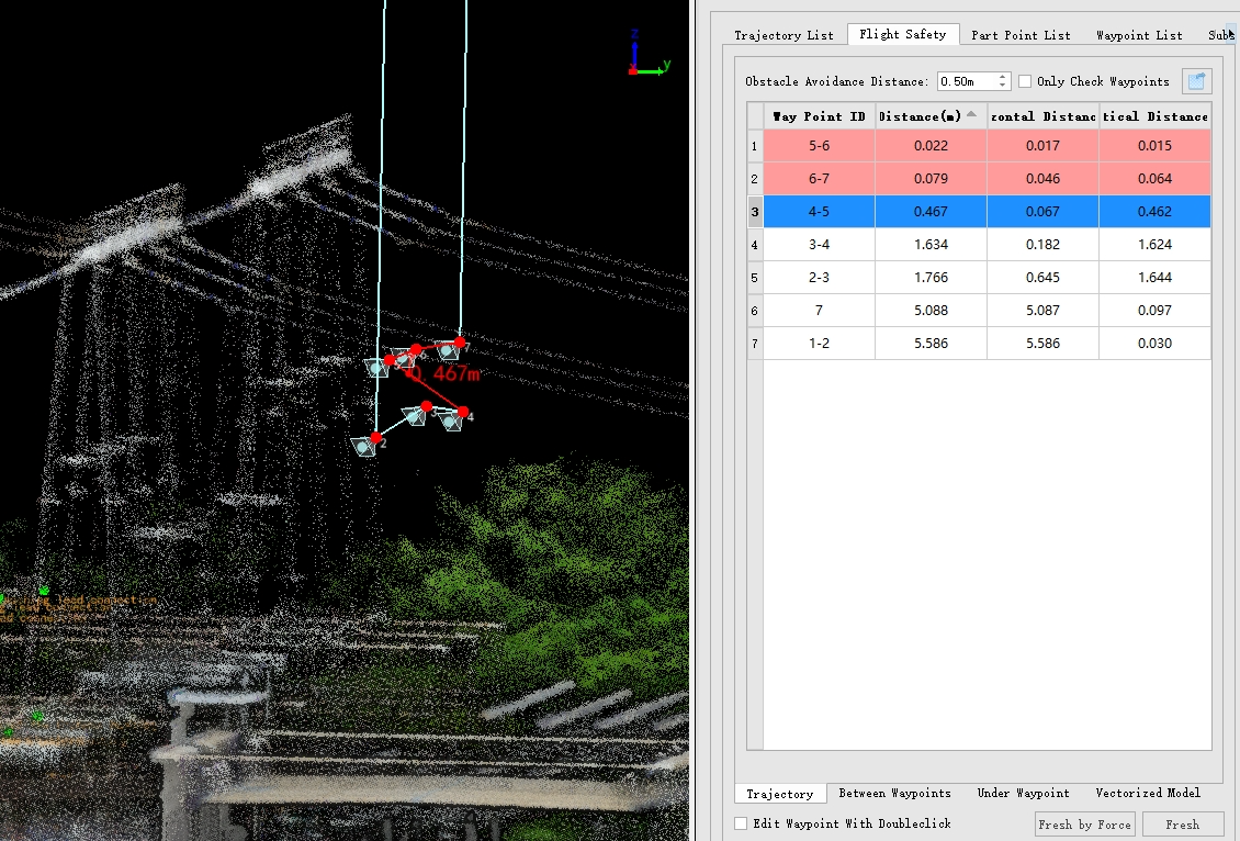
Safety Check
4. Drone Inspection
The drone autonomously executes the inspection mission along the planned route. It automatically adjusts its position and angle at each waypoint to capture high-resolution images of the target equipment. The system supports real-time monitoring and recording during the flight mission. After the mission is completed, the data is automatically organized and a flight report is generated.
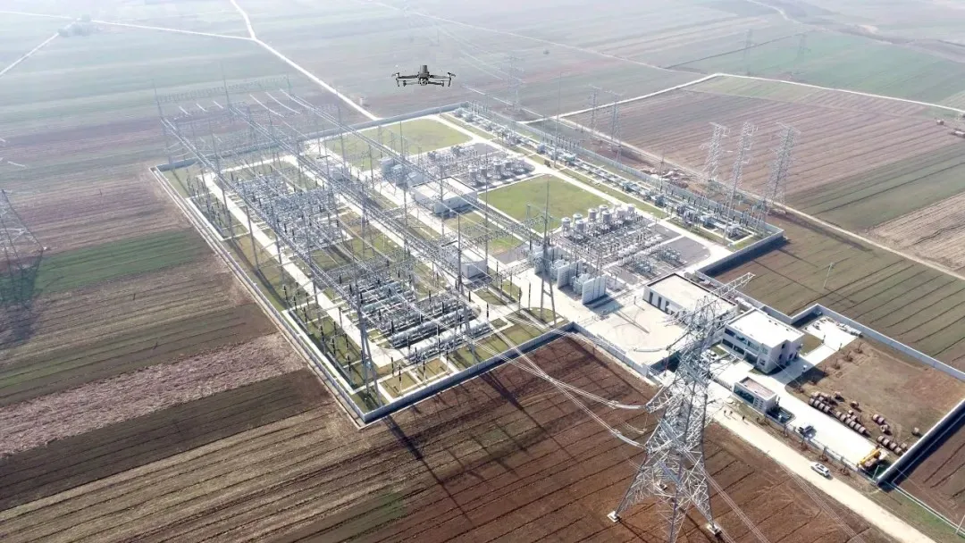
Autonomous Drone Inspection
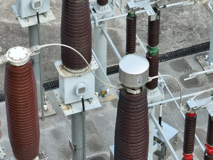
High-Resolution Inspection
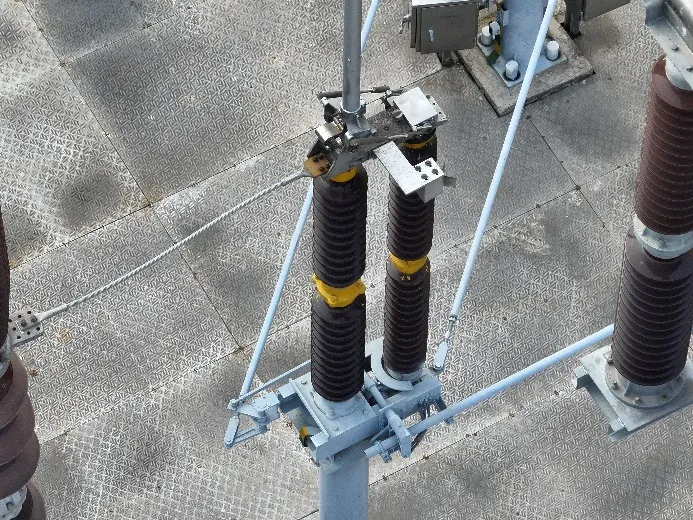
High-Resolution Inspection
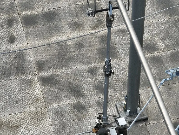
High-Resolution Inspection
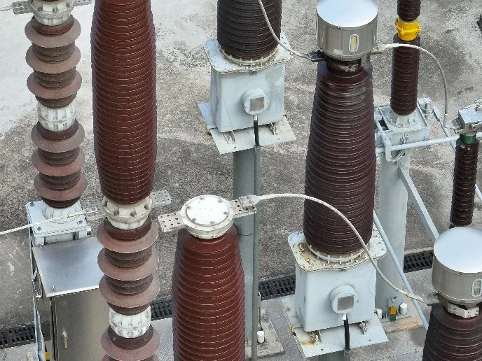
High-Resolution Inspection
Solution Summary
The fully autonomous fine inspection solution for substations consists of three core stages: data acquisition, processing and modeling, and autonomous inspection. By integrating LiDAR hardware and intelligent software, the solution achieves comprehensive digitization of substations, improves inspection efficiency and safety, and reduces the need for manual field work. The high-precision 3D model serves not only inspection purposes but also provides valuable data support for asset management and operational decision-making. LiPowerline: https://www.greenvalleyintl.com/LiPowerline LiDAR360: https://www.greenvalleyintl.com/LiDAR360
Guess you like

Topcon and GreenValley International Collaborate on Spatial Intelligence Innovations
Strategic collaboration will bring spatial intelligence into real-world industry applications by integrating hardware, software, cloud and AI to simplify, automate and intelligently connect complex workflows across construction, machine control, infrastructure and other high-value industries.
 Company News
Autonomous LiDAR Powerline Inspection Demonstrated in Malaysia
Discover how GreenValley LiAir X4 and LiPowerline support autonomous UAV LiDAR powerline inspection, vegetation risk detection, clearance analysis, and transmission corridor maintenance.
Case Studies
GreenValley International Inc (GVI), headquartered in Berkeley, California, is a leading innovator of 3D mapping technologies. GVI provides a wide range of advanced aerial, terrestrial, and mobile LiDAR survey and mapping hardware systems and cutting-edge software as well as turnkey solutions. Our portfolio includes airborne, handheld, mobile, and backpack laser scanning platforms, as well as point cloud processing software such as the LiDAR360 LiDAR data processing platform. GVI focuses on LiDAR and image fusion technology, specializing in LiDAR, UAV, SLAM, Photogrammetry, and other technologies to achieve an accurate digital representation of three-dimensional space. As we continue to expand our reach and technological capabilities, GVI remains committed to driving innovation and pushing the boundaries of what's possible in the LiDAR space.