Autonomous LiDAR Powerline Inspection Demonstrated in Malaysia
Discover how GreenValley LiAir X4 and LiPowerline support autonomous UAV LiDAR powerline inspection, vegetation risk detection, clearance analysis, and transmission corridor maintenance.
To support local partners in expanding powerline inspection and grid operation services in Malaysia, GreenValley International recently demonstrated its complete LiAir X4 + LiPowerline powerline inspection solution. Combining autonomous flight, high-precision LiDAR data acquisition, intelligent point cloud analysis, hazard detection, and refined flight route planning, the solution provides a reliable workflow for modern transmission line inspection and maintenance.
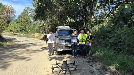
Autonomous Transmission Line Following with LiAir X4
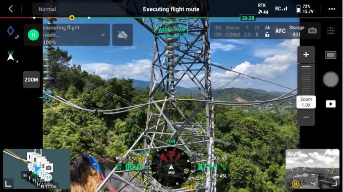
During the field demonstration, LiAir X4 performed autonomous transmission line following for efficient corridor data acquisition. The system supports adjustable line-following speeds from 2-10 m/s. In this demonstration, the UAV operated at 8 m/s while maintaining a flight altitude of 20 m above the ground wire, allowing the system to accurately follow the transmission corridor trajectory. Before the mission begins, operators can predefine the inspection tower range. After data acquisition is completed, the UAV automatically performs Return-to-Home (RTH), reducing manual intervention and improving operational efficiency in large-scale inspection scenarios.
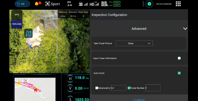
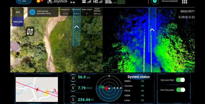
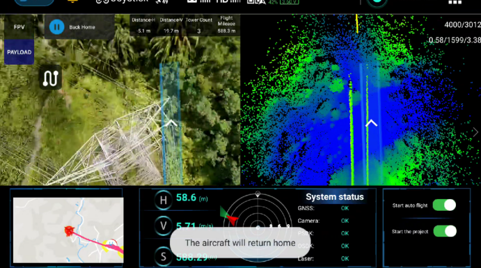
Autonomous Transmission Line Following with LiAir X4
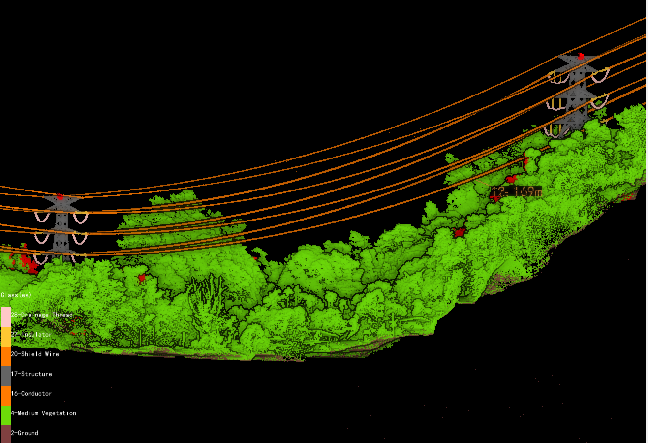
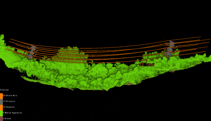
The collected LiDAR data was processed and automatically classified in LiPowerline to reconstruct the transmission corridor and tower structures in detail. The system accurately identified and classified key elements including: - Ground points - Medium vegetation - Conductors - Shield wires - Tower structures - Insulators The structured classification results provide reliable data support for vegetation analysis, hazard detection, asset management, and inspection planning.
Intelligent Vegetation Risk Detection
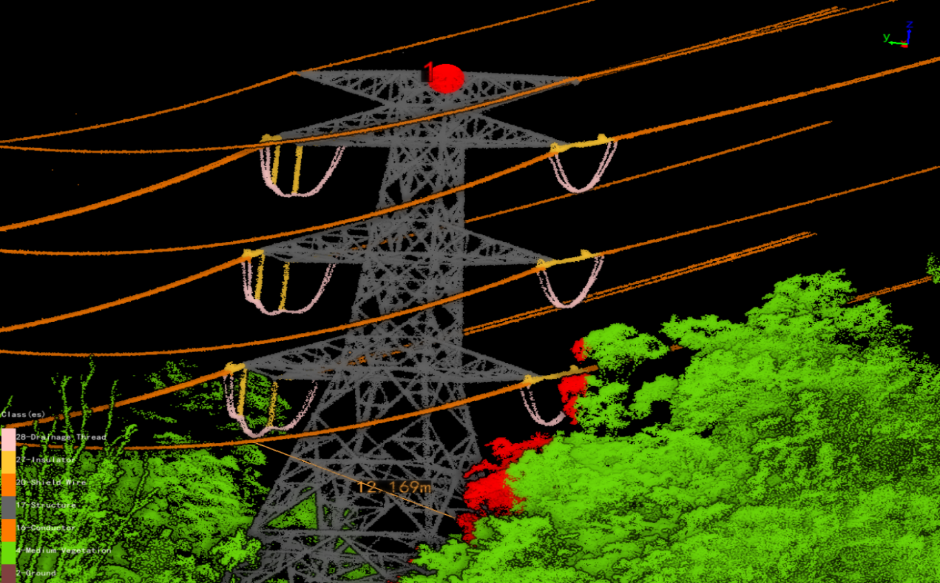
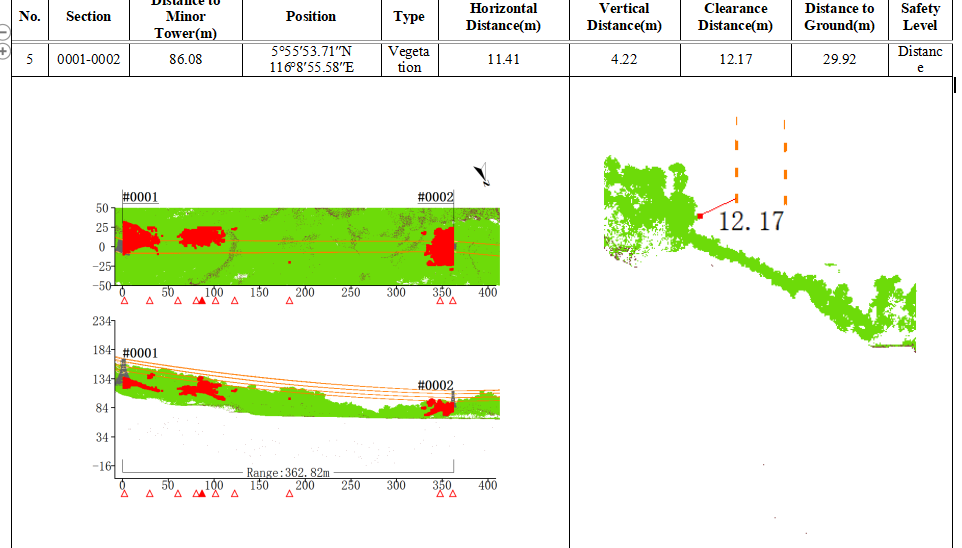
Based on the classified point cloud data, the system automatically detected vegetation risks and calculated clearance distances between conductors and surrounding vegetation. During the demonstration, the minimum detected clearance distance was 12.169 m, enabling rapid identification of potential risk locations along the transmission corridor. The workflow also supports customized inspection report generation based on local utility operation and maintenance standards, helping inspection teams generate standardized and practical deliverables for vegetation management and grid safety assessment.
Refined Inspection Route Planning with LiPowerline
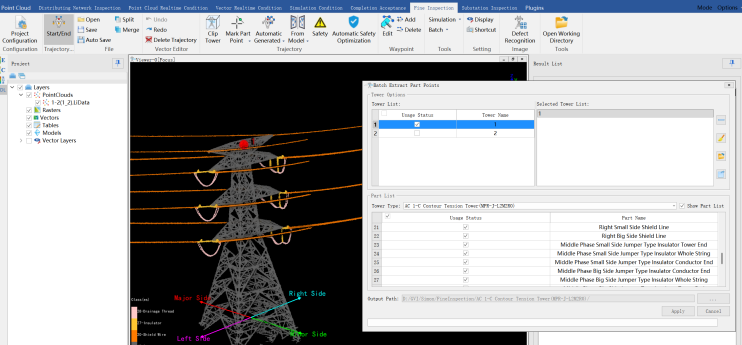
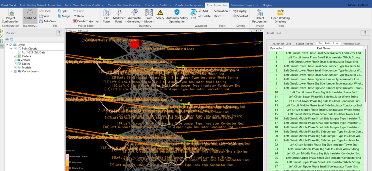
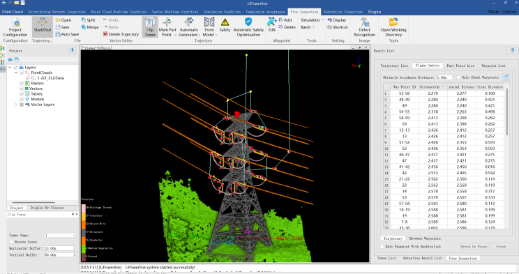
LiPowerline includes a built-in library of standard tower types and supports intelligent extraction of key inspection components, including: - Insulators - Suspension points - Jumper wires - Other critical transmission line components After extracting key component points, the system can automatically generate refined inspection flight routes with a single click. The workflow also supports: - Automatic flight route safety optimization - Customizable waypoint parameters - Multiple route export formats - Compatibility with various UAV platforms This enables detailed tower inspection and comprehensive coverage of critical transmission line assets.
A Complete Workflow for Smarter Powerline Inspection
The Malaysia field demonstration highlighted the practical effectiveness of the LiAir X4 + LiPowerline solution across the complete powerline inspection workflow. From autonomous transmission line following and high-density LiDAR acquisition, to intelligent classification, vegetation risk analysis, and automated inspection route generation, the solution helps utilities and inspection teams achieve: - Increased operational automation - More accurate spatial data acquisition - Faster hazard identification - More efficient inspection planning - Improved reporting and decision-making efficiency By combining advanced LiDAR hardware with intelligent software analysis, GreenValley International provides a reliable and scalable solution for modern transmission line inspection, helping utilities and service providers improve inspection efficiency, enhance safety management, and support smarter power infrastructure maintenance.
Explore the Complete Powerline Inspection Workflow
LiPowerline: https://www.greenvalleyintl.com/LiPowerline Contact us: https://www.greenvalleyintl.com/contactNew
Guess you like

Topcon and GreenValley International Collaborate on Spatial Intelligence Innovations
Strategic collaboration will bring spatial intelligence into real-world industry applications by integrating hardware, software, cloud and AI to simplify, automate and intelligently connect complex workflows across construction, machine control, infrastructure and other high-value industries.
 Company News
Fully Autonomous Fine Inspection Solution for Substations
Learn how GreenValley supports substation inspection with autonomous data capture, intelligent analysis, and high-precision LiDAR workflows for electric utility operations.
Articles
GreenValley International Inc (GVI), headquartered in Berkeley, California, is a leading innovator of 3D mapping technologies. GVI provides a wide range of advanced aerial, terrestrial, and mobile LiDAR survey and mapping hardware systems and cutting-edge software as well as turnkey solutions. Our portfolio includes airborne, handheld, mobile, and backpack laser scanning platforms, as well as point cloud processing software such as the LiDAR360 LiDAR data processing platform. GVI focuses on LiDAR and image fusion technology, specializing in LiDAR, UAV, SLAM, Photogrammetry, and other technologies to achieve an accurate digital representation of three-dimensional space. As we continue to expand our reach and technological capabilities, GVI remains committed to driving innovation and pushing the boundaries of what's possible in the LiDAR space.