

Use Workflow


Multi-Source Data Fusion

Massive Data Support

User-Friendly

Multi-Industry

One-click operation

Custom Workflow

Batch Processing

Universal Platform
Multiple Platforms and Data Sources Support
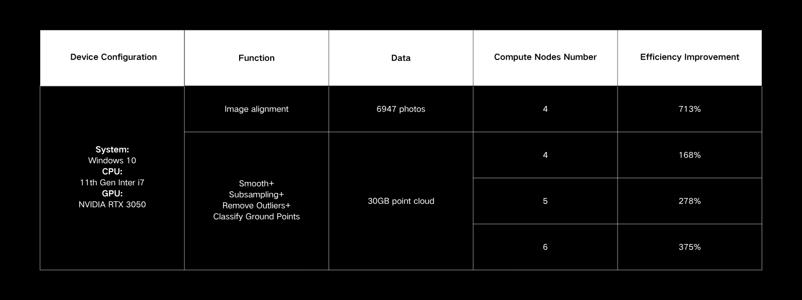
Distributed Computing
The Distributed Computing supports multi-task parallel scheduling and flexible utilization of cloud/local clusters for efficient processing. The distributed architecture splits tasks across multiple nodes, eliminating reliance on a single machine. Compared to traditional methods, this approach delivers multiple times higher efficiency. Seamlessly integrated with workflows, it helps you complete professional tasks with lower hardware costs and faster processing times.
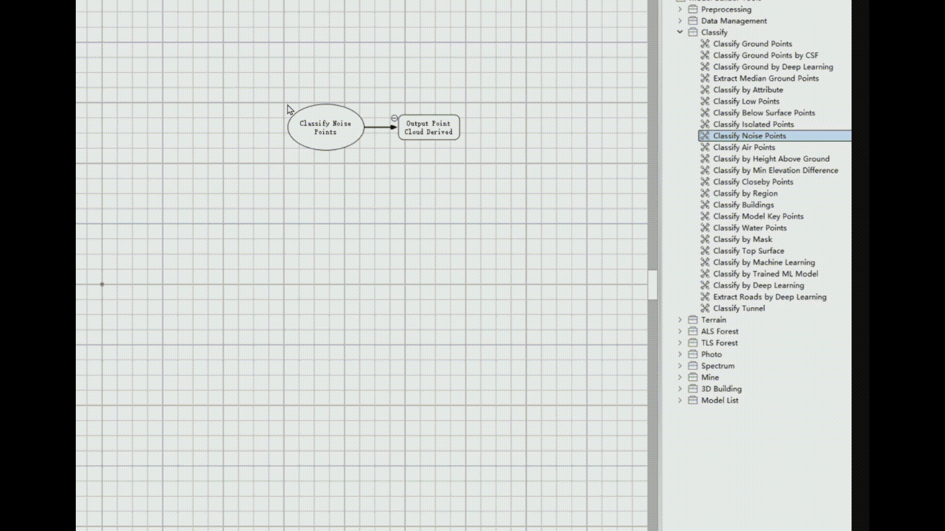
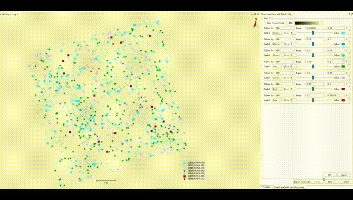
Automatic AI Classification
Classification module deeply integrates AI technology, allowing automatic classification for over 32 features. Integrating Segment Anything Model, supporting outline extraction for arbitrary features from images. Intelligent point cloud classification interactions make your data processing more convenient and efficient. Also you can train AI models for point cloud classification and image features extraction. Meets the automation production needs of various applications.
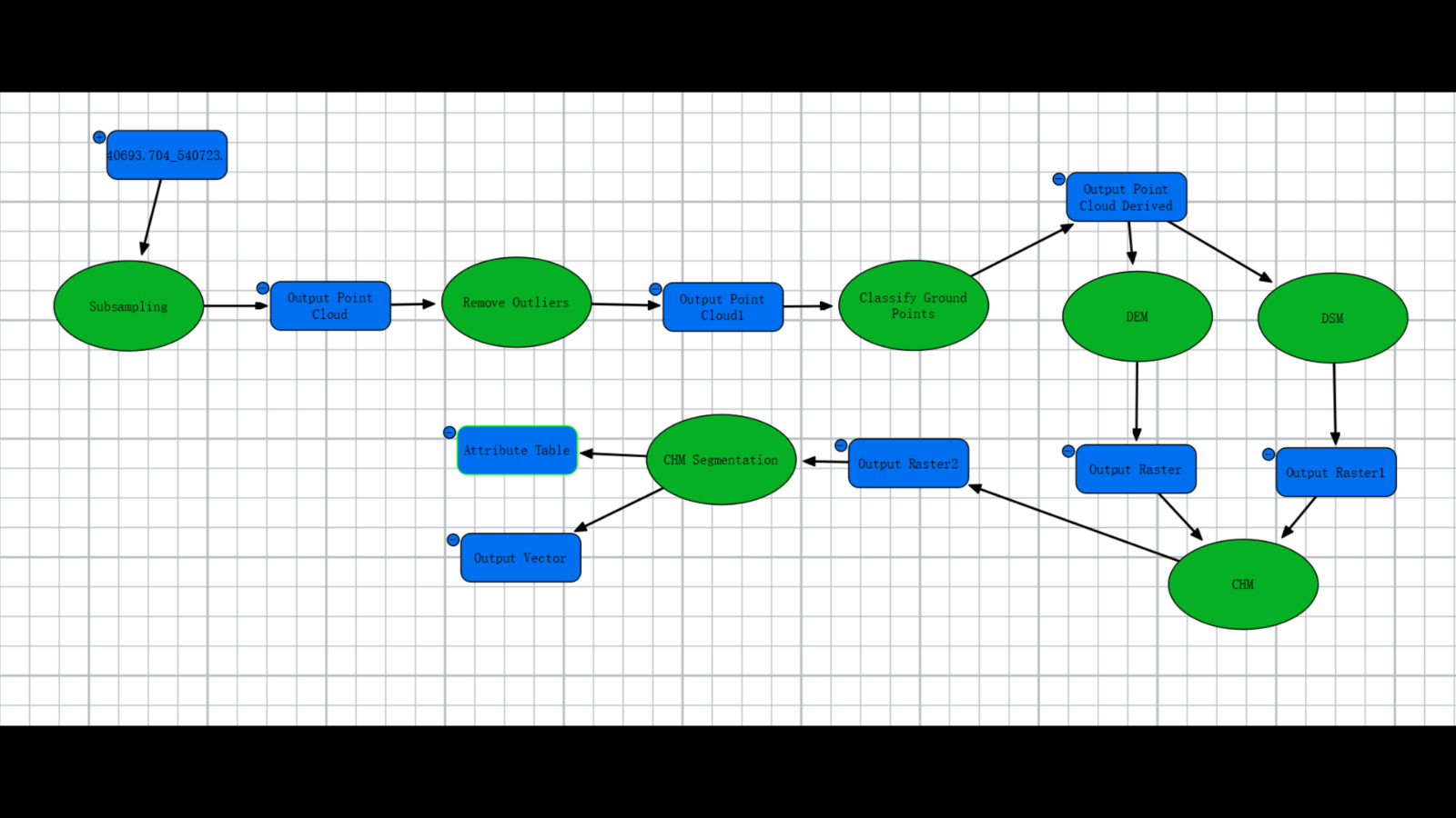
Model Builder
The Model Builder supports the free combination of over 200 functional modules to address more business scenarios; supports distributed and command-line operations, enabling efficient construction and automated workflows.
Use Workflow
Customize Workflow
Model List


Al Assistant
The AI assistant quickly answers questions about product features and usage, making work more efficient and hassle-free. Learn complex functions faster and resolve difficult issues more accurately.

Al Assistant
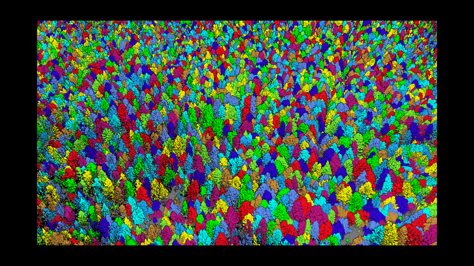
Rich Point Cloud Classification Scenarios
UAV Urban
UAV Rural
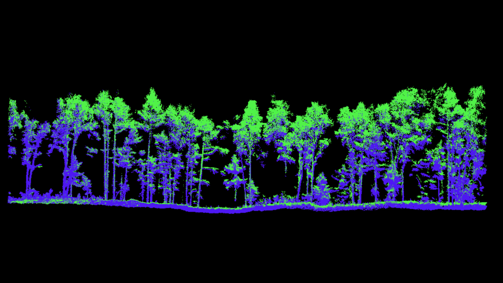
UAV/TLS Forest
Powerline
Tunnel
Interactive classification
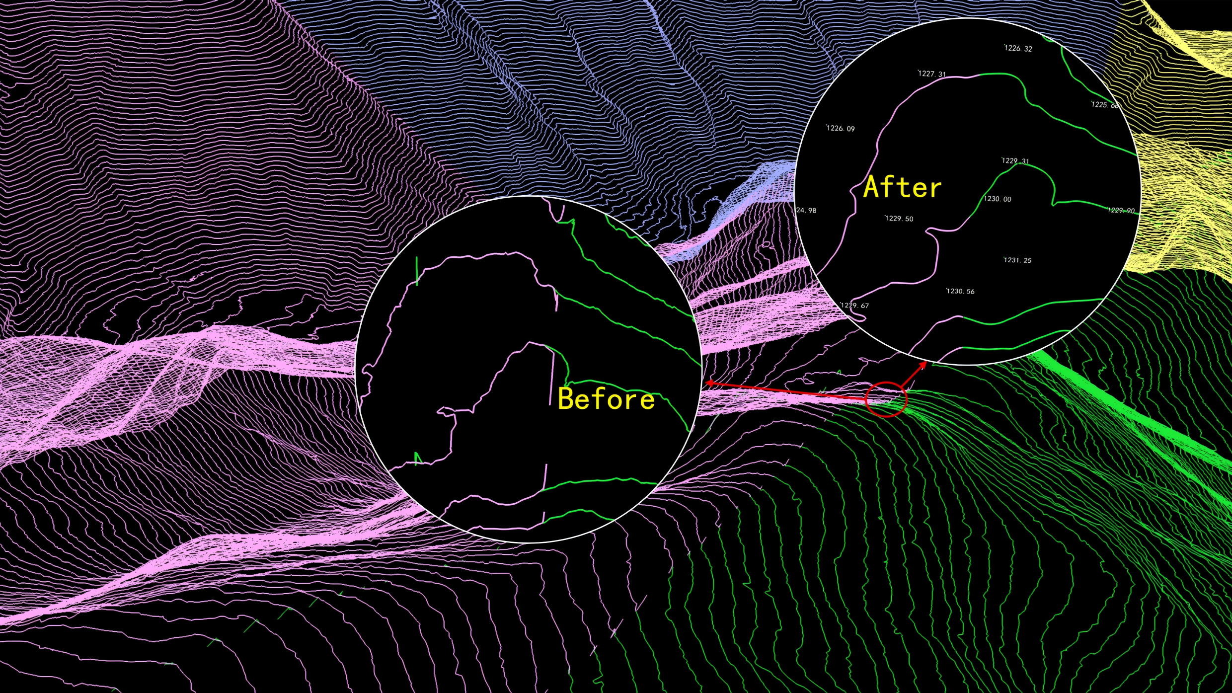
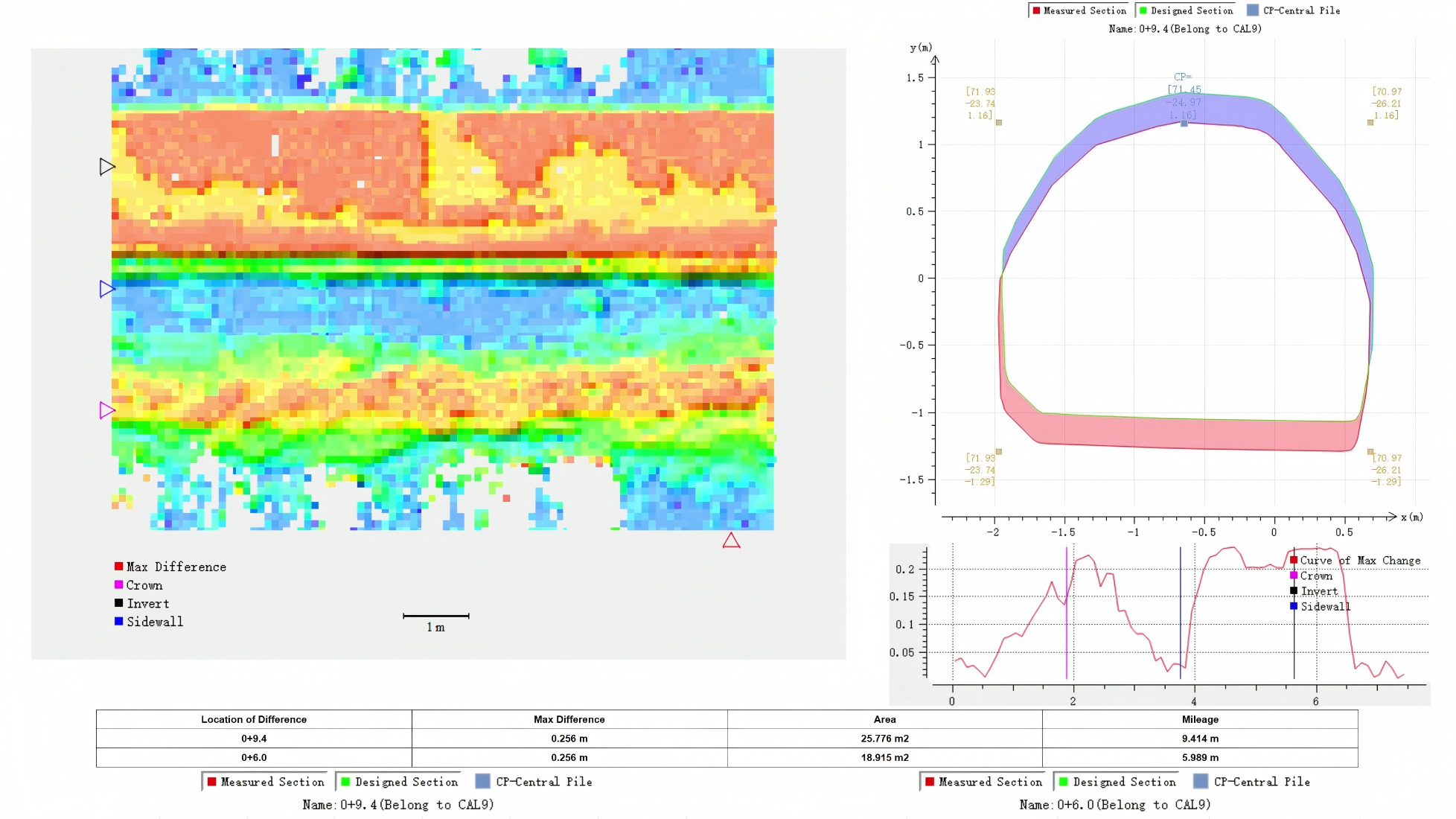
UAV LiDAR QC
UAV LiDAR accuracy inspection enables one-click calibration and point cloud precision checks, ensuring data reliability across the entire workflow from acquisition to processing.
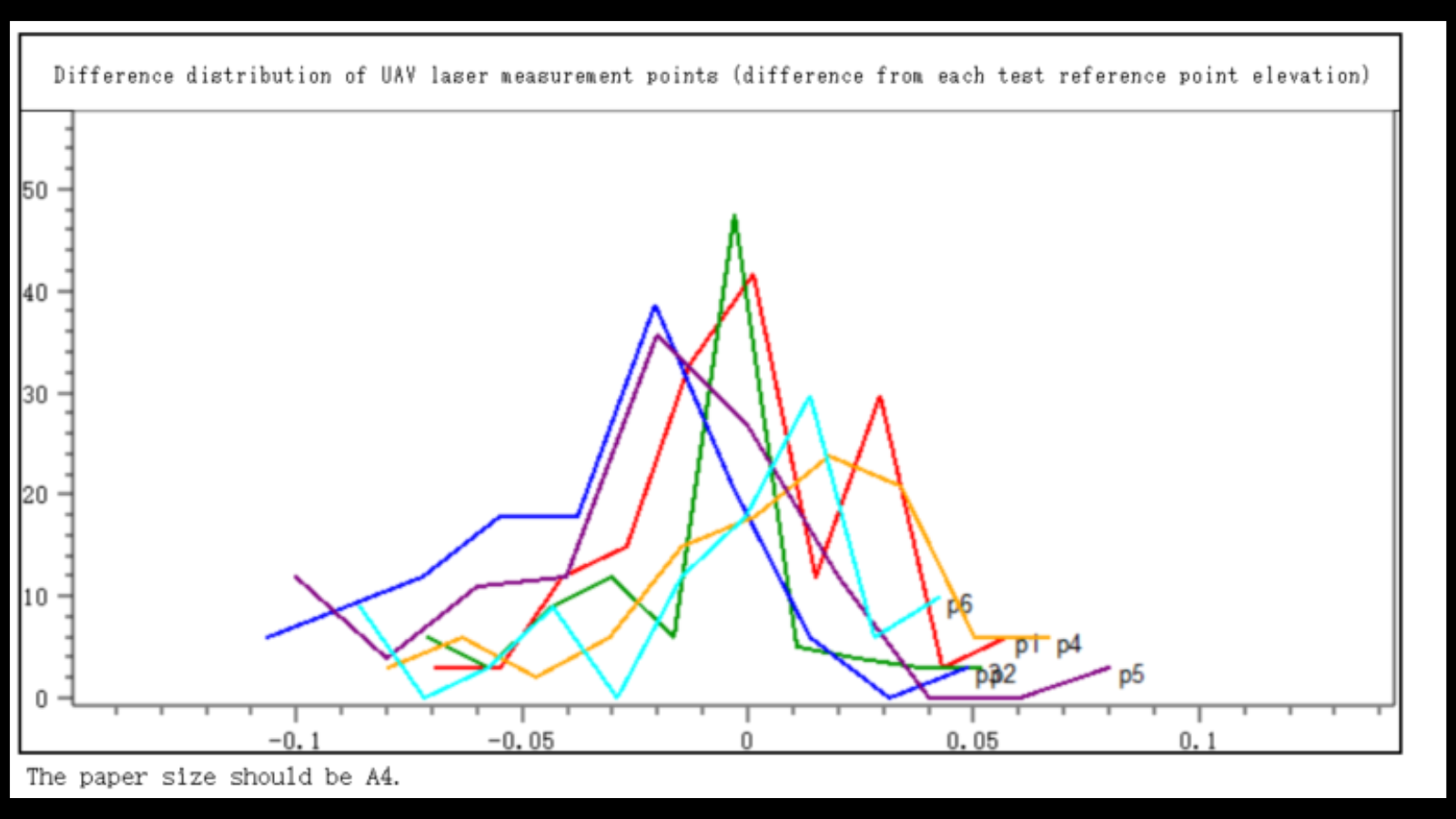
Difference Distribution of UAV Laser Point and Test Reference Point
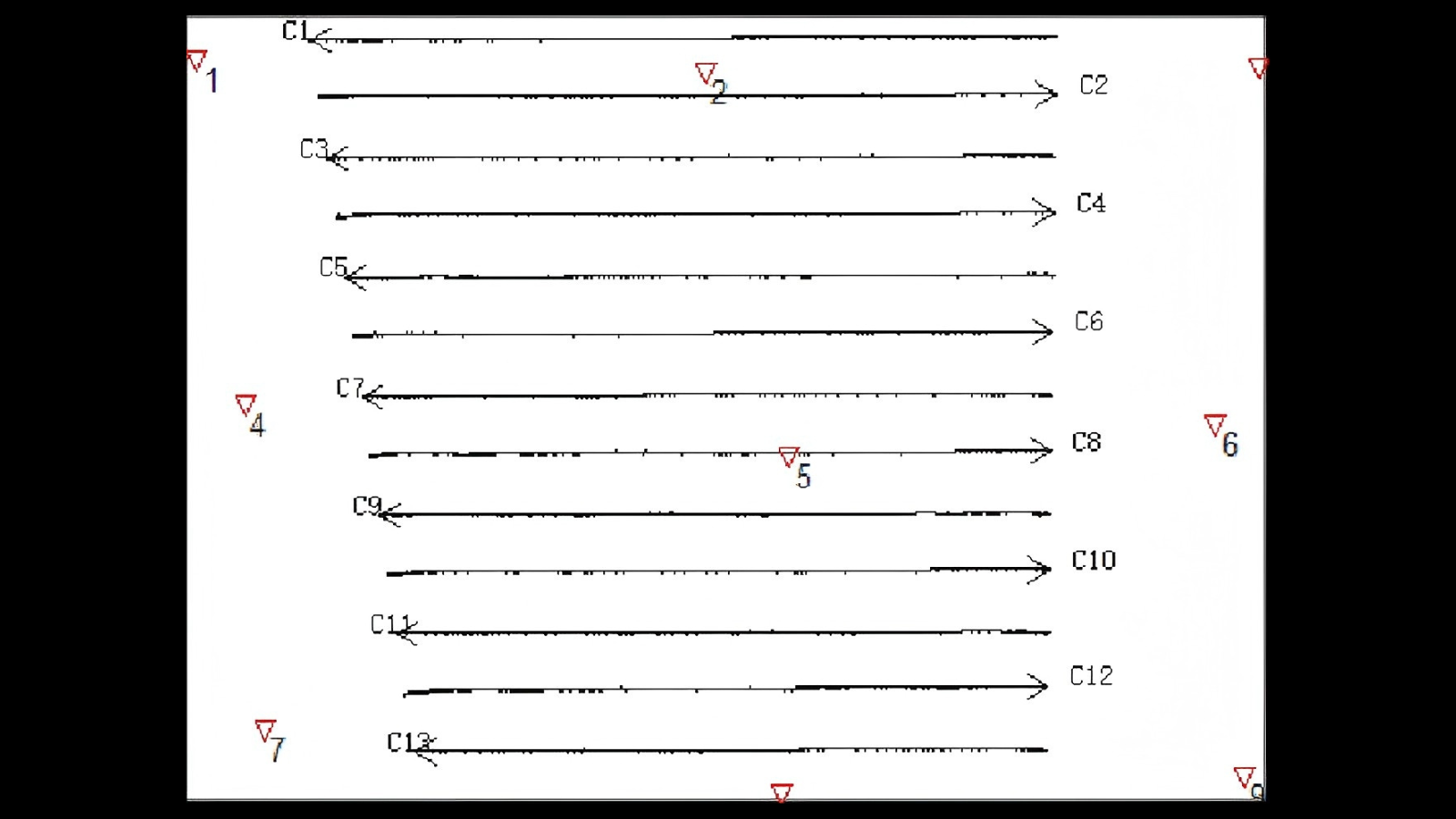
Calibration Site installation Status And Flight Status
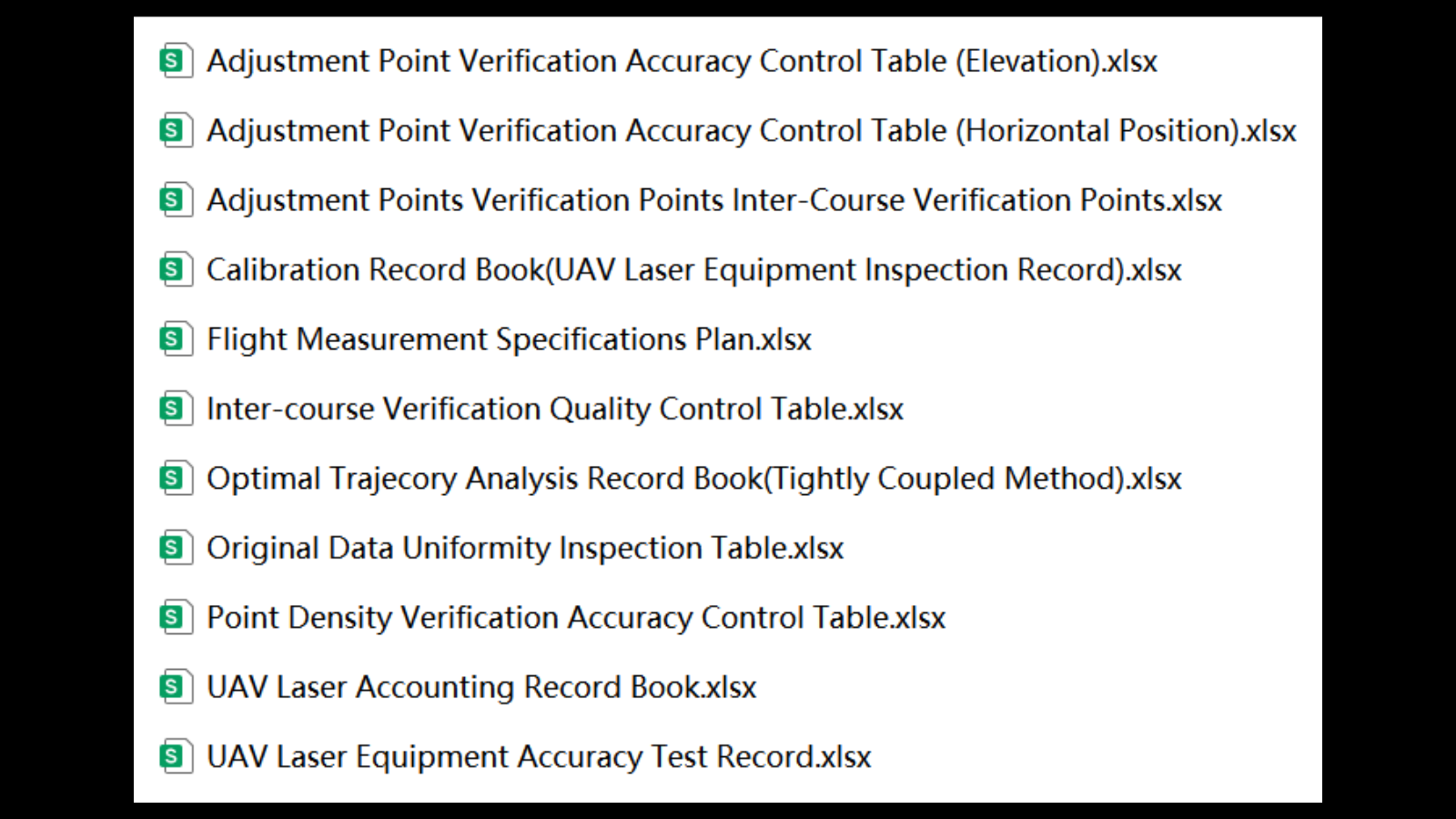
Reports
Preprocessing
The preprocessing module integrates multiple core functions to ensure data quality: trajectory adjustment corrects flight path deviations caused by various factors, effectively resolving data layering issues; data registration automatically aligns multi-station scans without manual stitching; colour adjustment can harmonise colour differences from multiple sources or under different lighting conditions, restoring the true colours of the point cloud; projections can define new coordinate systems or reproject between multiple standard coordinate systems, ensuring seamless workflow integration. These tools collectively optimise the raw data, making the point cloud clear and reliable.
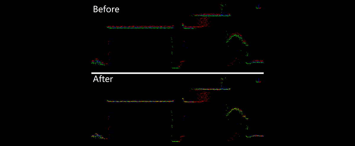
Trajectory Adjustment
Data Registration
Color Adjustment
DJI L2 Data Processing
Photogrammetry
New Photo module can create RGB, infrared and multispectral orthophotograph. Supports targets automatically detection and GCPs matching. Easily improves the quality of image project and the accuracy of point cloud matching. Providing reliable data for features extraction, AI classification, building texture and DOM.
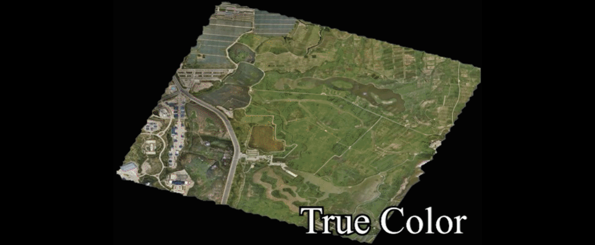
DOM
DOM Editor
Image Applications
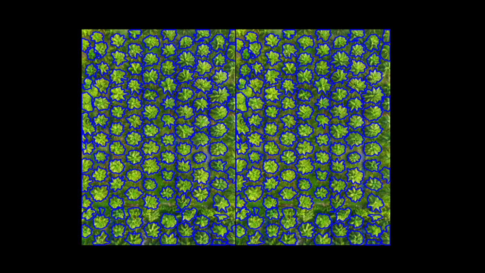
Vectorization
Vector module supports collaboration for multi source data. Seamlessly integrates CAD and GIS files. Quickly extract features' outline from point clouds/images by SAM. 50+ 2D & 3D semi-auto extraction and drawing tools, provide you with a detailed, automated, and intelligent vector editing experience.
Semi-Auto Vectorization
Various Tools
SAM Detection
Intelligent Extraction
Forestry Application
Foestry module can classify trees and shrubs, trunks and crown, individual trees,obtain 18+ attributes including trunk volume, curvature and biomass. Meets the needs of detailed forestry surveys, forest management and carbon monitoring. Provides you with a complete guide for forestry analysis and mapping process. Generates individual tree, stand volume, thinning analysis reports and so on, to standardize the survey results.70 species tree modeling and individual tree attributes rendering, to visualize the analysis results.
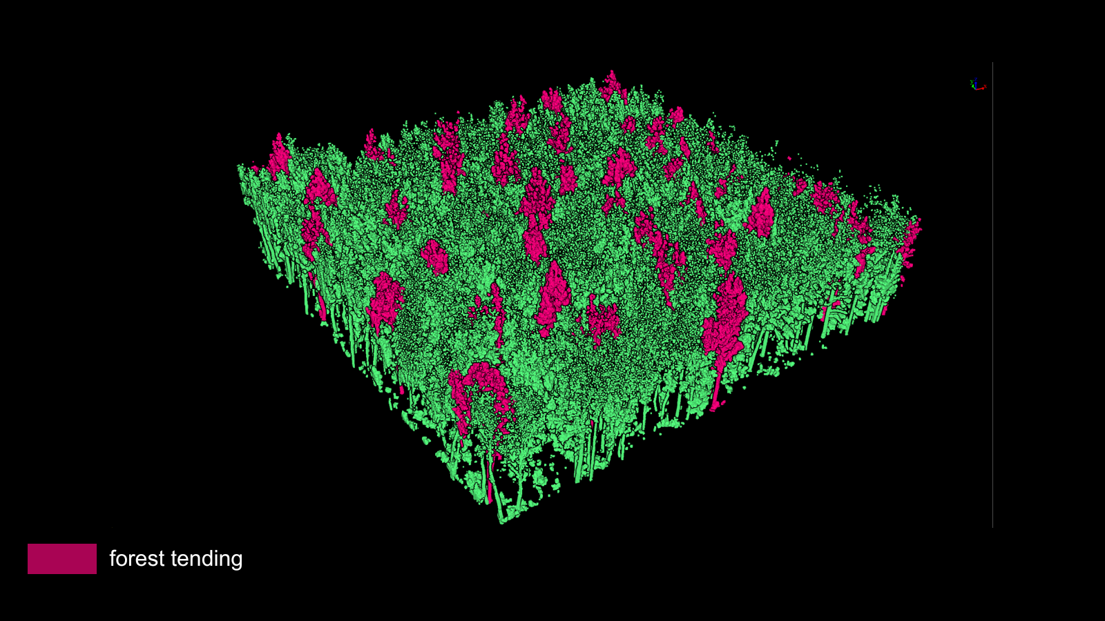
Forest Tending
Thinning Analysis
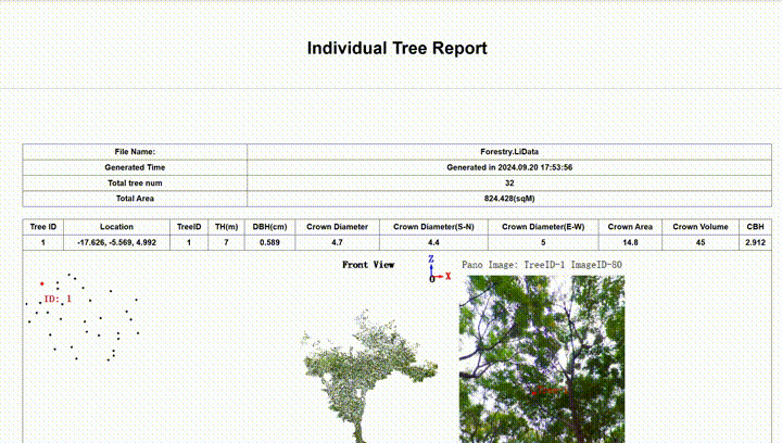
Individual Tree Report
Auto Registration by Tree Locations
Individual Palm Tree Segmentation
Individual Tree Segmentation
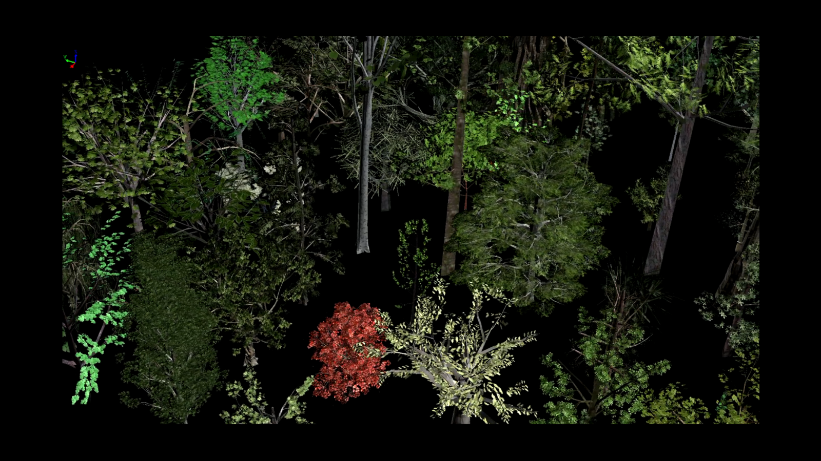
Tree Model
Topographic Mapping
Terrain module supports the complete workflow for production, checking and refinement of various terrain products including DEM, contour and so on. 15 types of terrain products support terrain mapping, geological surveys applications. Based on terrain data, generates REM, drainage and flood area, aiding in hydrological applications. Volume measurement, change detection, and section analysis provide reliable support for engineering surveys.

Topographic Surveying

Terrain Analysis

Hydrological Analysis
Contours Sheet Join
TIN Editing
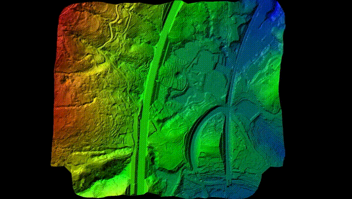
Big Data Mesh Editing
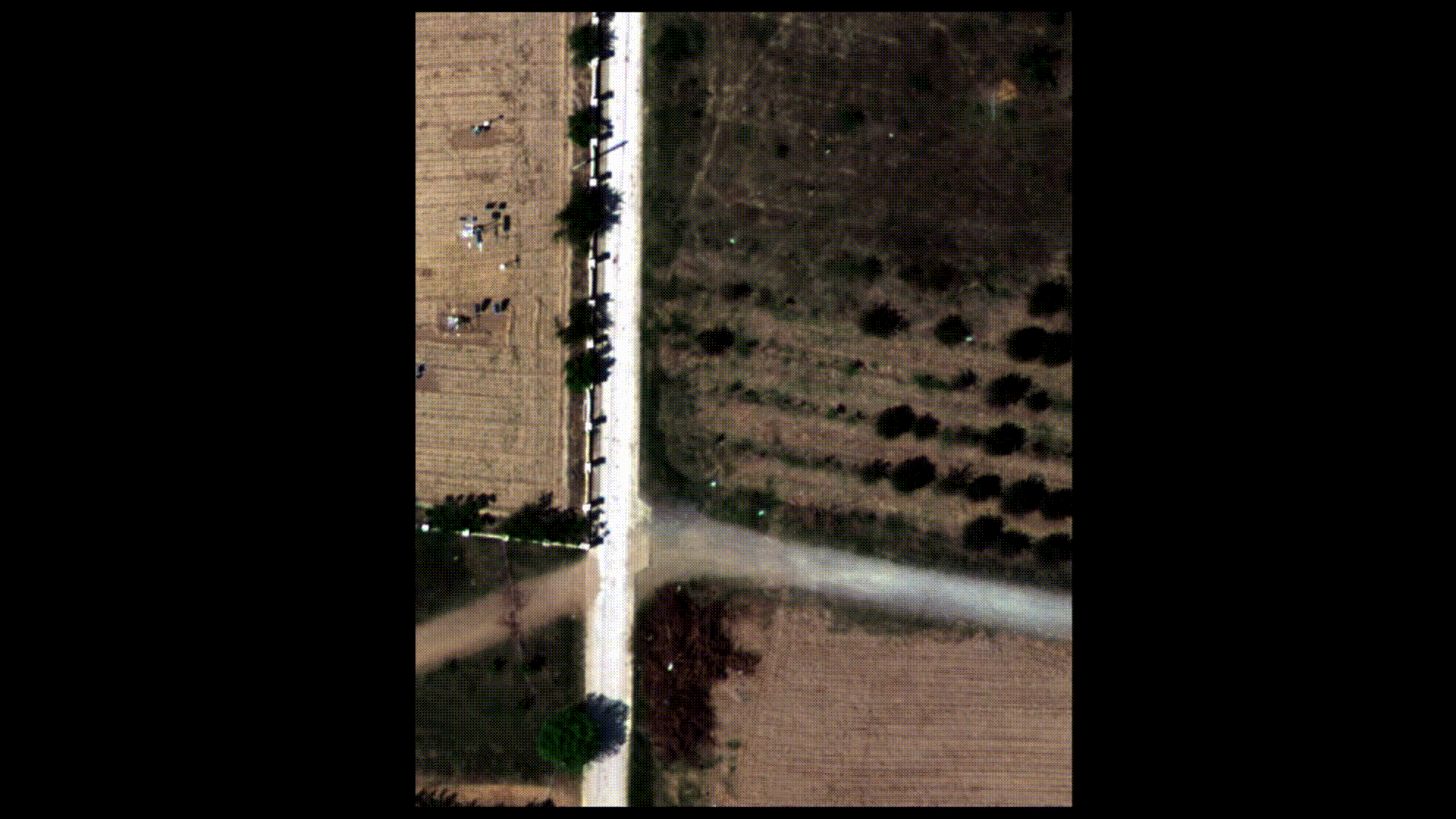
Spectrum
The LiDAR360 Spectral Module denoises, enhances, and classifies spectral data, fusing it with point clouds for rapid feature extraction and multi-source analysis, boosting efficiency and decision-making.
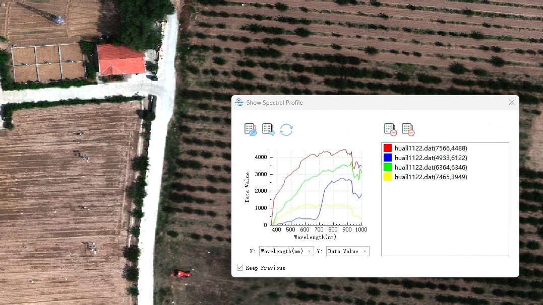
Show Spectral Profile
Classify by Spectral Angle Mapper
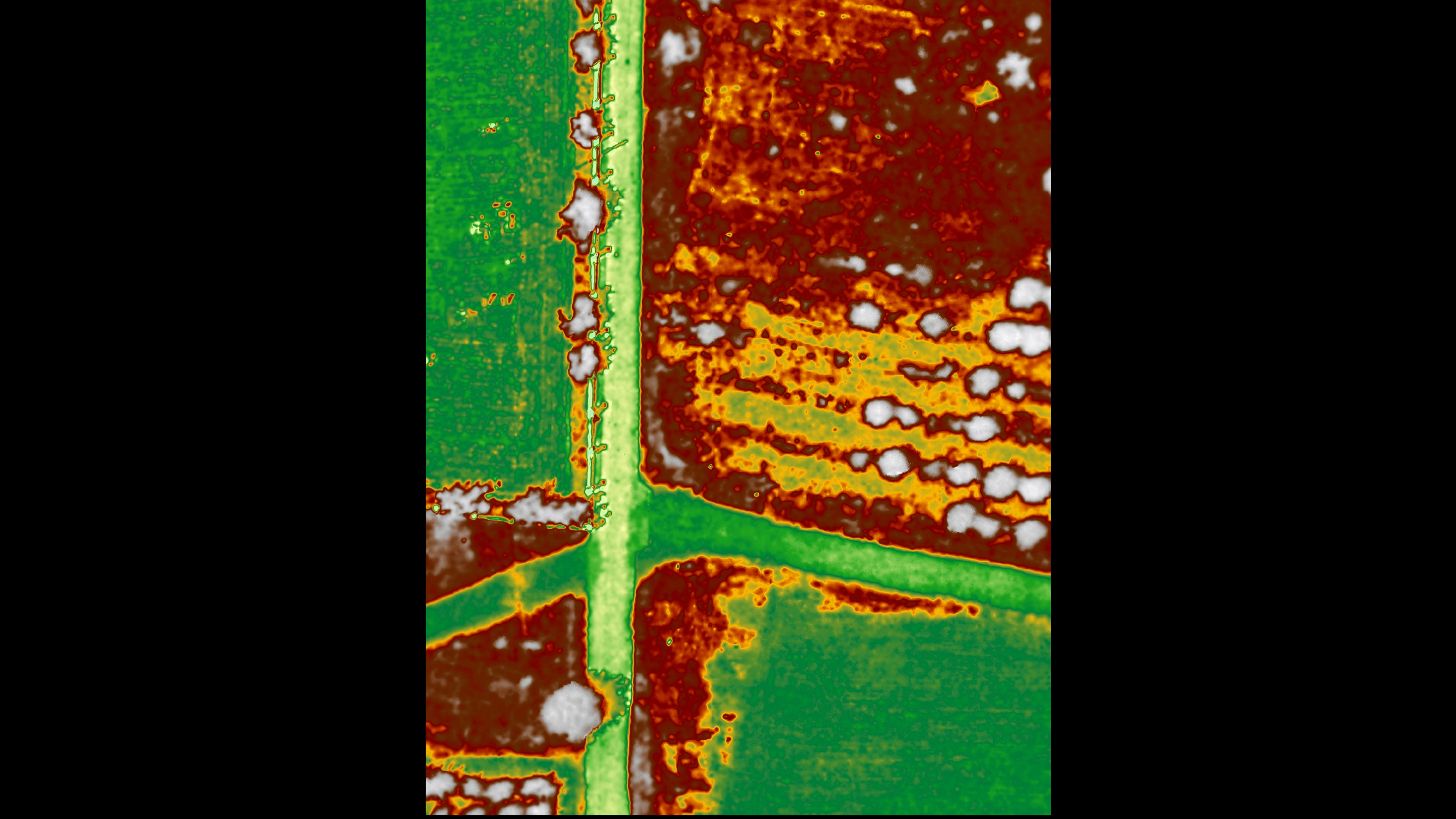
NDVI
Geographical Analysis
LiDAR is one of the few remote sensing technologies that can penetrate vegetation to obtain ground points. LiDAR360 can accurately extract ground points from LiDAR point clouds and obtain parameters such as slope and slope direction for section and terrain change analysis, providing support for environmental surveys, disaster monitoring, and mining survey.
 Structure Analysis
 Joint and Strike Diagram
 Hydrological Analysis
Mining Application
LiDAR360 provide Production safety analysis, earthwork calculation and volume change analysis for open-pit Mine to Increase productivity, provide rapid modeling, section analysis and volume calculation for tunnel to help construction.

Tunnel Modeling

Extract Crests and Toes

Inter-Ramp Compliance

Section Analysis
Tunnel Deformation Monitoring

Volume Change Analysis
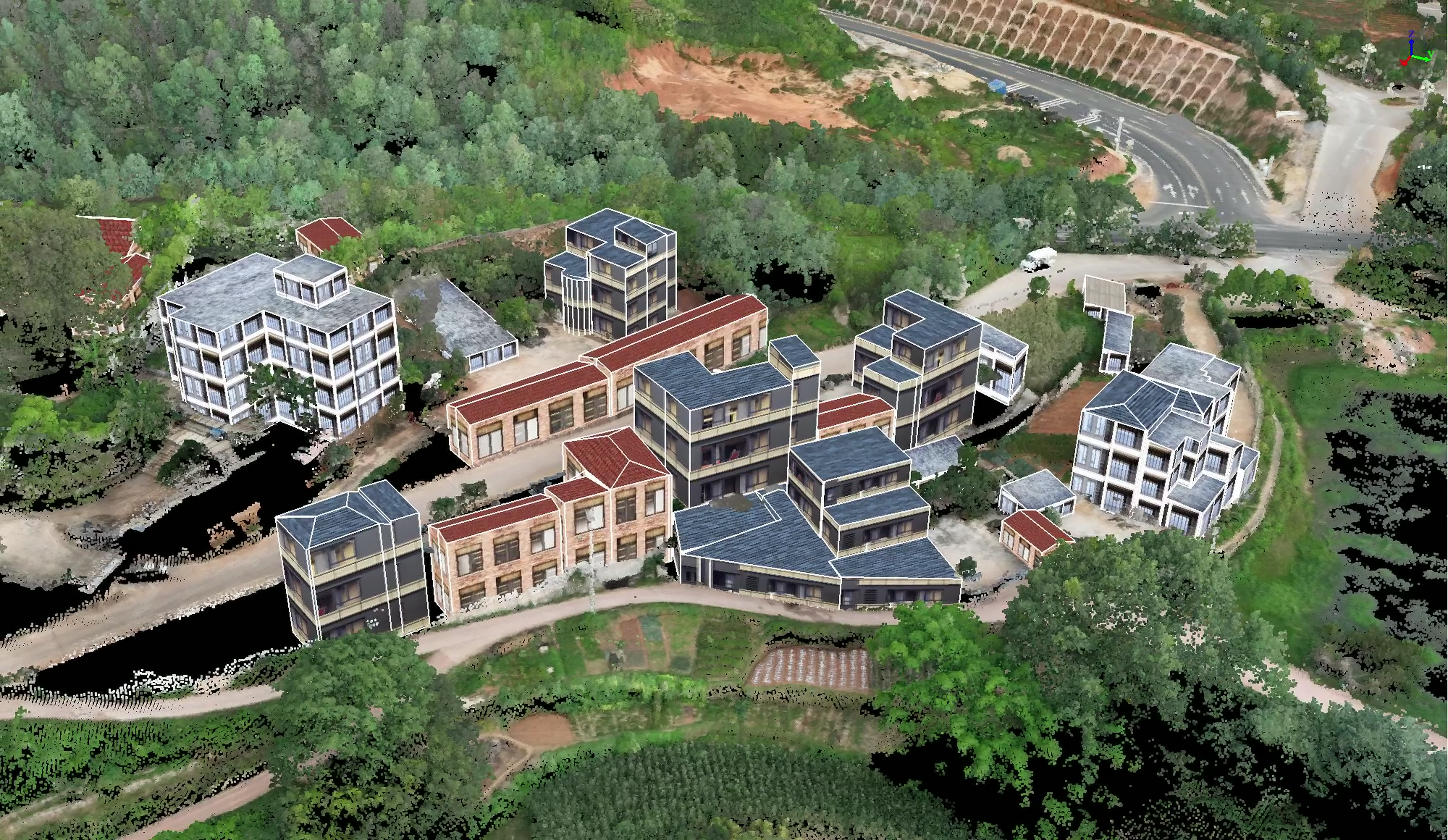
Digital Twins and 3D Real Scene
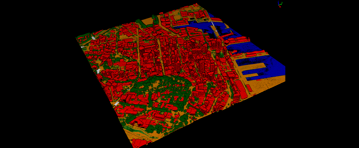
LiDAR360 employs intelligent algorithms for terrain and feature scene separation, vegetation, and building target monolithic segmentation and modeling to achieve city-level geographic scene and physical replica restoration, helping real-world 3D construction.


Applications
 TerrainLearn More
 MiningLearn More
  ForestryLearn More
  PowerlineLearn More
  UtilitiesLearn More
  HD MapsLearn More
 GreenValley International Inc (GVI), headquartered in Berkeley, California, is a leading innovator of 3D mapping technologies. GVI provides a wide range of advanced aerial, terrestrial, and mobile LiDAR survey and mapping hardware systems and cutting-edge software as well as turnkey solutions. Our portfolio includes airborne, handheld, mobile, and backpack laser scanning platforms, as well as point cloud processing software such as the LiDAR360 LiDAR data processing platform. GVI focuses on LiDAR and image fusion technology, specializing in LiDAR, UAV, SLAM, Photogrammetry, and other technologies to achieve an accurate digital representation of three-dimensional space. As we continue to expand our reach and technological capabilities, GVI remains committed to driving innovation and pushing the boundaries of what's possible in the LiDAR space.
