Case StudiesFrom Weeks to Hours: How LiMobile M2 + LiDAR360MLS Automate Road Marking Recognition
From Weeks to Hours: How LiMobile M2 + LiDAR360MLS Automate Road Marking Recognition
Curious how an Australian university turned weeks of road-marking model training into a matter of hours? This case breaks down the exact LiMobile M2 + LiDAR360MLS workflow that replaced manual coding with one-click template marking and delivered 99% detection accuracy.
For engineering teams in smart transportation and road mapping, building a reliable road marking recognition model used to mean climbing a technical mountain. The process required Python and TensorFlow expertise, hours of manual point labelling, and lengthy training cycles with no guarantee the model would learn correctly. Even experienced teams found themselves spending weeks preparing a single usable model. A team from the School of Civil Engineering at the University of New South Wales (UNSW) in Australia faced exactly this bottleneck. Their project required accurate road marking extraction from mobile LiDAR data, but traditional workflows were too slow and too uncertain. That changed when they adopted GreenValley's LiMobile M2 mobile mapping system paired with LiDAR360MLS software and its built-in deep learning capabilities.
The Traditional Road Marking Recognition Workflow
Conventional self-training approaches create unnecessary friction. Teams need programming skills to write training scripts, then spend days guessing which points to label, hoping the model converges. Random point sampling often misses critical edge features, leading to poor detection rates on real-world data. The whole cycle—annotation, training, validation, retraining—becomes a repetitive loop that drags down project timelines. What UNSW needed was a way to skip the coding and cut straight to results.
GVI Solution: Mark Once, Train Automatically
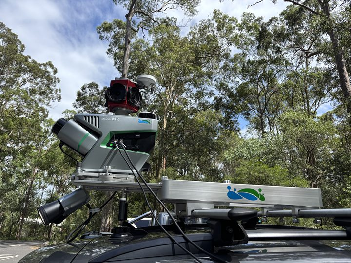
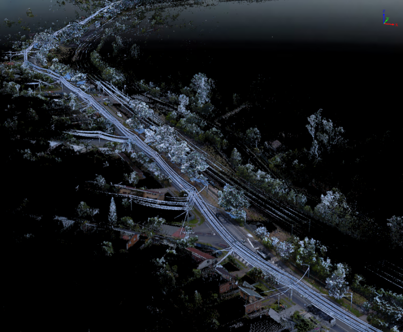
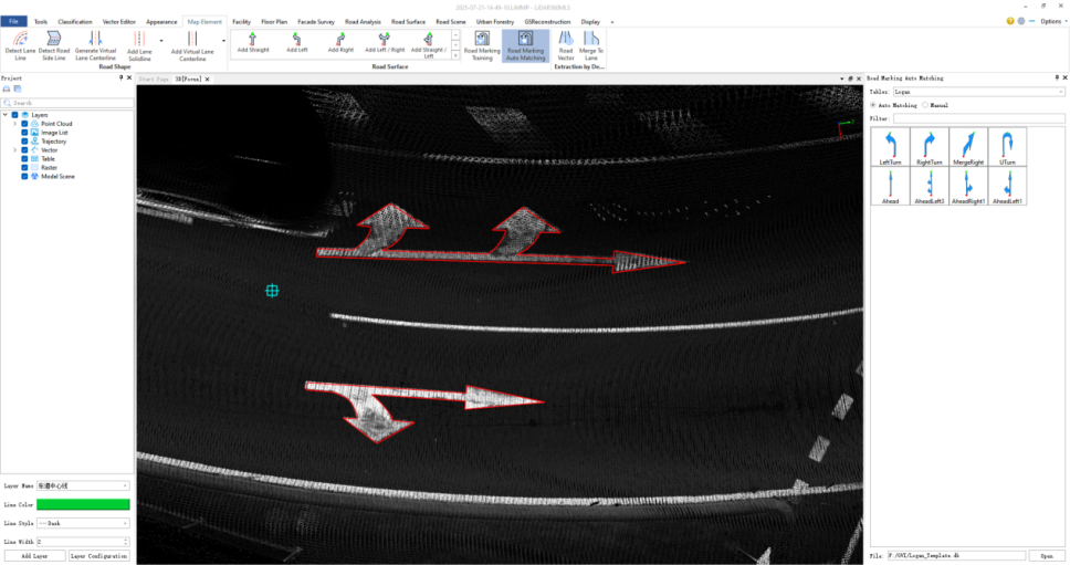
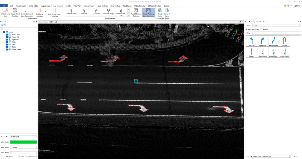
GreenValley's approach flips the workflow upside down. Instead of writing code and guessing at labels, operators simply mark road sign templates once on point clouds—outlining edges and identifying a few key points. The pre-trained model inside LiDAR360MLS instantly recognises the patterns and begins automatic training with no extra steps. For the UNSW project, the team scanned Brisbane's road network using the LiMobile M2 system, collecting colored point cloud data that captured the full richness of road surface markings. They then labelled turn arrows, straight-ahead markers, and other road signs in the point cloud, outlining edges and key points just once per marking type.
Built-In Model Training and Validation
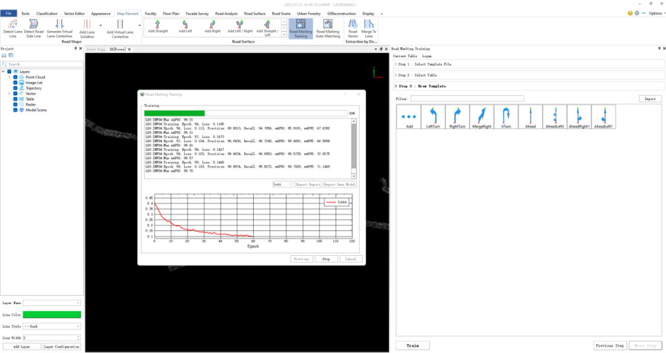
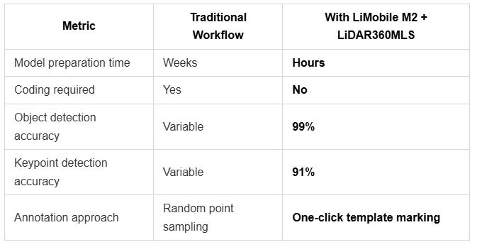
Once the markings were annotated, the team triggered the built-in model training in LiDAR360MLS. The software handled the heavy lifting automatically, producing an object detection training accuracy of 99% and a keypoint detection training accuracy of 91%. LiDAR360MLS then generated an accuracy report, giving the team a transparent view of model performance before they deployed it across the full dataset. This validation step ensured the model met project requirements without any manual coding or iterative debugging.
Automatic Recognition at Scale
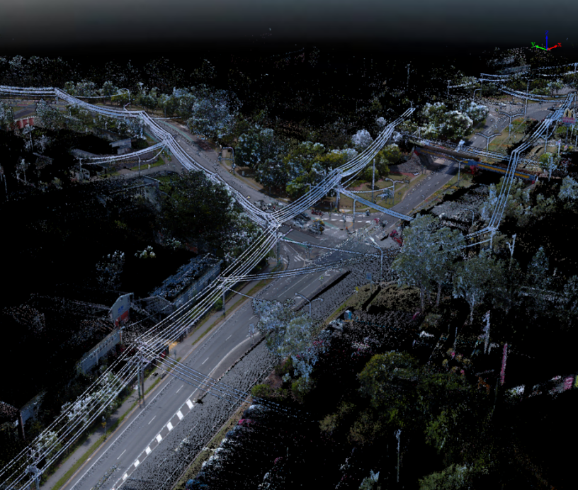
With the trained model validated, LiDAR360MLS automatically recognised road markings along the entire surveyed route. The software detected and classified road surface features across the full point cloud, delivering structured outputs ready for downstream use in road inventory, asset management, and autonomous driving map production.
Why This Matters for Smart Transportation
The UNSW project demonstrates that high-accuracy road marking recognition no longer requires a dedicated machine learning team. By leveraging LiDAR360MLS's built-in deep learning workflow, civil engineering researchers can focus on application outcomes rather than model engineering. The result is a dramatically shorter path from raw point cloud data to actionable road inventory. Australian client feedback: "We used to spend weeks prepping a usable model. Now it's done in hours. Game-changer for field mapping."
Key Results
Learn more about LiMobile M2: https://www.greenvalleyintl.com/LiMobileM2
Guess you like

Topcon and GreenValley International Collaborate on Spatial Intelligence Innovations
Strategic collaboration will bring spatial intelligence into real-world industry applications by integrating hardware, software, cloud and AI to simplify, automate and intelligently connect complex workflows across construction, machine control, infrastructure and other high-value industries.
 Company News
LiDAR360MLS

LiMobile M2
Affordable Mobile Laser Scanning System

GreenValley International Inc (GVI), headquartered in Berkeley, California, is a leading innovator of 3D mapping technologies. GVI provides a wide range of advanced aerial, terrestrial, and mobile LiDAR survey and mapping hardware systems and cutting-edge software as well as turnkey solutions. Our portfolio includes airborne, handheld, mobile, and backpack laser scanning platforms, as well as point cloud processing software such as the LiDAR360 LiDAR data processing platform. GVI focuses on LiDAR and image fusion technology, specializing in LiDAR, UAV, SLAM, Photogrammetry, and other technologies to achieve an accurate digital representation of three-dimensional space. As we continue to expand our reach and technological capabilities, GVI remains committed to driving innovation and pushing the boundaries of what's possible in the LiDAR space.