LiMobile M2 Completes 4,000 km Nationwide Railway Survey in Thailand
LiMobile M2 completed more than 4,000 km of railway surveying in Thailand, delivering point clouds and panoramic imagery with stable performance in demanding field conditions.
A major mobile mapping milestone for railway infrastructure
Surveying a nationwide railway network requires more than high-precision data. It requires a system that can remain dependable through long working days, changing weather, vibration, and complex on-track conditions. Between June 26 and October 8, 2026, GreenValley's LiMobile M2 Mobile Mapping System supported an extensive railway surveying mission in Thailand. The project captured more than 4,000 km of railway tracks, producing point clouds and 360-degree panoramic imagery for railway infrastructure documentation and digital development. The project team reported that this was Thailand's first full railway-line survey completed with a mobile mapping system. It represents an important application of mobile mapping technology for large-scale railway infrastructure.
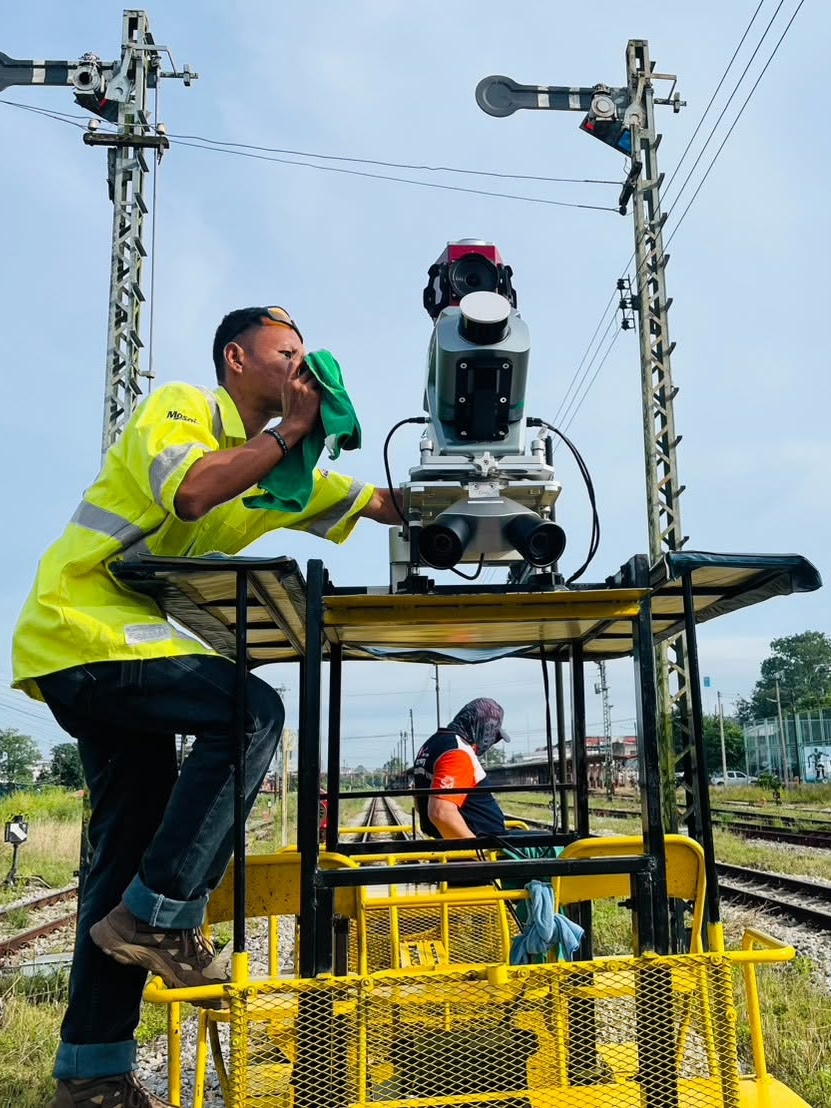
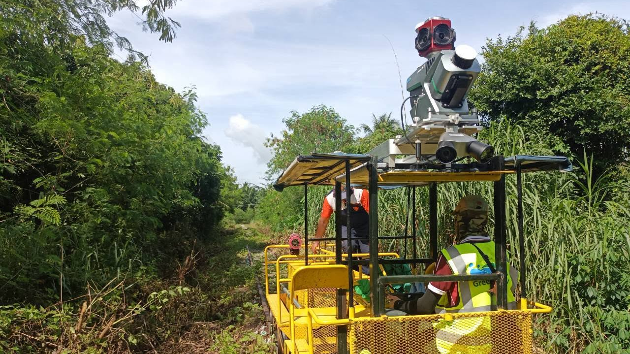
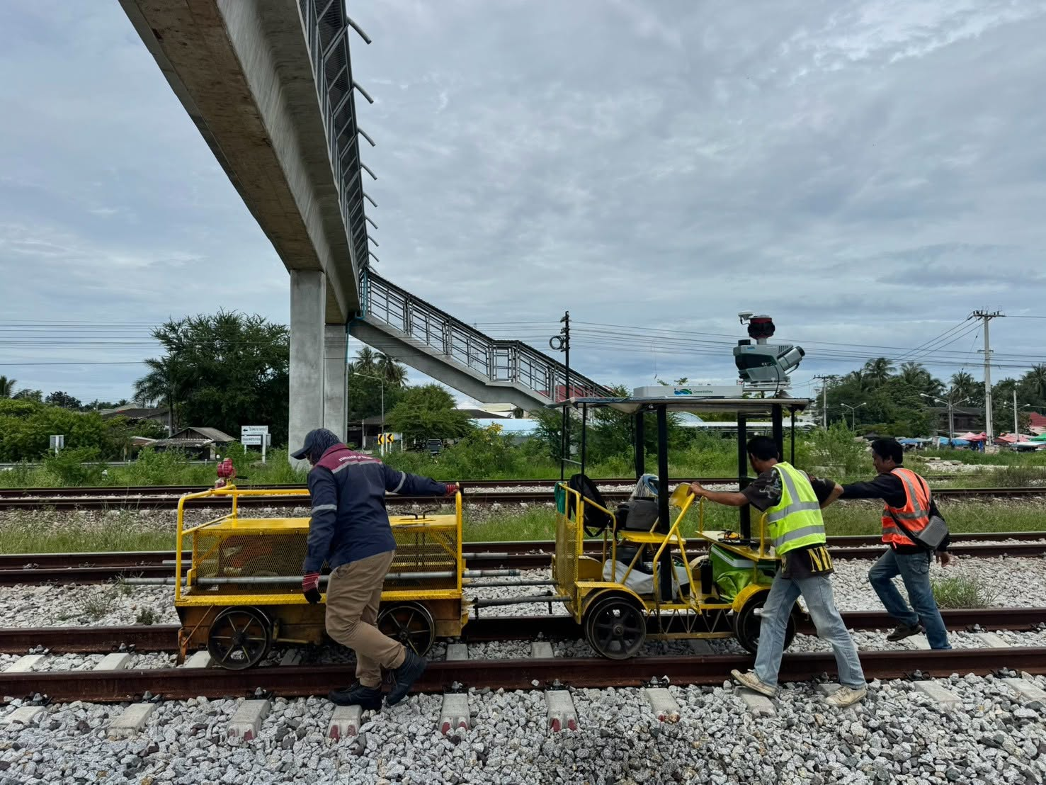
Nationwide data capture across more than 4,000 km
The survey covered more than 4,000 km of railway tracks across Thailand. LiMobile M2 was used to collect high-density point cloud data and 360-degree panoramic imagery along the railway corridor. This combination of spatial data supports a more complete view of the railway environment. It can help project teams document assets, review corridor conditions, and build a reliable data foundation for future analysis and digital infrastructure workflows.
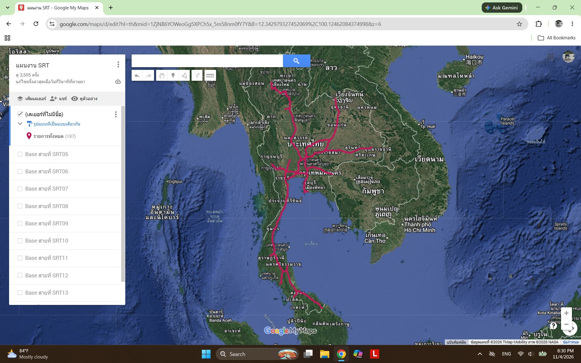
High-precision positioning for a large survey area
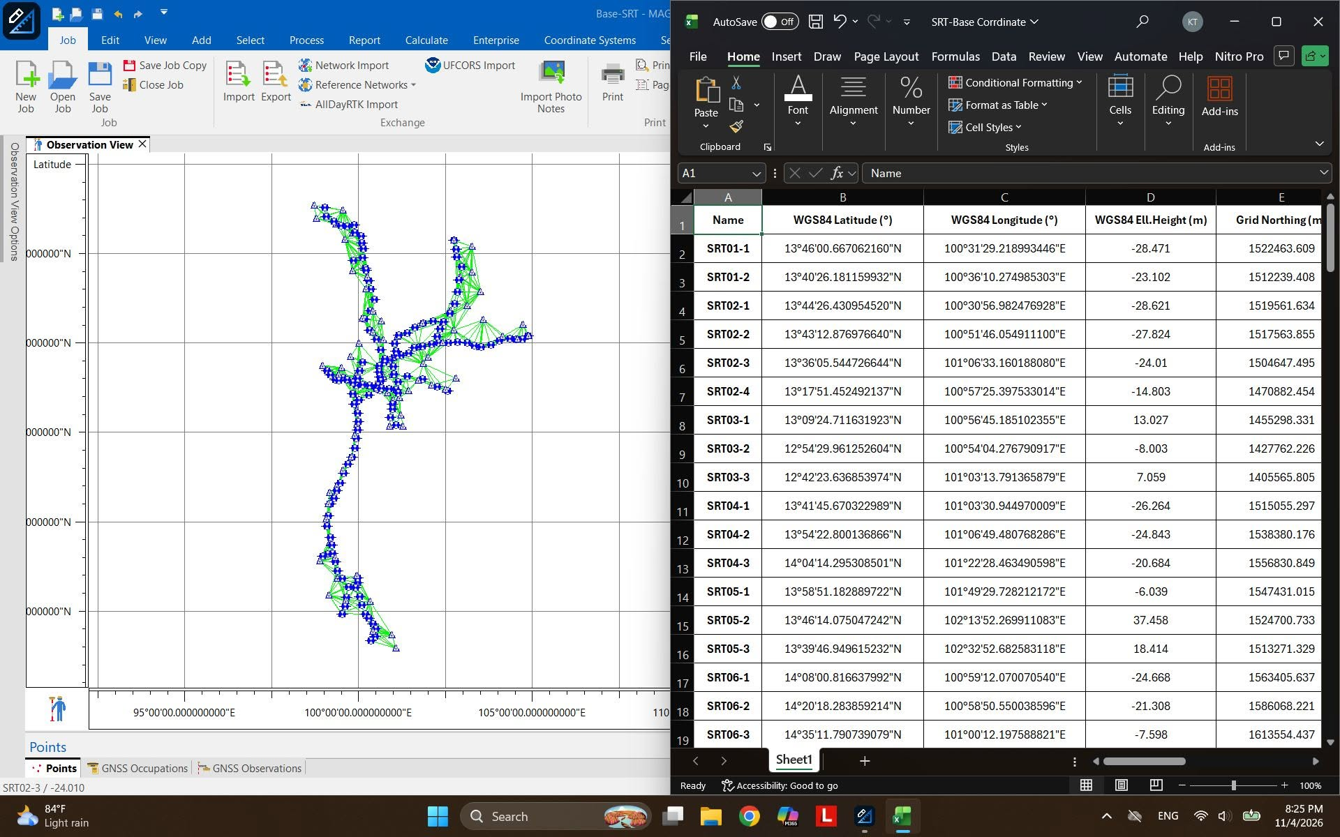
Reliable positioning was essential for a project of this scale. The workflow used PPK processing supported by 141 network-enhanced base stations, providing comprehensive geospatial coverage across the survey area. For railway projects, consistent positioning is central to producing datasets that can be reviewed, compared, and integrated into downstream engineering and asset-management workflows. The PPK workflow helped the project team maintain data continuity throughout the nationwide mission.
Built for demanding railway conditions
Railway surveying presents field conditions that can challenge both equipment and operators. During this project, the team worked through high rail temperatures, frequent thunderstorms, continuous vibration, and on-track trolley interference. LiMobile M2 operated for at least four to six hours per day under these conditions. After initial training and deployment, the system completed the project without a reported equipment failure. This reliability matters when survey work must continue across long corridors and tight project schedules. Stable acquisition reduces unnecessary interruptions and helps teams keep large-scale data collection moving forward.
From track data to digital infrastructure
The Thailand railway survey demonstrates how LiMobile M2 supports large-scale corridor mapping through stable data acquisition, efficient surveying, and dependable performance in challenging field conditions. For railway owners, survey teams, and infrastructure managers, mobile mapping creates a practical path from track-level data capture to a more complete digital representation of the network. GreenValley International extends its thanks to Thai partner Dprom and the full project team for their work on this significant achievement.
Learn more about the LiMobile M2 Mobile Mapping System (https://www.greenvalleyintl.com/LiMobileM2). For mobile mapping solutions for railway and infrastructure projects, contact GreenValley International at info@greenvalleyintl.com.
Guess you like

Topcon and GreenValley International Collaborate on Spatial Intelligence Innovations
Strategic collaboration will bring spatial intelligence into real-world industry applications by integrating hardware, software, cloud and AI to simplify, automate and intelligently connect complex workflows across construction, machine control, infrastructure and other high-value industries.
 Company News
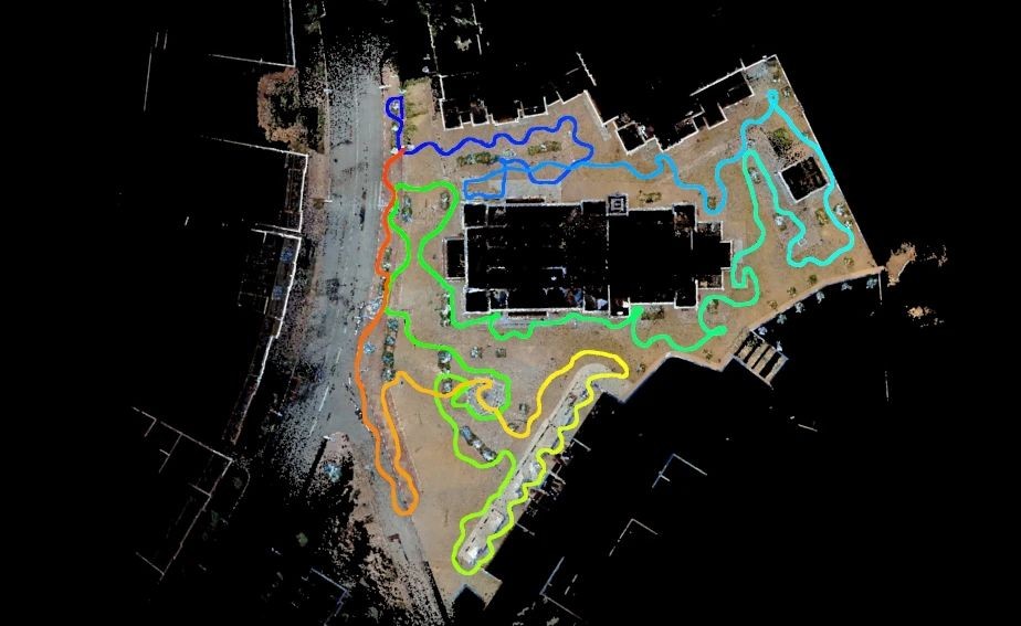
From Weeks to Hours: How LiMobile M2 + LiDAR360MLS Automate Road Marking Recognition
Curious how an Australian university turned weeks of road-marking model training into a matter of hours? This case breaks down the exact LiMobile M2 + LiDAR360MLS workflow that replaced manual coding with one-click template marking and delivered 99% detection accuracy.
Case Studies
LiMobile M2
Affordable Mobile Laser Scanning System

GreenValley International Inc (GVI), headquartered in Berkeley, California, is a leading innovator of 3D mapping technologies. GVI provides a wide range of advanced aerial, terrestrial, and mobile LiDAR survey and mapping hardware systems and cutting-edge software as well as turnkey solutions. Our portfolio includes airborne, handheld, mobile, and backpack laser scanning platforms, as well as point cloud processing software such as the LiDAR360 LiDAR data processing platform. GVI focuses on LiDAR and image fusion technology, specializing in LiDAR, UAV, SLAM, Photogrammetry, and other technologies to achieve an accurate digital representation of three-dimensional space. As we continue to expand our reach and technological capabilities, GVI remains committed to driving innovation and pushing the boundaries of what's possible in the LiDAR space.