Forest Terrain Mapping After the Japan Earthquake
Learn how GreenValley LiGrip H120 helps survey teams capture beneath-canopy terrain data quickly and safely after earthquake-triggered landslides.
I. Background and Challenges
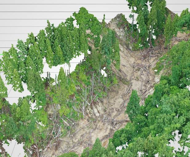
The 2024 Noto Peninsula earthquake struck Ishikawa Prefecture, Japan, on January 1, with a magnitude of 7.6, triggering more than 2,300 landslides across the affected region. Rapid and accurate terrain data acquisition was critical for emergency response and recovery planning. The survey was conducted at two landslide sites in Mitsui-machi, Wajima City, including a single large slope failure affecting downstream residential areas and farmland, as well as a multi-landslide site where sediment flowed into mountain streams and agricultural land.
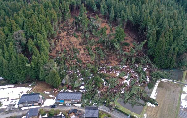
Landslide Site Overview
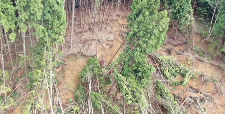
Multi-Landslide Area
However, surveying in forested disaster areas presented major challenges: • Traditional surveying methods (e.g., total stations) are too time-consuming for large-scale disaster response • UAV photogrammetry is significantly affected by tree canopies, making it difficult to obtain terrain data within forested areas • Surveying on dangerous mountain slopes poses safety hazards • Multiple landslides and fallen trees create complex terrain, making accurate ground data acquisition difficult
II. Solution: SLAM LiDAR Scanner for Rapid & Safe Data Capture
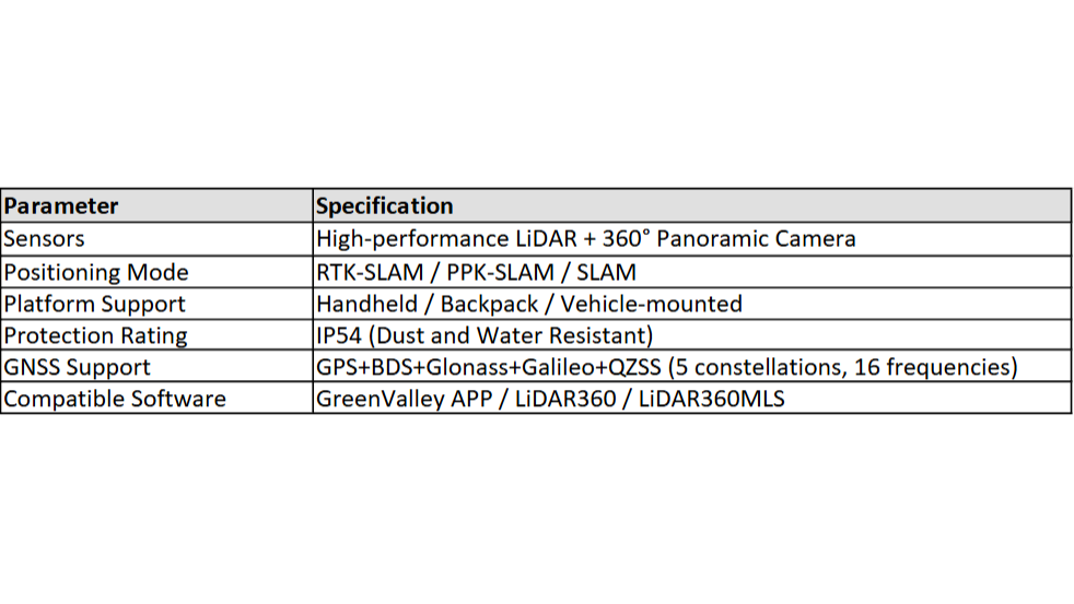
SLAM (Simultaneous Localization and Mapping) enables continuous point cloud generation by matching real-time LiDAR observations with previously captured features, allowing accurate mapping while moving — without traditional static instrument setup. In this project, GreenValley International LiGrip H120 Handheld SLAM LiDAR Scanner was deployed to efficiently capture large-scale, complex terrain data. LiGrip H120 offers flexible operation modes and robust positioning performance in both GNSS-covered and challenging environments.
III. Implementation Process
Workflow
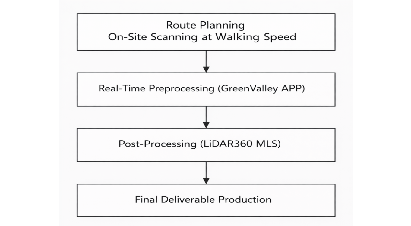
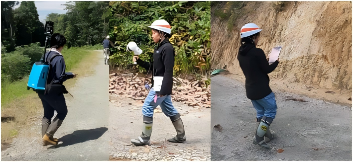
The client used the LiGrip H120 handheld 3D scanner along planned routes: route planning → on-site scanning at walking speed → real-time preprocessing (GreenValley APP) → post-processing (LiDAR360MLS) → final deliverable production.
On-Site Scanning Best Practices
Hold the scanner steadily at chest level with both hands, avoiding swinging or tilting. Choose start/end points with multiple route options. When transitioning between spaces, enter slowly with sideways steps and pause briefly to capture features from both areas. Walk slowly indoors, make smooth curved turns, and pause ~5 seconds at doorways to capture both sides.
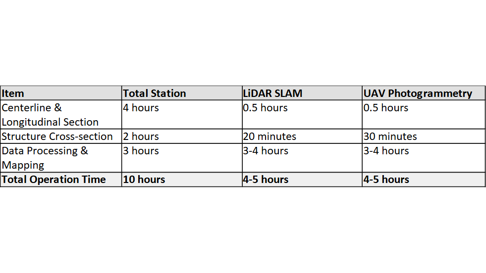
Operation Time Comparison
Survey content: Centerline and longitudinal section measurement 500 m, structure planning site cross-section measurement 50 m. The data shows that LiDAR SLAM and UAV photogrammetry have essentially the same operation time, but total station surveying requires approximately twice the operation time compared to ICT-based surveying. Particularly for on-site work, total station surveying requires 6 hours, while ICT-based surveying can be completed in approximately 1 hour.
IV. Solution Summary
Quantified Results
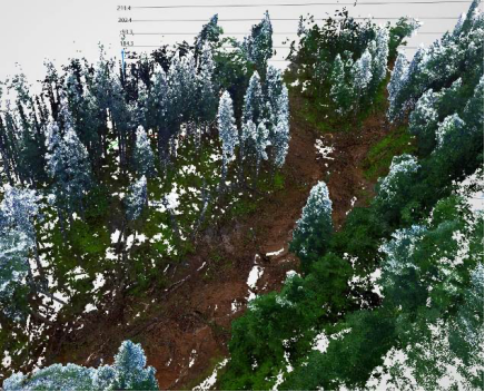
By adopting the GVI LiGrip H120 handheld scanner and LiDAR SLAM surveying solution, the client achieved: • Approximately 83% reduction in on-site operation time: from 6 hours with total station to approximately 1 hour • Over 50% improvement in overall operational efficiency: total operation time reduced from 10 hours to 4-5 hours • Effective acquisition of sub-canopy terrain data: solving the vegetation obstruction problem of UAV photogrammetry • Measurement accuracy comparable to total station: suitable for design-level engineering applications • Significantly improved safety: reduced operation time on dangerous mountain slopes
Applicable Scenarios
LiDAR SLAM technology is particularly suitable for the following survey types: • Streams (Valley Engineering): Unaffected by tall tree canopies, direct laser measurement of ground surface • Landslide Sites (Small to Medium Scale): Can capture micro-topography and slope crack details • Forest Road Disasters: Can conduct comprehensive surveys including landslides • Structure Measurement: Can freely acquire high-density point clouds from various angles for inspection and damage assessment
Client Feedback
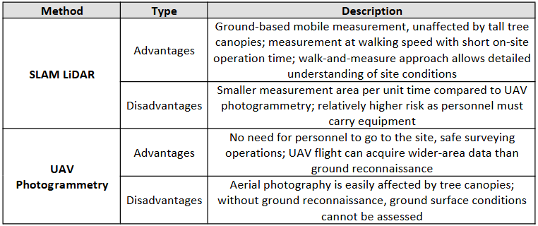
"UAV photogrammetry has advantages in wide-area data acquisition and can safely obtain data after disasters without entering dangerous sites. On the other hand, LiDAR SLAM surveying can acquire sub-canopy terrain data that is difficult to measure with UAV photogrammetry. In forest area surveys, vegetation impact has always been a challenge, but since LiDAR SLAM measures from near ground level, it can avoid the effects of vegetation, especially tree canopies. By applying these surveying methods, terrain data can be acquired more quickly and safely, contributing to improved operational efficiency and safety in disaster site surveying operations." — Kazuki Okutani, Senior Engineer, Osaka Branch, Forest Technology Company 👉 Planning surveys in forested or GNSS-challenged disaster areas? Talk to our team at info@greenvalleyintl.com to learn how LiDAR SLAM can complement UAV and total station workflows.
Guess you like

Topcon and GreenValley International Collaborate on Spatial Intelligence Innovations
Strategic collaboration will bring spatial intelligence into real-world industry applications by integrating hardware, software, cloud and AI to simplify, automate and intelligently connect complex workflows across construction, machine control, infrastructure and other high-value industries.
 Company News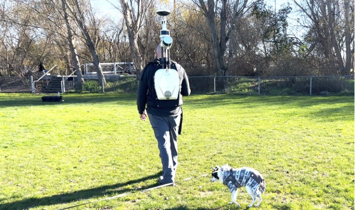
Unlocking Carbon Stock Calculations with GreenValley’s LiBackpack and LiDAR360
Learn how GreenValley LiBackpack DGC50H and LiDAR360 streamline carbon stock assessment through a digital beneath-canopy workflow that replaces manual field surveys with tree segmentation and biomass estimation.
Case Studies
GreenValley International Inc (GVI), headquartered in Berkeley, California, is a leading innovator of 3D mapping technologies. GVI provides a wide range of advanced aerial, terrestrial, and mobile LiDAR survey and mapping hardware systems and cutting-edge software as well as turnkey solutions. Our portfolio includes airborne, handheld, mobile, and backpack laser scanning platforms, as well as point cloud processing software such as the LiDAR360 LiDAR data processing platform. GVI focuses on LiDAR and image fusion technology, specializing in LiDAR, UAV, SLAM, Photogrammetry, and other technologies to achieve an accurate digital representation of three-dimensional space. As we continue to expand our reach and technological capabilities, GVI remains committed to driving innovation and pushing the boundaries of what's possible in the LiDAR space.