Case StudiesHow to Streamline Building Modeling with UAV LiDAR LiAir H600 + LiDAR360 Software
How to Streamline Building Modeling with UAV LiDAR LiAir H600 + LiDAR360 Software
Streamline building modeling with GreenValley LiAir H600 UAV LiDAR and LiDAR360 software for urban survey, terrain mapping, and AEC workflows.
Anyone working with 3D reality modeling has probably fallen into the trap of "individualizing building models"—that painful process of manually separating each building, adjusting contours, and patching details point by point. It's slow, exhausting, and costly—sometimes taking days or even weeks. But now, with a UAV LiDAR system LiAir series + LiDAR360 software combo, you can push modeling efficiency to a whole new level. Here's a step-by-step look at this time-saving, effort-reducing workflow—practical skills you can start using today!
1. Data Acquisition
Accurate data is the foundation of good modeling. You'll need to capture two key datasets:
① LiDAR Point Clouds
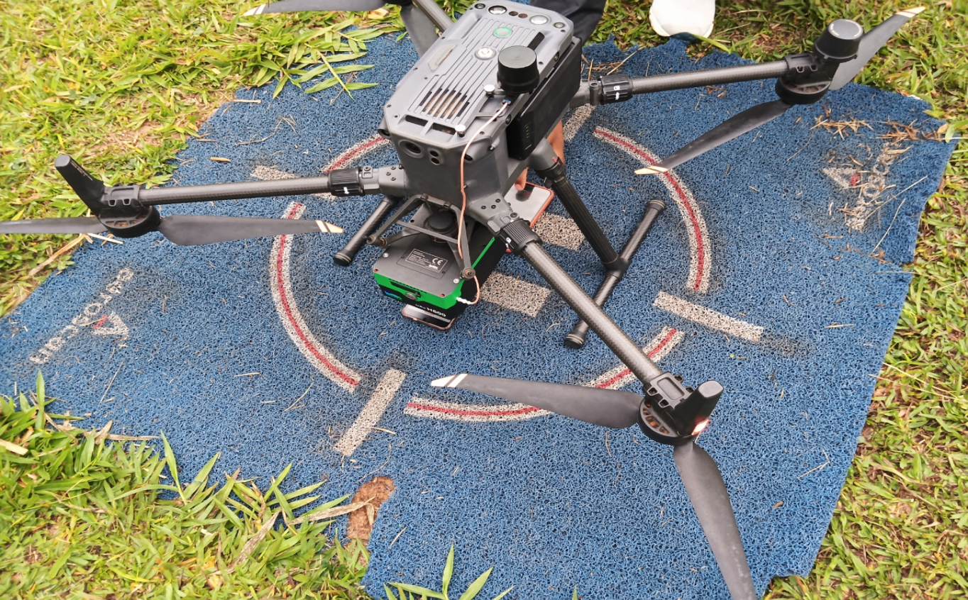
Device: LiAir H600 + DJI M350 Steps: - a. Mount the LiAir H600 on the M350, open the LiPlan app, and enter the flight planning interface. - b. Set flight height and overlap; the software auto-generates the flight path. - c. Launch the UAV to fly along the planned route.
② Oblique Imagery
If LiDAR provides the "skeleton," oblique imagery gives the "skin" for realism. Setup: DJI Zenmuse P1 camera + Pilot2 app Key Parameters: - Overlap: 80% forward, 70% side - Flight height based on resolution needs - Positioning: Enable UAV RTK, wait for "fixed solution" before flying
2. Data Processing
After field collection, convert raw data into usable point clouds: - Open LiGeoreference - Import raw data - Select POS Process, Georeference, Smooth, Colorizaion (Default Setting) - Click Start
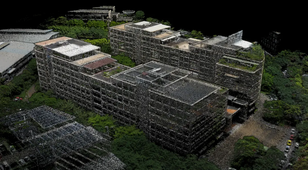
3. Building Modeling
From point clouds to fully editable building models—without tedious manual work.
① Point Cloud Classification
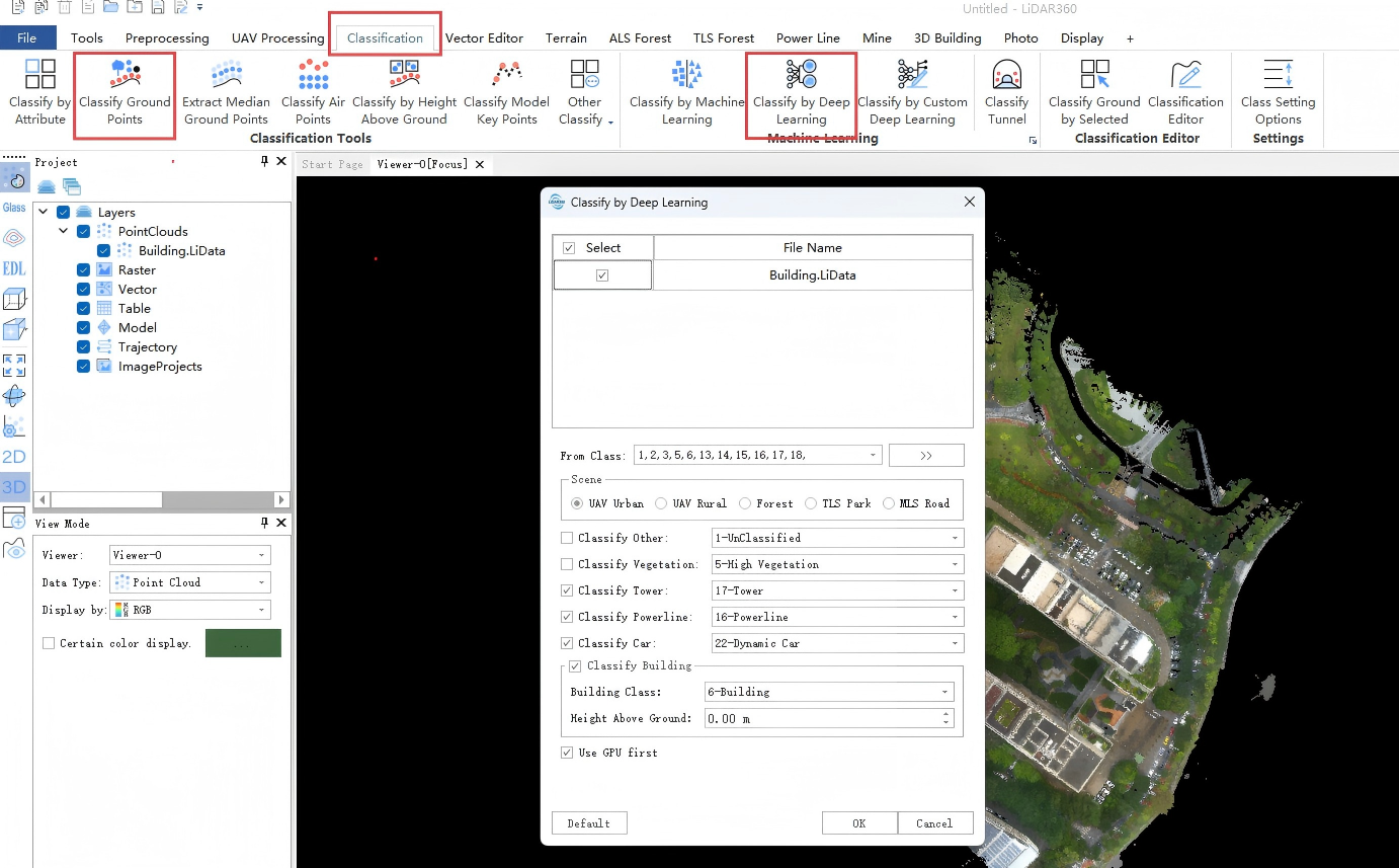
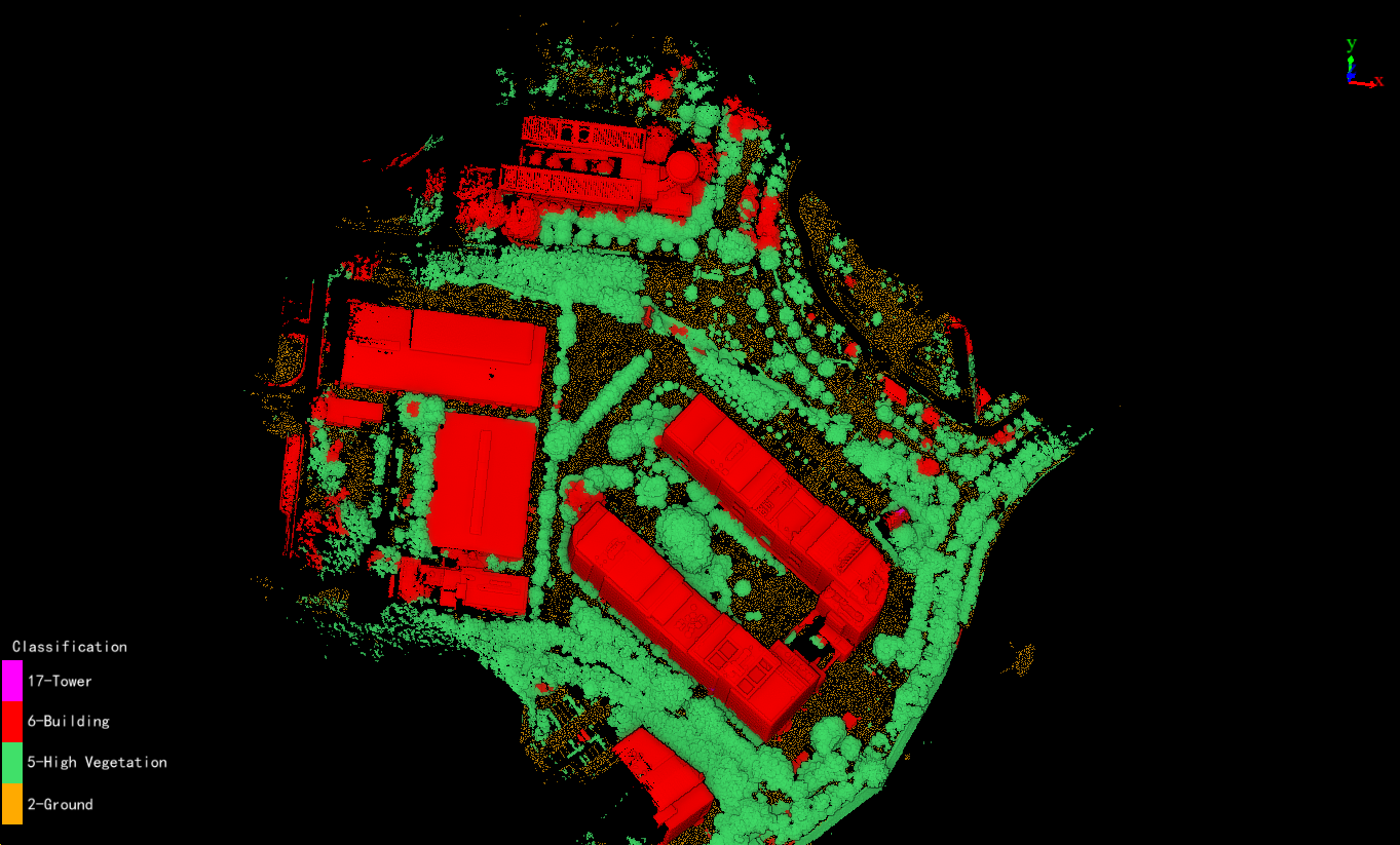
Import processed data into LiDAR360's Classification module Start AI classification: Classify Ground Points (Distinguish between ground points and air points) + Classify by Deep Learning (Auto-detects buildings)
② Building Contour Extraction
- Go to Vector Editing - Use Extract Building Footprint, drag a box around the target, double-click to finish - LiDAR360 auto-generates building outlines
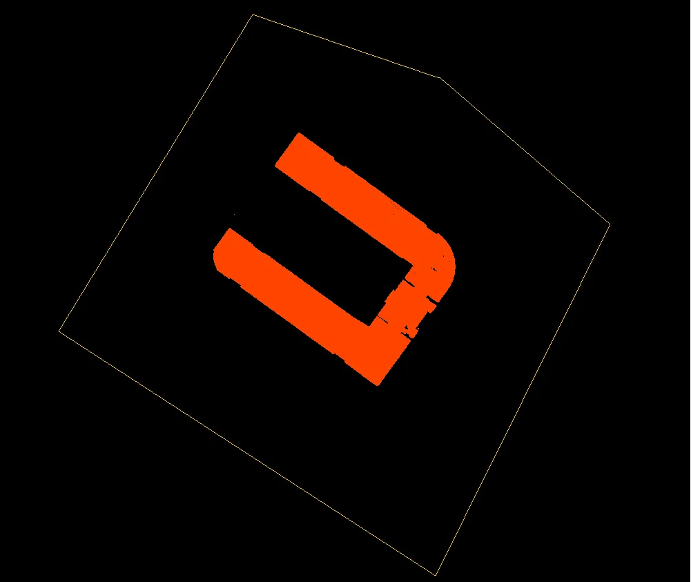
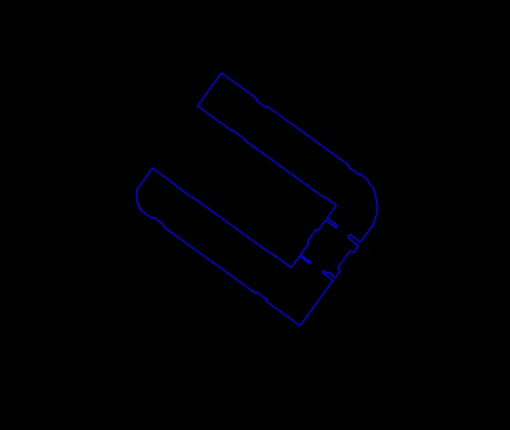
③ Building Model Creation
- Switch to the 3D Building module and click Auto Create Buildings - LiDAR360 will automatically load classified point clouds and extracted footprints - Assign Roof Class and Ground Class, set Output Path - Click OK to generate building models
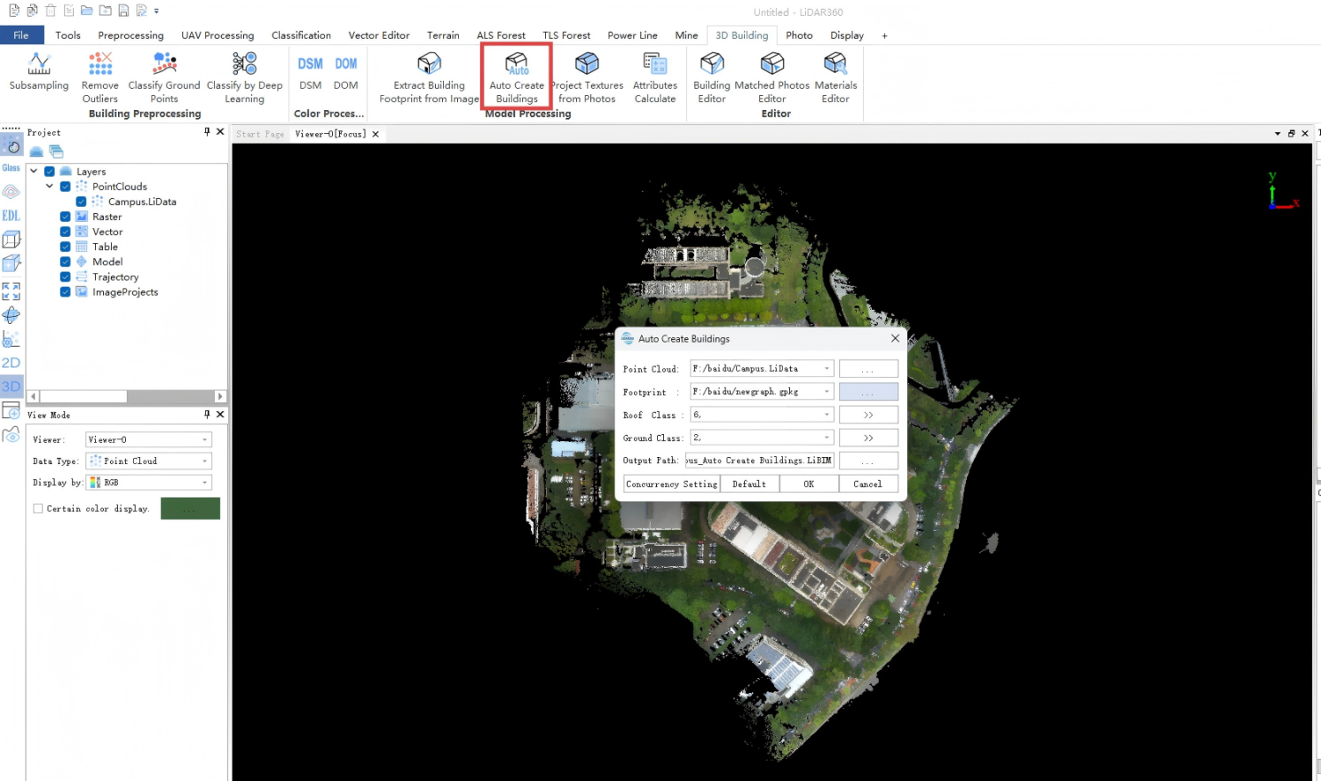
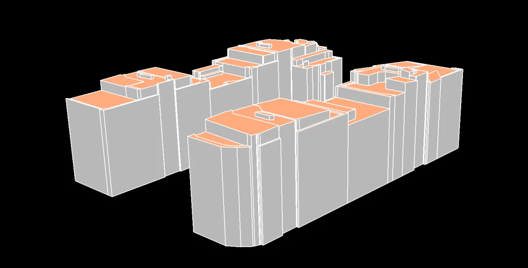
④ Texture Mapping with Oblique Imagery
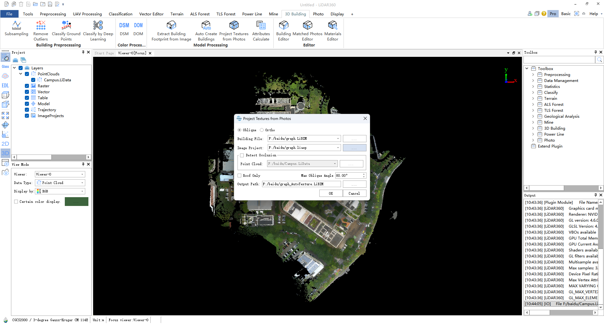
- Import oblique images, run aerial triangulation in LiDAR360, output .ligeo - Load the triangulation results, click 3D Building → Project Textures from Photos - Select the building model and imagery project to be mapped, set the output path, and click OK
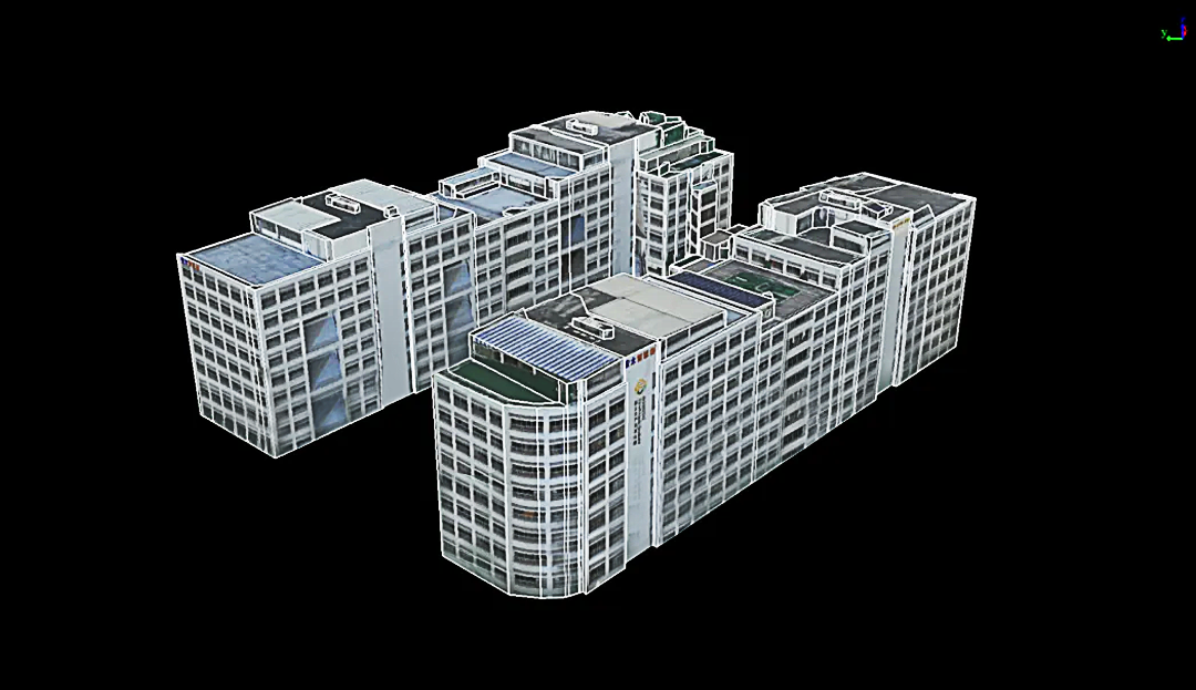
⑤ Final Results
High-accuracy, textured building models ready for editing, visualization, and analysis
Why It Matters
With LiAir H600+ LiDAR360's efficiency, building modeling no longer means endless manual labor. So—what's the biggest challenge you've faced in building modeling? 👉 Is it slow manual editing or data processing bottlenecks? Drop a comment and share your experience—we'd love to exchange ideas on more efficient 3D workflows! Learn more about LiAir H600(https://www.greenvalleyintl.com/LiAirH600) and LiDAR360(https://www.greenvalleyintl.com/LiDAR360) and see how you can accelerate your workflow today.
Guess you like

Topcon and GreenValley International Collaborate on Spatial Intelligence Innovations
Strategic collaboration will bring spatial intelligence into real-world industry applications by integrating hardware, software, cloud and AI to simplify, automate and intelligently connect complex workflows across construction, machine control, infrastructure and other high-value industries.
 Company News
GVI Trade-Up Program: Upgrade Your Legacy LiDAR Workflow
Upgrade eligible legacy GreenValley LiAir, LiGrip and LiBackpack systems through the limited-time GVI Trade-Up Program. Receive upgrade credit, warranty coverage, software benefits, and personalized assessments before June 30, 2026.
Company News
GreenValley International Inc (GVI), headquartered in Berkeley, California, is a leading innovator of 3D mapping technologies. GVI provides a wide range of advanced aerial, terrestrial, and mobile LiDAR survey and mapping hardware systems and cutting-edge software as well as turnkey solutions. Our portfolio includes airborne, handheld, mobile, and backpack laser scanning platforms, as well as point cloud processing software such as the LiDAR360 LiDAR data processing platform. GVI focuses on LiDAR and image fusion technology, specializing in LiDAR, UAV, SLAM, Photogrammetry, and other technologies to achieve an accurate digital representation of three-dimensional space. As we continue to expand our reach and technological capabilities, GVI remains committed to driving innovation and pushing the boundaries of what's possible in the LiDAR space.