


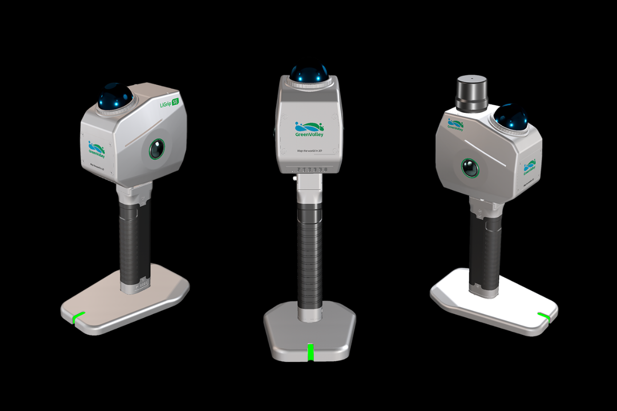
LiGrip SE
Precise, Efficient, and Cost-Effective 3D LiDAR Scanner
Weight
1.33 kg
Absolute Accuracy
5 cm
Relative Accuracy
2 cm
Panoramic Camera
12 MP x 2
Horizontality / Verticality
<0.05°
IP Rating
IP54
Battery Life
2.5h (Single Battery)
APP Platform
Android, iOS
- Built for exceptional value, the LiGrip SE saves you time, money, and effort.
- Reliable Performance: Premium hardware drastically reduces rework costs.
- End-to-End Workflow: A seamless, all-in-one solution from data acquisition to final deliverables.
- Maximum ROI: Boosts your overall operational efficiency with complete peace of mind.
The Exceptional Value Choice
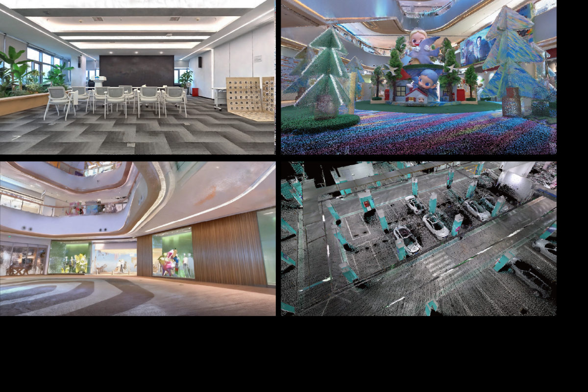
12MP Cameras: Clearer Imagery, Visible Details
Superior image quality delivers enhanced point cloud colorization and stunning 3D Gaussian Splatting (3DGS) results.
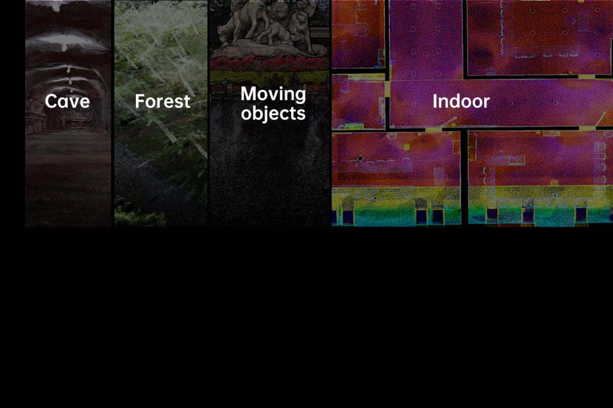
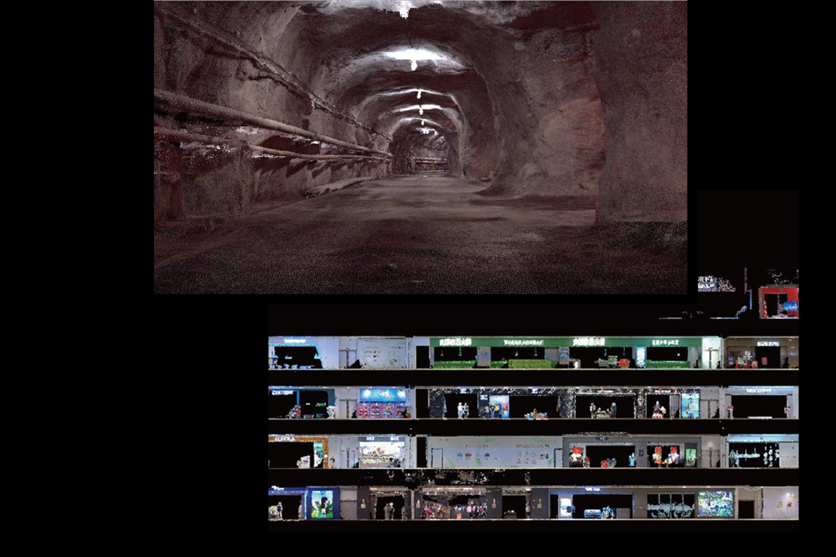
Robust Environmental Adaptability
Seamlessly map indoors, outdoors, and complex multi-floor spaces. From dense forestry to underground mines, it delivers stable, continuous data capture—maintaining reliable accuracy even in fully GNSS-denied environments.
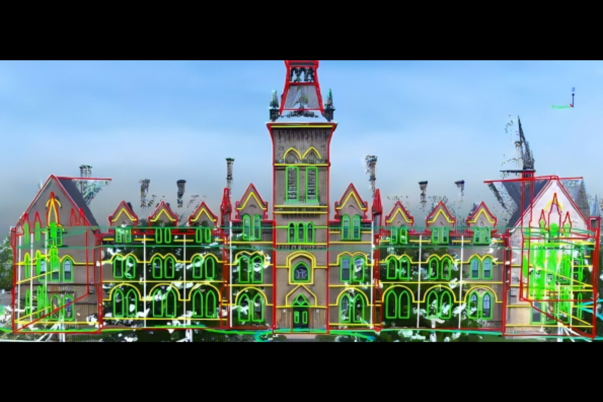
Professional Survey-Grade Accuracy
Powered by advanced SLAM and fusion positioning, it delivers 2 cm relative and 5 cm absolute accuracy. Count on exceptional consistency and reliability across any scenario or repeated scan.
- Eliminate software switching. Seamlessly transition from data acquisition to modeling and analysis with automated processing for direct deliverable output. Significantly lower your learning curve and operational costs.
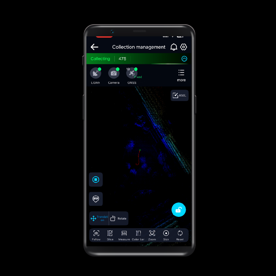
- Start scanning immediately with real-time feedback. Powered by cluster processing, it significantly reduces both on-site fieldwork and in-office processing time for highly efficient project delivery.
All-in-One Data Processing for a Highly Efficient Workflow
Multi-form Data Collection
Supports various deployment modes to flexibly adapt to diverse collection scenarios.

Frontpack Kit
Frees your hands for long-duration work in complex environments.
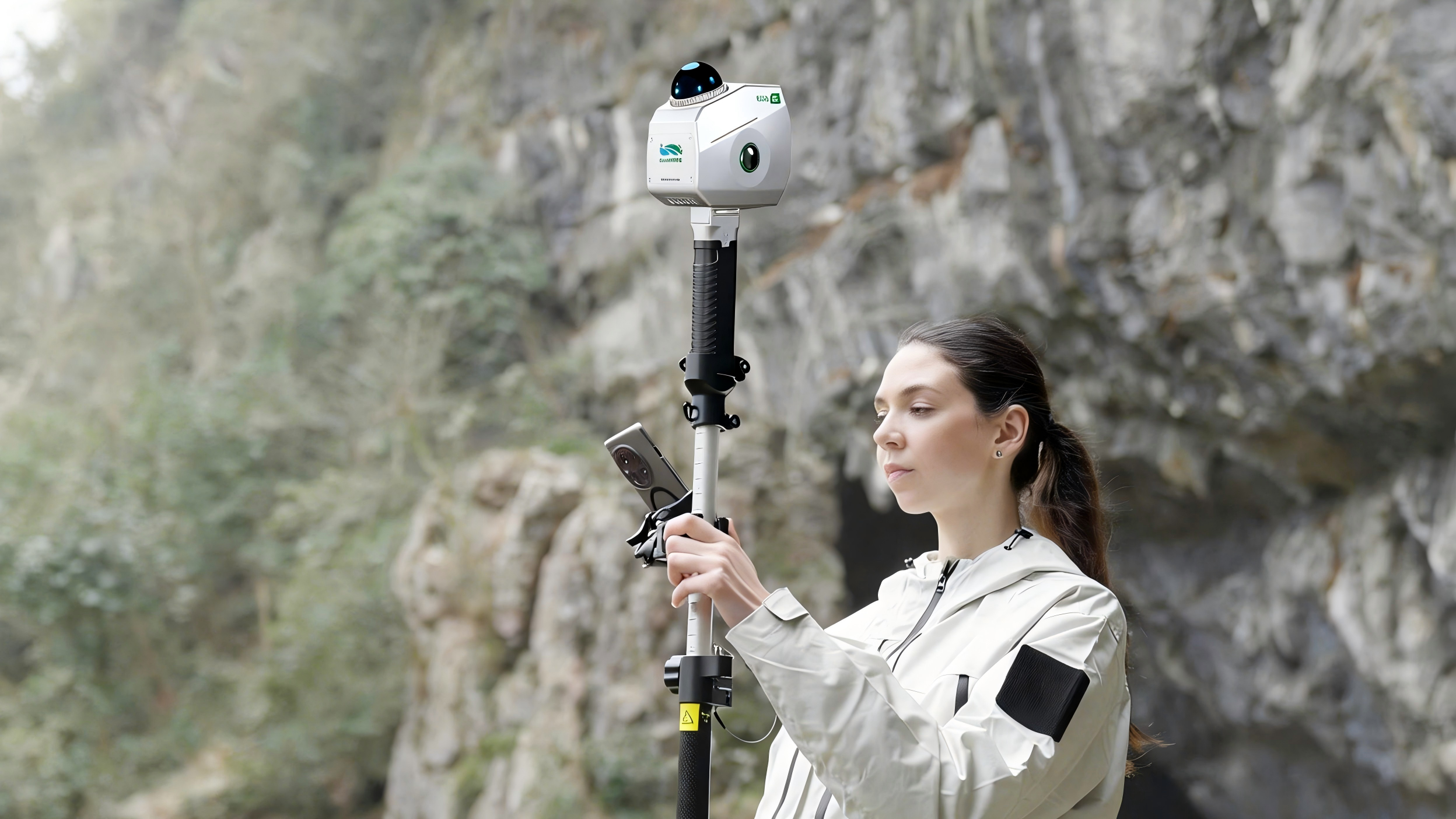
Telescopic Pole Kit
Extends measurement height, effectively collecting facade and stockpile data.
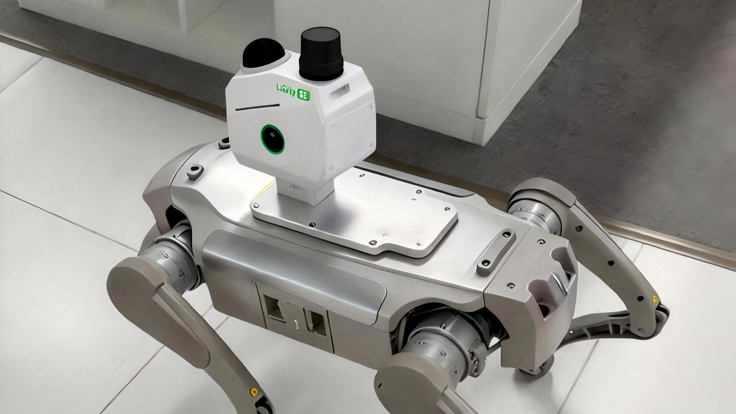
Robot Dog
Suitable for data collection in dangerous environments.
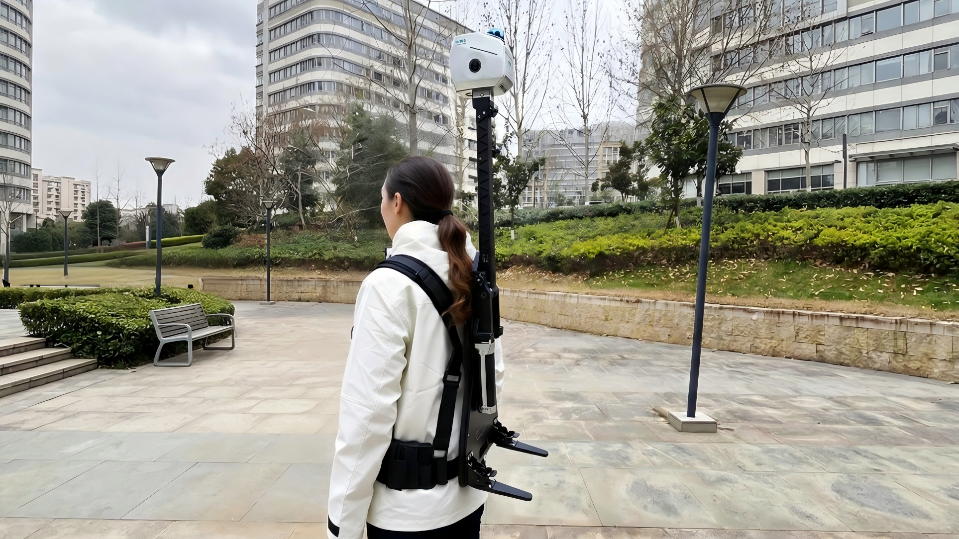
Backpack Kit
Supports dual batteries for long-duration and long-distance operations.
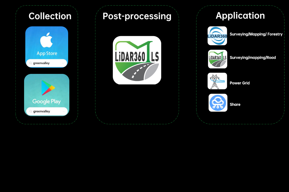
Supporting Softwares
 GreenValley APP
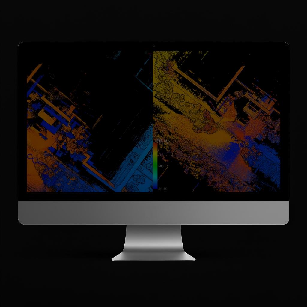 LiDAR360MLS-BP Module
 LiDAR360/LiDAR360MLS
Application Scenarios
 CAD
CAD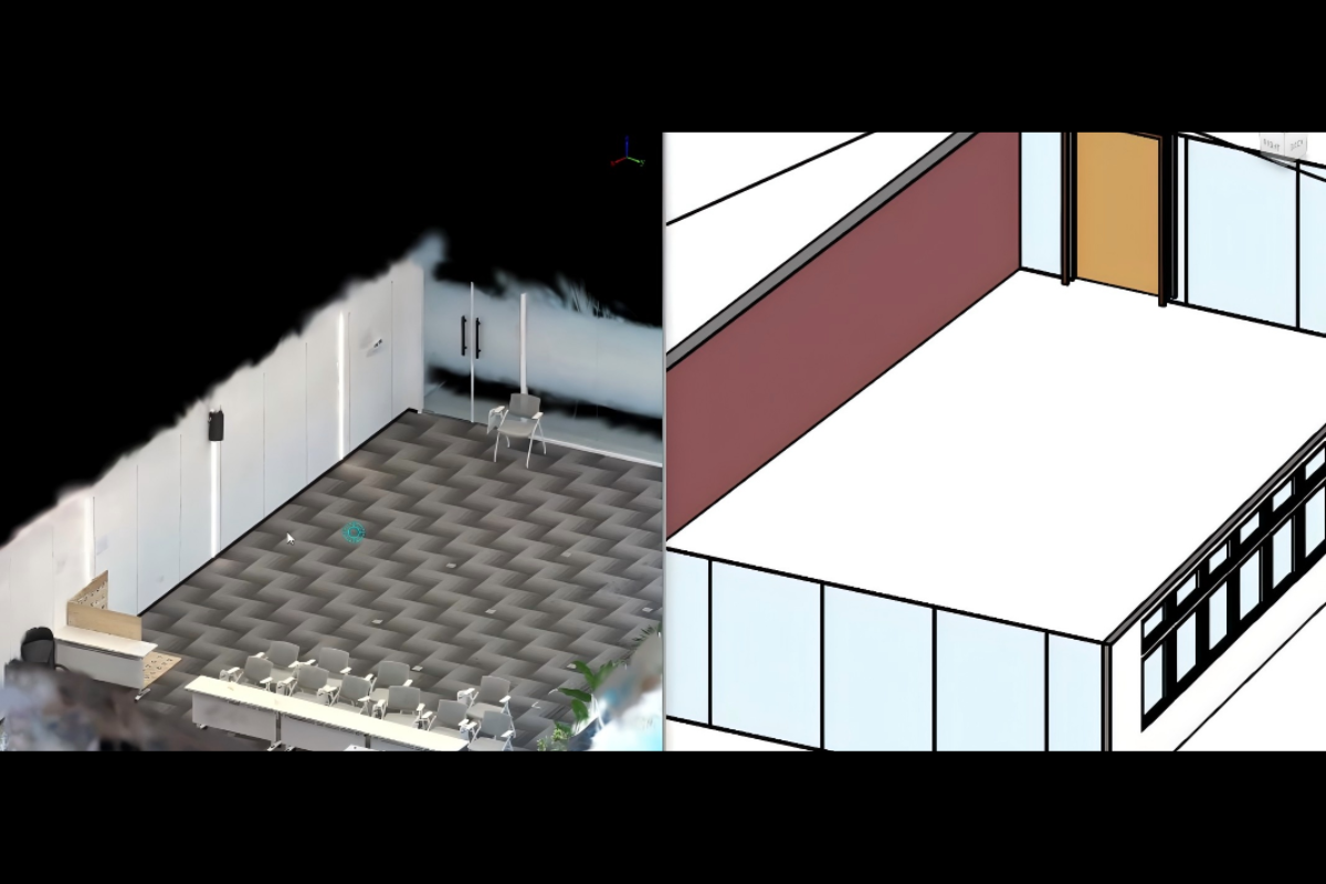 BIM Modeling
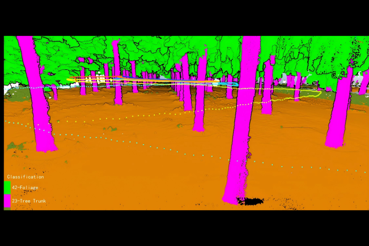 Classification
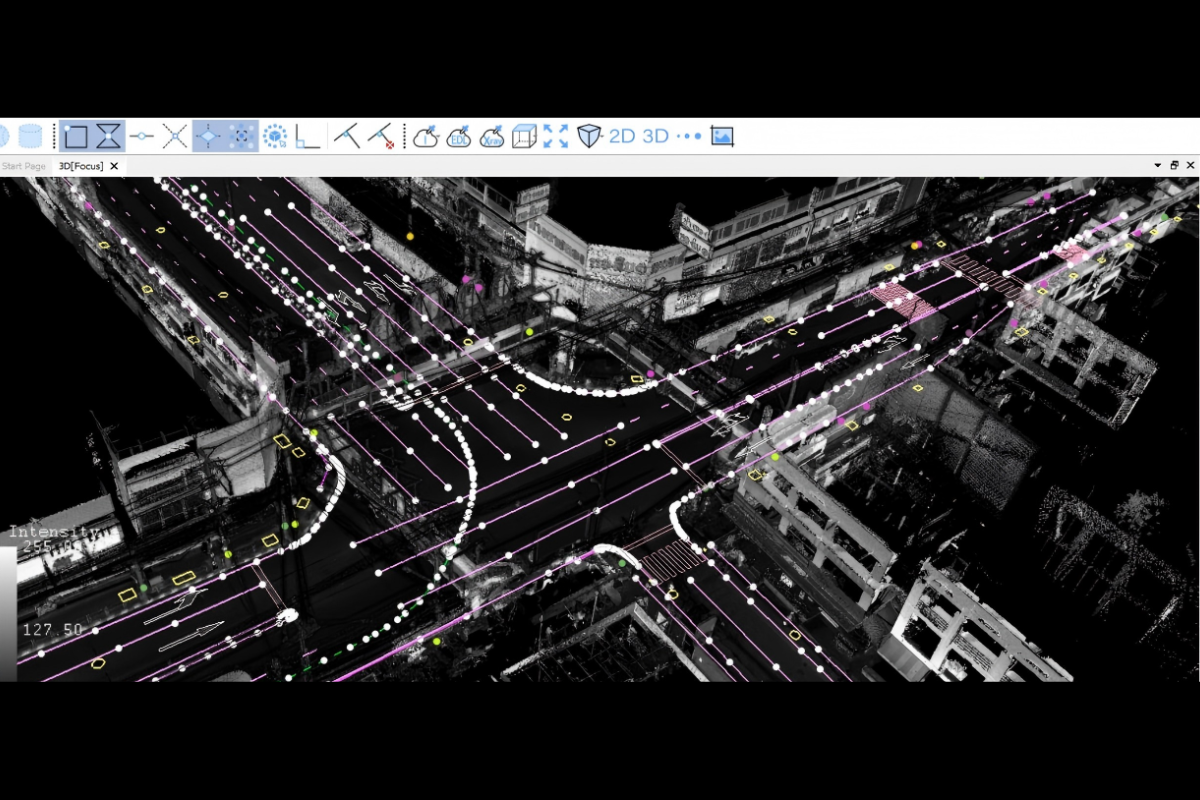 Road Topographic Surveying
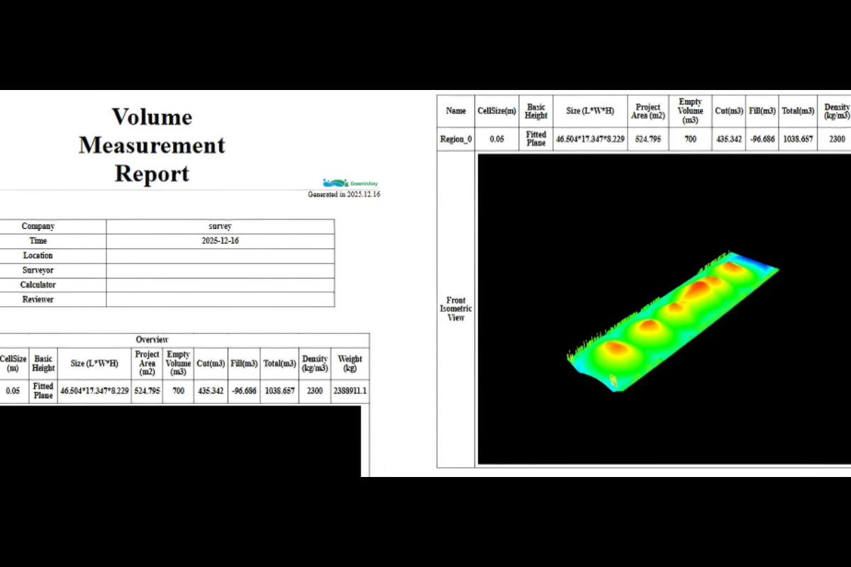 Volume Measurement and Reporting
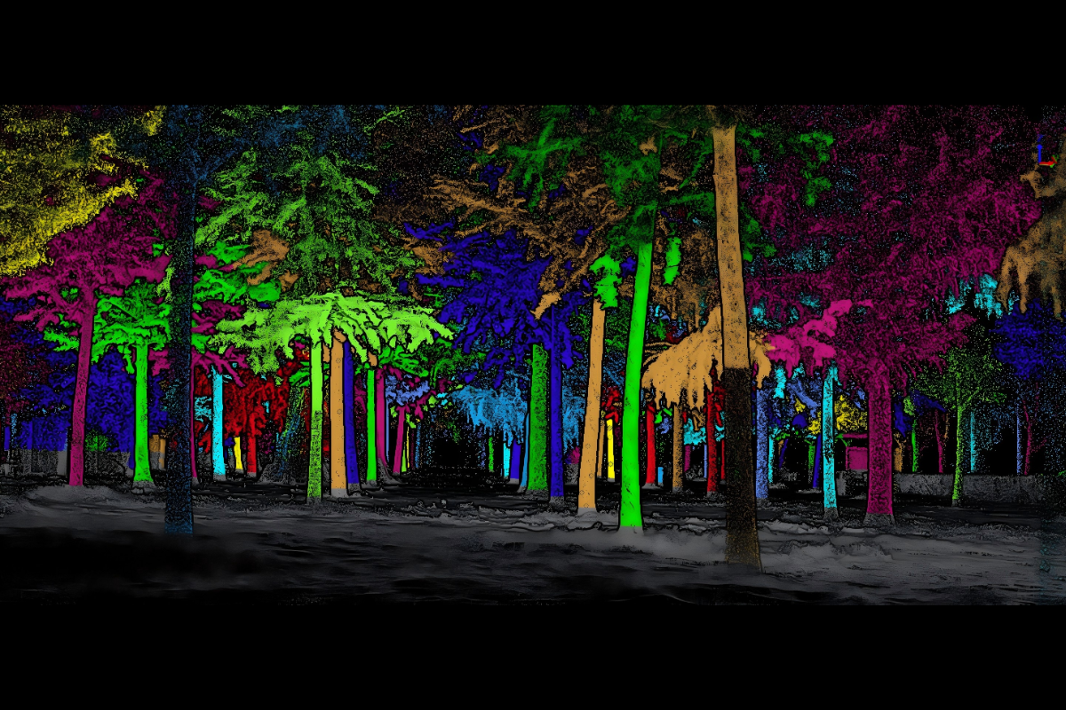 Forestry Analysis
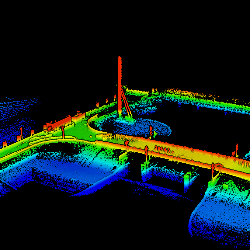 Construction Surveying
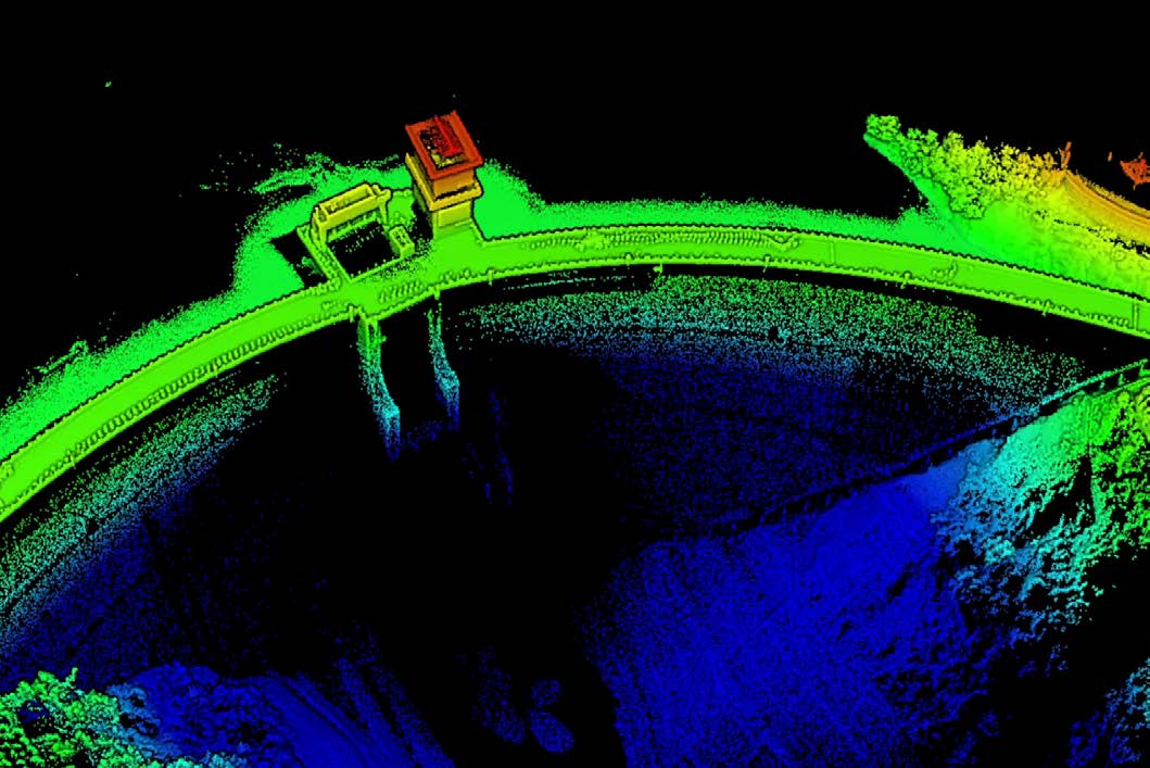 Topographic Surveying
GreenValley International Inc (GVI), headquartered in Berkeley, California, is a leading innovator of 3D mapping technologies. GVI provides a wide range of advanced aerial, terrestrial, and mobile LiDAR survey and mapping hardware systems and cutting-edge software as well as turnkey solutions. Our portfolio includes airborne, handheld, mobile, and backpack laser scanning platforms, as well as point cloud processing software such as the LiDAR360 LiDAR data processing platform. GVI focuses on LiDAR and image fusion technology, specializing in LiDAR, UAV, SLAM, Photogrammetry, and other technologies to achieve an accurate digital representation of three-dimensional space. As we continue to expand our reach and technological capabilities, GVI remains committed to driving innovation and pushing the boundaries of what's possible in the LiDAR space.
