Subscribe

LiDAR360 automatically extracts the height under branches, making forestry investigations more efficient!
-- 13 Oct 2023 --

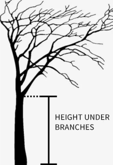
Underbranch height refers to the height of the first living branch of the crown to the ground, which is an important index reflecting the dynamic change of the vertical structure of the crown. It can be used to calculate crown length, crown length ratio and other crown size indicators, and is also commonly used to predict crown width model, crown type model and biomass model. It is an important result of forestry investigation and has great application value.LiDAR360 automatically extracts the height under branches, making forestry investigations more efficient!


LiDAR360 automatically extracts the height under branches, making forestry investigations more efficient! 

Figure 1. Branch height definition


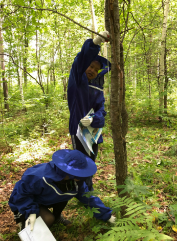
The traditional sub-branch height measurement method requires investigators to use tools such as wheel ruler and circumference ruler to manually measure the trees in the sample plot one by one, which has the pain points of (1) large consumption of manpower and material resources, (2) low work efficiency, (3) fieldwork, and the working cycle is easily affected by weather, time and other factors.
LiDAR360 automatically extracts the height under branches, making forestry investigations more efficient! 

Figure 2 Traditional methods for measuring subbranch height (image from the Internet)


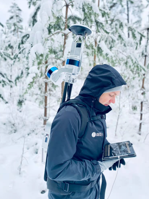
As a new technology of sample land survey, ground-based LiDAR can quickly acquire forest 3D characteristics, and with post-processing software, it can realize high efficiency, high precision and multi-element forest sample survey.
LiDAR360 automatically extracts the height under branches, making forestry investigations more efficient! 

Figure 3 International customers are using green Earth LiDAR backpack equipment


Taking a sample plot with a range of 28.28*28.28 meters and containing about 200 trees as an example, using the traditional method to measure the branch height, a team of 2 people can usually complete the measurement of 1 sample plot for 1 day. With the use of backpack LiDAR, it takes less than 30 minutes to complete the data acquisition of a sample site, and with the point cloud post-processing software LiDAR360, 1 person can complete the data acquisition + processing of 3 to 4 sample sites in 1 day, saving manpower, improving efficiency, and significantly reducing field workload.


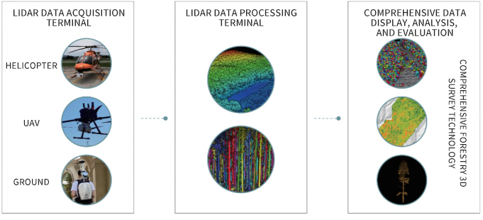
As a one-stop solution provider for multi-industry Lidar, Digital Green Soil has provided services for forestry resource survey in 200+ regions around the world based on fully self-developed multi-platform LiDAR hardware + post-processing and industry application software, and participated in major projects such as carbon sink infrastructure construction of the State Forestry Administration. In the field of forestry investigation has a strong technical strength and high-quality industry reputation.       
LiDAR360 automatically extracts the height under branches, making forestry investigations more efficient! 

Figure 4 Forestry survey solutions


Lvdu self-developed point cloud post-processing and industry application software LiDAR360, with forestry module, can segment single tree point cloud from massive point clouds with one click, and automatically extract multiple parameters of single tree location, tree height, DBH, crown width, and branch height. It is the only software in the world that can extract tree branch height based on point cloud, and has been downloaded more than 100,000 times worldwide.

The extraction process of LiDAR360 branch height is as follows:

LiDAR360 automatically extracts the height under branches, making forestry investigations more efficient! 

Figure 5 LiDAR360 extraction sub-branch height process


Pre-processing: Pre-processing includes point cloud splicing, de-noising, thinning, blocking and other operations, depending on the data situation. LiDAR360 contains a wealth of point cloud pre-processing tools, supporting the whole process of multi-platform and multi-format point cloud data pre-processing.


Ground point classification: Use the toolbar "foundation forestry" > "ground point classification" function, click OK to complete the automatic classification of ground points. The software supports one-click selection of terrain, and automatically adjusts default parameters according to terrain, ensuring that the classification of ground points under various terrain conditions can achieve ideal results.


Normalization: The effect of topographic relief on tree point cloud elevation can be removed by using the function of "foundation Forestry" > "normalization", which is a necessary step before the single wood division process.


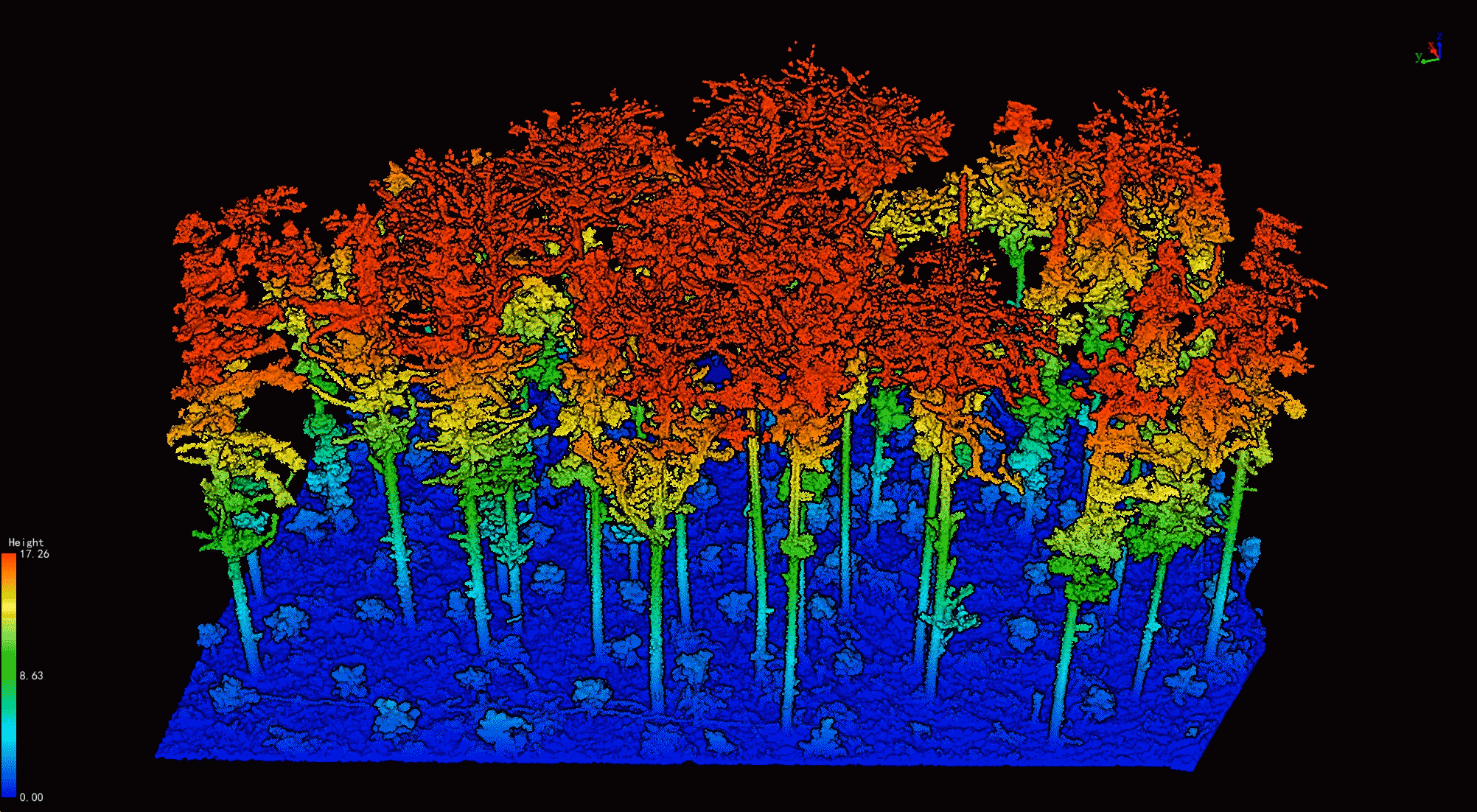
Single tree segmentation: Using the "foundation forestry" > "single tree segmentation" function, you can segment single trees from the forest point cloud with one click and form a property table.
LiDAR360 automatically extracts the height under branches, making forestry investigations more efficient! 

FIG. 6 Results of single wood segmentation


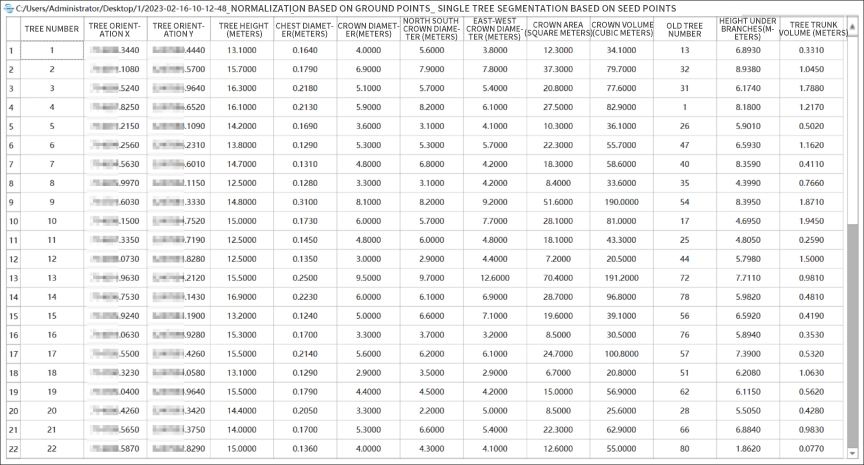
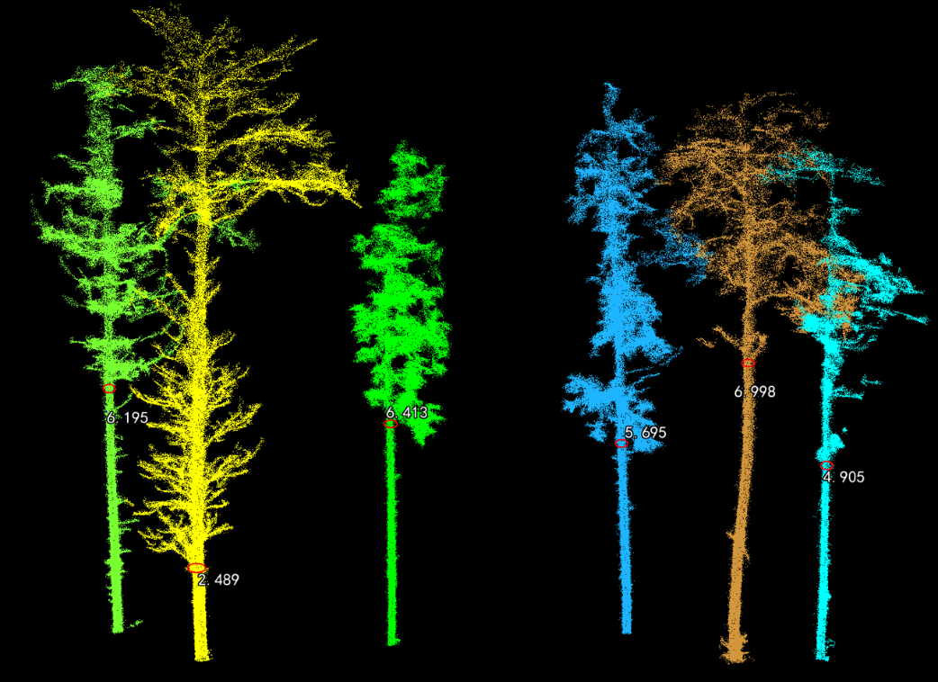
Sub-branch height and trunk volume extraction: Use the function of "Foundation forestry" > "sub-branch height extraction" to automatically extract sub-branch height, trunk volume and other parameters, and write them into the property table.
LiDAR360 automatically extracts the height under branches, making forestry investigations more efficient! 

FIG. 7 Attribute table of single wood segmentation results


As shown in the figure, after the processing process is completed, the attributes of tree location, tree height, DBH, crown diameter, north-south crown diameter, east-west crown diameter, crown area, crown volume, height under branches, and trunk volume are included in the attribute table. At the same time, the software can obtain the elevation, slope, slope direction and other attributes of a single tree through the function of "extending the properties of a single tree". The extraction results of individual tree parameters can be used to calculate volume, stock, biomass and carbon sink, providing efficient support for related industry applications.       
 

LiDAR360 automatically extracts the height under branches, making forestry investigations more efficient! 

Figure 8. High extraction effect under branch


Recommended Articles

HOW CAN WE HELP YOU?
Message us your questions and contact information.
We’ll get back to you right away!