

DEM

Terrain Applications
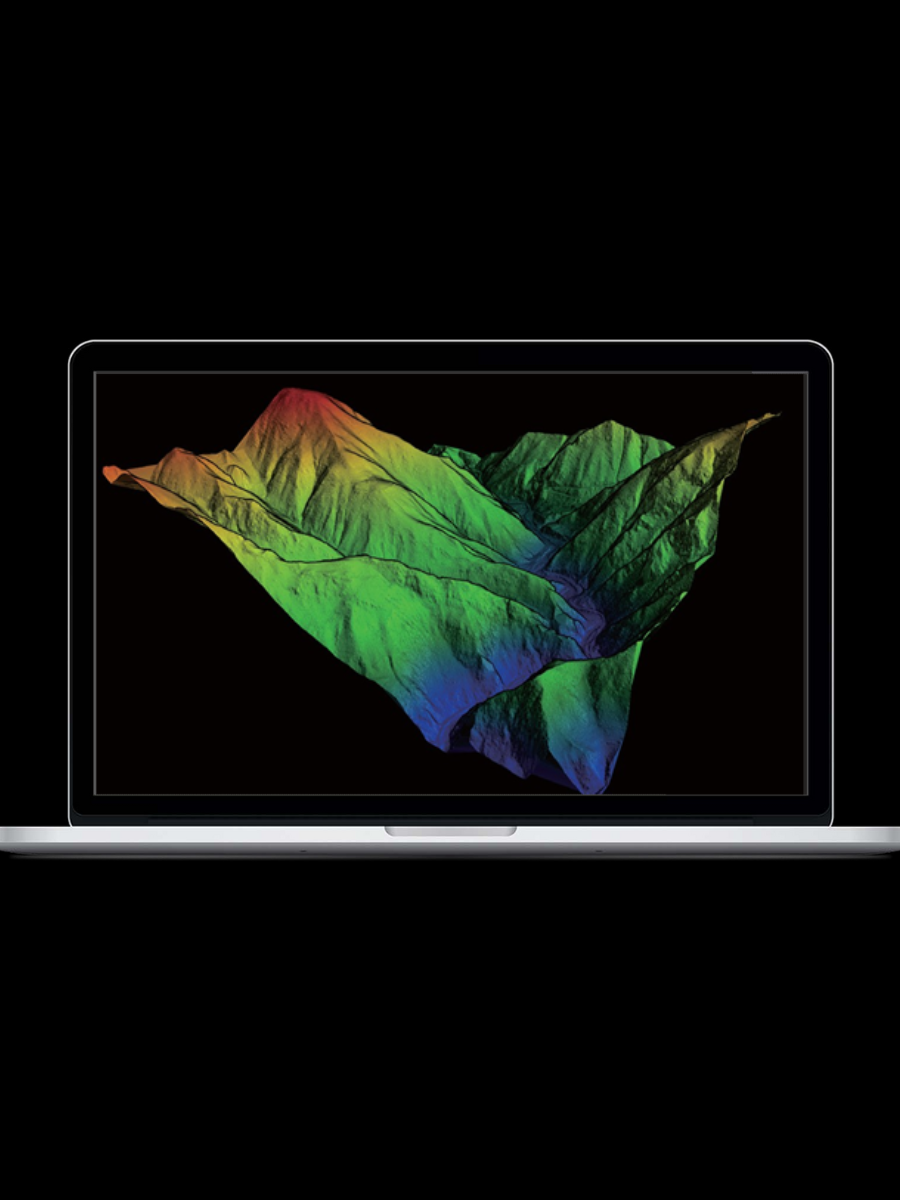
With the rapid advancement of surveying and mapping technology, the utilization of 3D laser scanning technology has become incredibly widespread. This technology is now being employed in a multitude of applications, revolutionizing the creation of DEM, DSM, DTM, and contour lines.
At GVI, we are proud to offer a comprehensive range of turnkey applications that include state-of-the-art hardware and software products. These innovative solutions are designed to enhance every aspect of LiDAR data collection, processing, and analysis, making them more efficient and productive than ever before.

Turnkey Solutions

Most Efficient Software

Cost-effective Products

Multiple Applications
Cost-effective Products
We have a complete LiDAR product line, developing team, large-scale production capacity, all this advantages lead us to a better product competitiveness and industry application ability.

Case Studies

LiAir Helped in U Thong Ancient City Topographic Survey Project in Thailand
U Thong Ancient City Located along the Sam Phan Crocodile River in the area of U Thong District, Suphan Buri Province, the boundary of the city is defined by a moat that was excavated. It surrounds an oval-shaped flat area, about 2 x 1 square kilometers in size, which found many ancient sites and antiquities spread within the plains of the city.
Read More 

Generating Terrain Models using LiDAR360
This case combines LiDAR point cloud post-processing software LiDAR360 and uses data collected from an open-pit mine as test data to introduce the application of 3D point cloud data in the production of terrain products.
Read More

Filling the Point Cloud Gaps with LiDAR360
3D point clouds constructed from multiple laser scanning platforms, such as mobile handheld and UAV LiDAR systems, can provide comprehensive spatial descriptions of objects or regions of interest that would be difficult to generate using just a single laser scanning platform.
Read More
Applications


DOM

DSM

Tin Model

Contour Lines Volume Measurement

DLG
Which one is right for you?
 LiDAR360
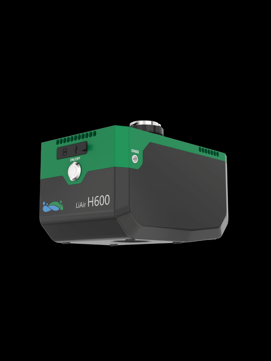 LiAir H600
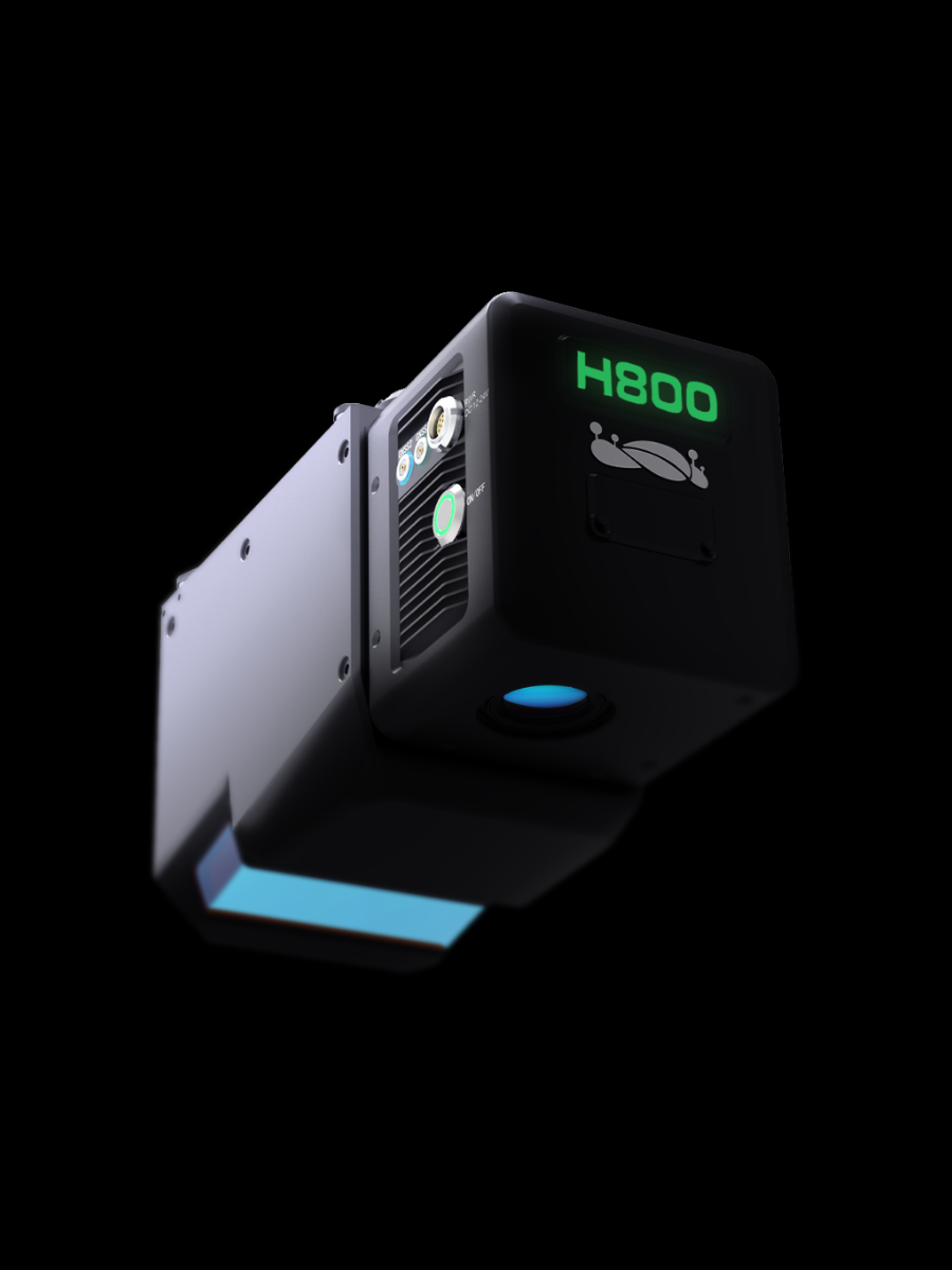 LiAir H800
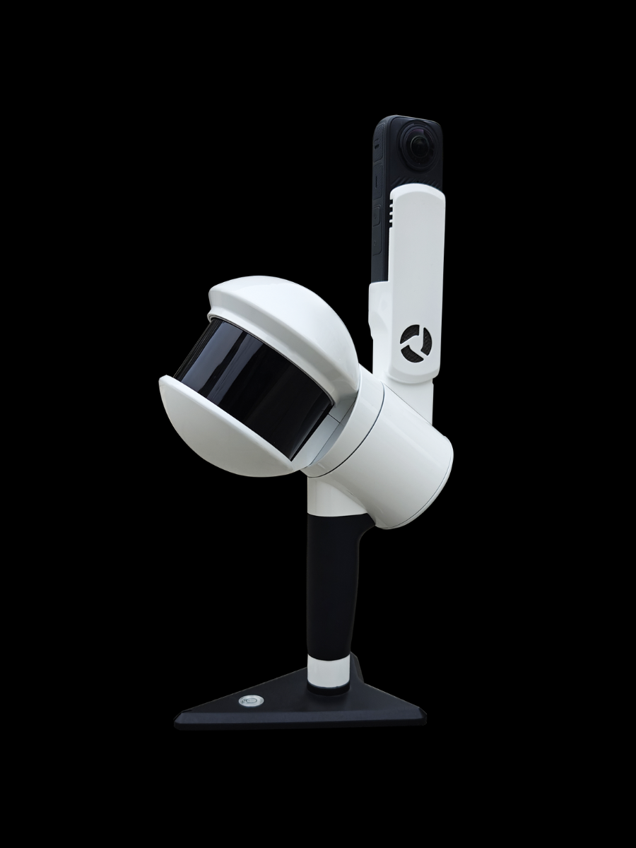 LiGrip H300
GreenValley International Inc (GVI), headquartered in Berkeley, California, is a leading innovator of 3D mapping technologies. GVI provides a wide range of advanced aerial, terrestrial, and mobile LiDAR survey and mapping hardware systems and cutting-edge software as well as turnkey solutions. Our portfolio includes airborne, handheld, mobile, and backpack laser scanning platforms, as well as point cloud processing software such as the LiDAR360 LiDAR data processing platform. GVI focuses on LiDAR and image fusion technology, specializing in LiDAR, UAV, SLAM, Photogrammetry, and other technologies to achieve an accurate digital representation of three-dimensional space. As we continue to expand our reach and technological capabilities, GVI remains committed to driving innovation and pushing the boundaries of what's possible in the LiDAR space.
+1(510)345-2899info@greenvalleyintl.com 729 Heinz Avenue, Suite 9, Berkeley, California 94710, USA Subscribe
Copyright © 2026 GreenValley International Inc. All Rights Reserved.
