Case StudiesDigitizing a Desert Oasis: LiGrip + LiDAR360MLS Preserve Morocco's Tinghir Heritage
Digitizing a Desert Oasis: LiGrip + LiDAR360MLS Preserve Morocco's Tinghir Heritage
See how a handheld scanner turned Morocco’s intricate desert oasis heritage site into a precise digital twin — and why traditional surveys simply couldn’t keep up.
In Tinghir, a desert oasis city in southeastern Morocco, a multifunctional complex blending Islamic architectural essence—serving religious, cultural, and administrative purposes—urgently requires precise digital preservation. The building features irregular walls and intricate carvings that traditional survey methods struggle to capture efficiently. Faced with these challenges, the client turned to GreenValley's LiGrip handheld 3D laser scanner and LiDAR360MLS software to efficiently capture façade data and establish a high-accuracy digital twin.
The Challenge of Heritage Documentation
Heritage buildings demand a level of detail that conventional survey tools often cannot deliver. Irregular wall surfaces, ornate carvings, and complex spatial layouts require dense, accurate 3D data. Traditional methods are slow, labor-intensive, and prone to missing fine geometric features. For a multifunctional complex that combines religious, cultural, and administrative functions, any documentation gap risks losing irreplaceable architectural information. The client needed a solution that could capture both the macro geometry of the building envelope and the micro details of decorative elements—without requiring a large survey crew or weeks of field work.
Lightweight Hardware Meets Intelligent Software
The solution combined the portability of LiGrip with the processing power of LiDAR360MLS into a seamless workflow from field to final deliverables.
1. On-Site Data Collection with LiGrip
The client planned the scanning route in advance based on site conditions, then used the LiGrip SLAM scanner to capture façades and the surrounding environment. The handheld form factor allowed the operator to navigate tight spaces and varied terrain around the complex with ease. Real-time point cloud data was generated during scanning, giving immediate feedback on data coverage and quality.
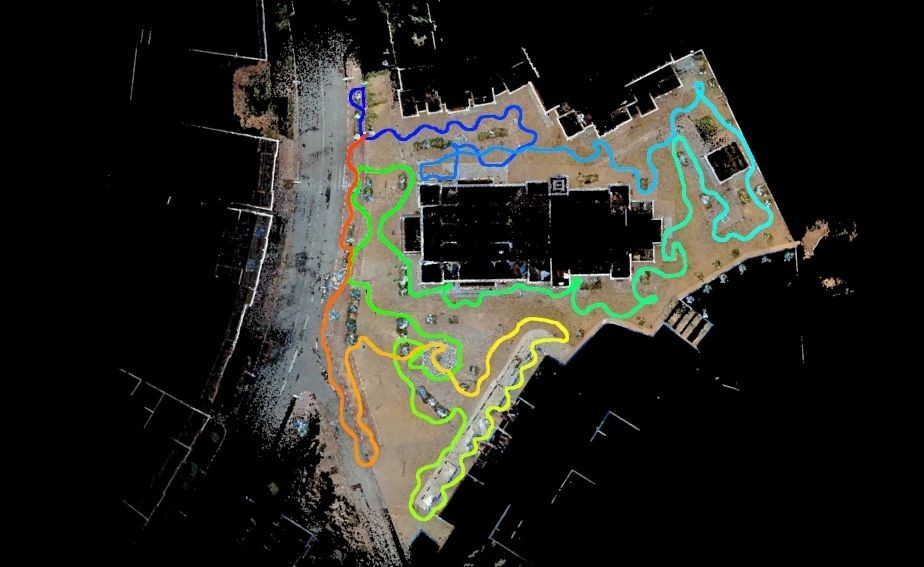
2. Smart Processing with LiDAR360MLS
Back in the office, LiDAR360MLS processed the raw point cloud through filtering, denoising, and classification steps, producing a high-quality point cloud that accurately reproduced the actual building structure—including irregular wall surfaces and finely detailed carvings.
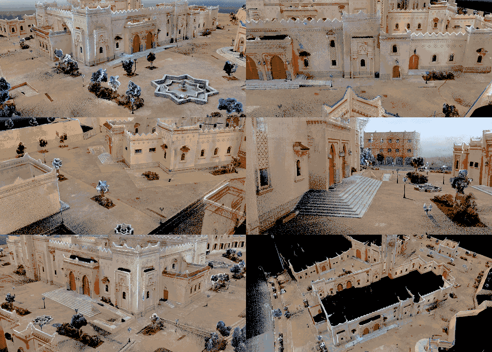
Three Intelligent Extraction Workflows
LiDAR360MLS enabled three distinct downstream products from a single point cloud dataset
(1) Rapid façade vectorization
Using the façade measurement module, the client drew vector elements of the building façade. Through the attribute table's field calculator, they precisely calculated the area of elements such as doors and windows and the length of line features, producing measurement outputs directly useful for energy-saving renovation planning and structural documentation.
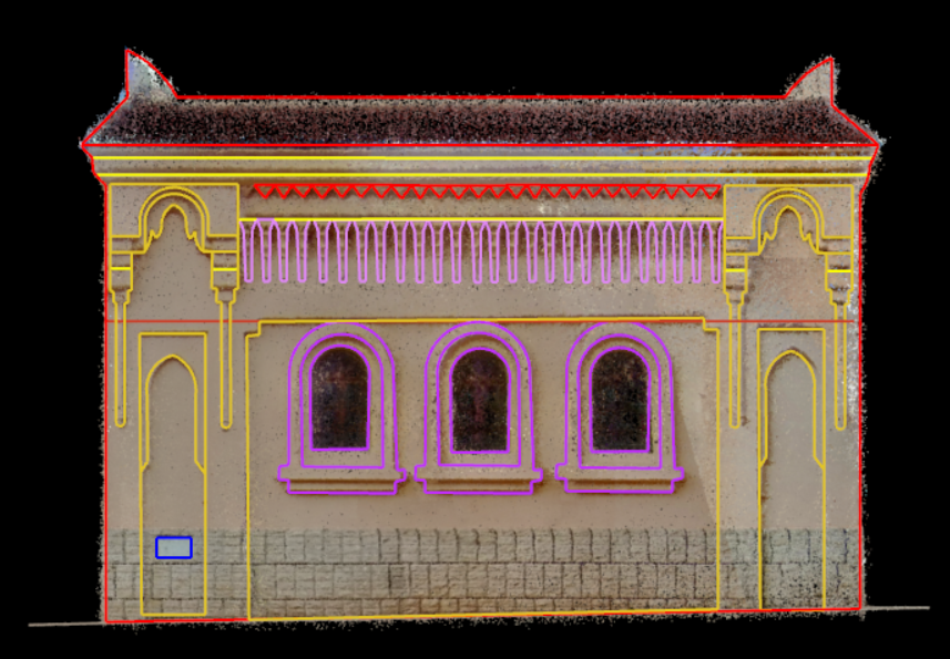
(2) Efficient 2D floorplan generation
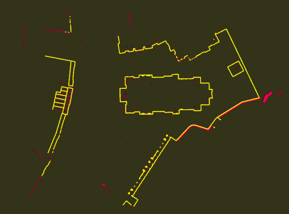
With the floorplan module, the client automatically extracted 2D vector floorplans of building structures from the classified façade point clouds. The results could be directly imported into AutoCAD for further architectural work, eliminating the need for manual redrawing.
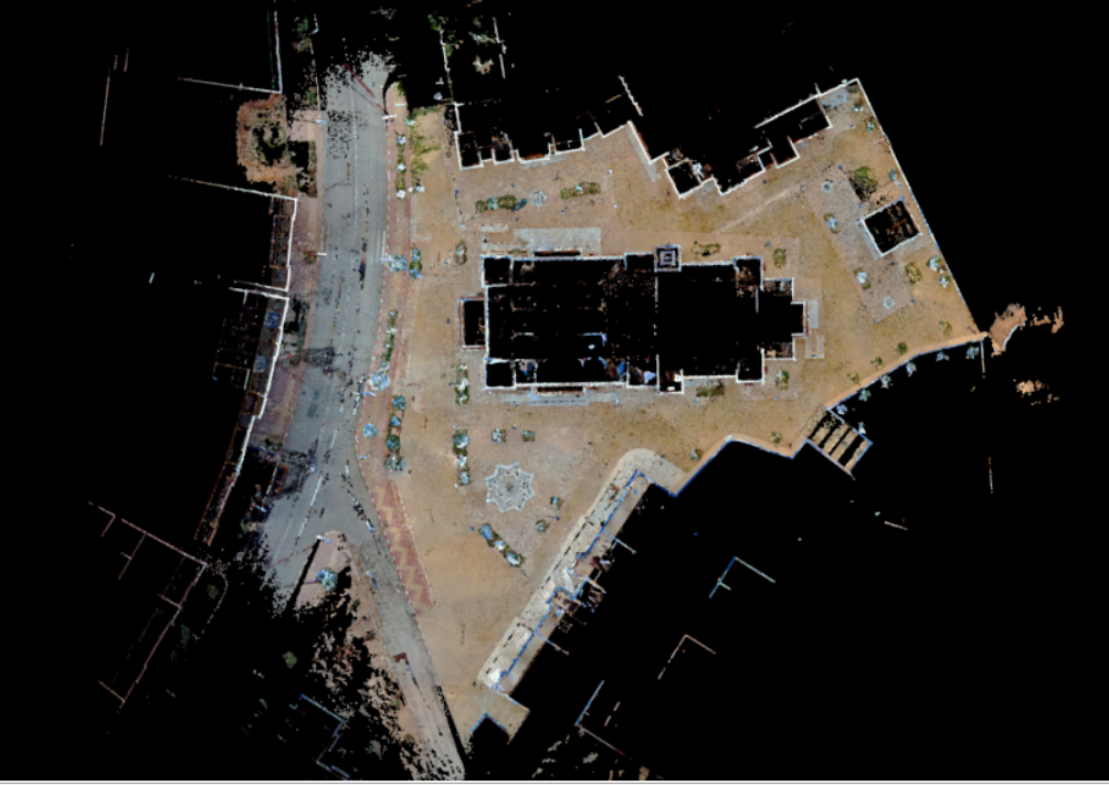
(3) One-click Mesh model generation
Using the SLAM processing module, the client generated a textured Mesh model of the entire scene with a single click. The Mesh model supports both measurement and mapping operations, providing an intuitive 3D visualization suitable for stakeholder review, virtual tours, and heritage archiving.
Why LiGrip + LiDAR360MLS?
Efficiency over traditional surveys. Bulky total station setups and manual sketching cannot match the speed of handheld scanning paired with automated software processing. Digital permanence over hand-drawn sketches. Physical sketches degrade and are hard to share. Digital point clouds and vector outputs are instantly preserved, duplicated, and distributed. Automated computation over manual calculation. One-click extraction of lengths, areas, and volumes removes human calculation error and accelerates documentation delivery. The success of the Tinghir project proves that LiGrip is not just a breakthrough in portable hardware—together with LiDAR360MLS, it forms a complete end-to-end solution from data acquisition to analysis. Whether for heritage preservation, factory digitization, or urban information modeling, GreenValley continues to redefine the boundaries of 3D mapping with precision, efficiency, and portability.
Guess you like

Topcon and GreenValley International Collaborate on Spatial Intelligence Innovations
Strategic collaboration will bring spatial intelligence into real-world industry applications by integrating hardware, software, cloud and AI to simplify, automate and intelligently connect complex workflows across construction, machine control, infrastructure and other high-value industries.
 Company News
GVI Trade-Up Program: Upgrade Your Legacy LiDAR Workflow
Upgrade eligible legacy GreenValley LiAir, LiGrip and LiBackpack systems through the limited-time GVI Trade-Up Program. Receive upgrade credit, warranty coverage, software benefits, and personalized assessments before June 30, 2026.
Company News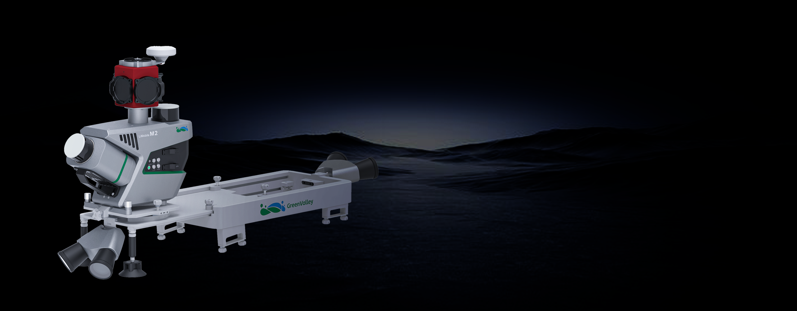
LiMobile M2
Affordable Mobile Laser Scanning System

GreenValley International Inc (GVI), headquartered in Berkeley, California, is a leading innovator of 3D mapping technologies. GVI provides a wide range of advanced aerial, terrestrial, and mobile LiDAR survey and mapping hardware systems and cutting-edge software as well as turnkey solutions. Our portfolio includes airborne, handheld, mobile, and backpack laser scanning platforms, as well as point cloud processing software such as the LiDAR360 LiDAR data processing platform. GVI focuses on LiDAR and image fusion technology, specializing in LiDAR, UAV, SLAM, Photogrammetry, and other technologies to achieve an accurate digital representation of three-dimensional space. As we continue to expand our reach and technological capabilities, GVI remains committed to driving innovation and pushing the boundaries of what's possible in the LiDAR space.