## Getting Started ##
### User Interface Overview ###
### Steps ###
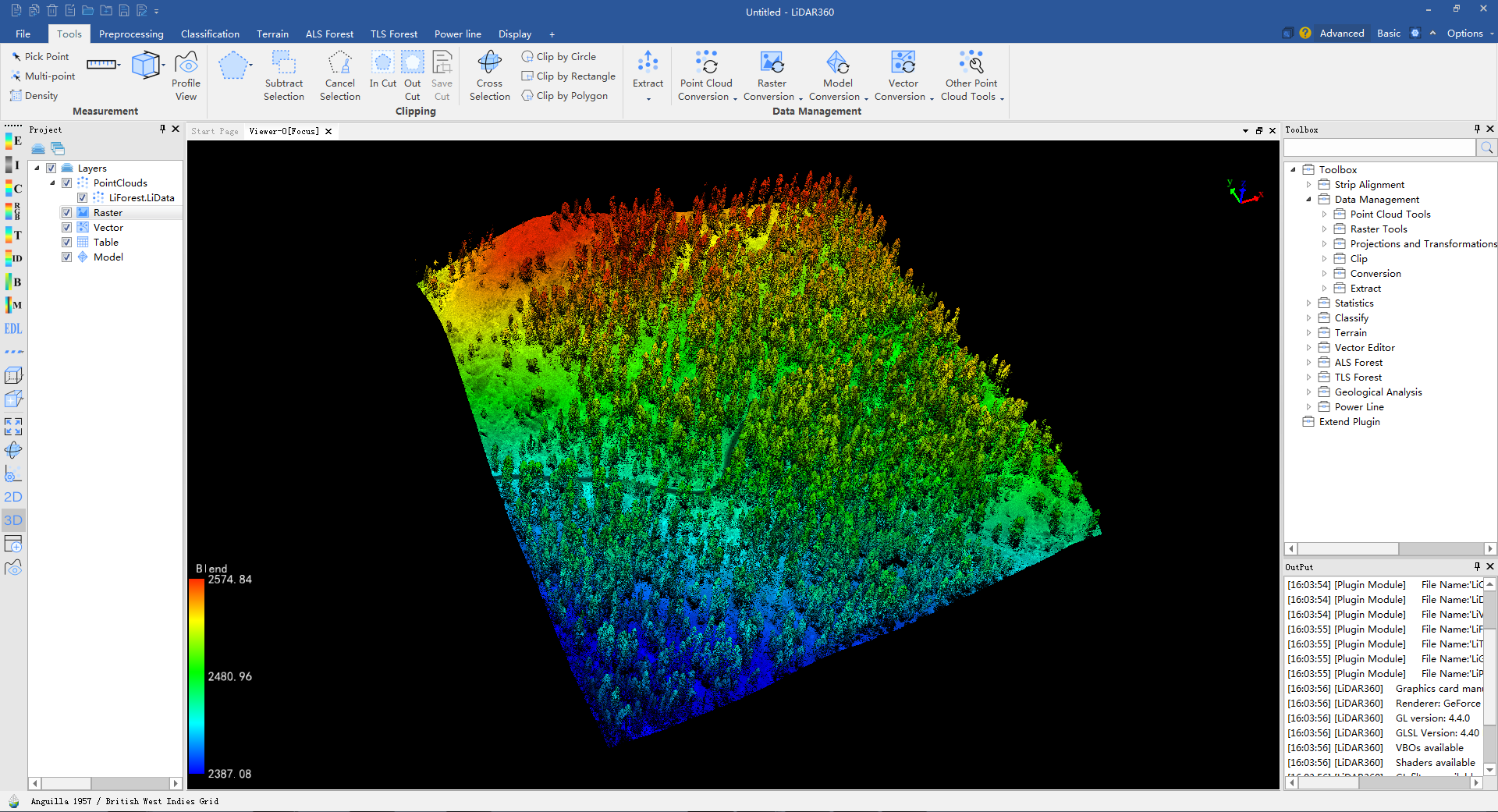
1. Click ***File > [Add Data](../ToolReference/ProjectTools/AddData.md)*** to open data. You can import point clouds ([***.LiData**](../Appendix/LiData.md), \*.las, \*.laz, \*.txt, \*.asc, \*.neu, \*.xyz, \*.pts, \*.csv. \*.ply), rasters (\*.tif, \*.jpg), vectors (\*.shp), tables (\*.csv) and models (**[\*.LiModel](../Appendix/LiModel.md)**, **[\*.LiTin](../Appendix/LiTin.md)**, \*.osgb, \*.ive, \*.desc, *.obj) into LiDAR360. The point cloud data will be converted into LiData file for the first time been added, it is the customized file format for massive point cloud data visualization and processing.
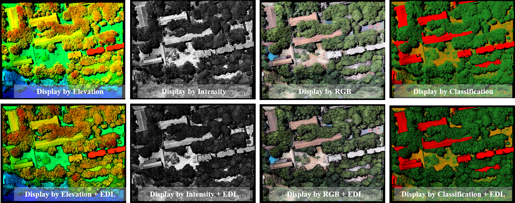
2. Ten display modes for point clouds are provided in LiDAR360: Display by Elevation, Display by Intensity, Display by Classification, Display by RGB, Display by Return Number, Display by GPS Time, Display by Blend, Display by Tree ID, Display by Mix and Display by EDL. EDL can be used with other display modes. Refer to [**Color Tools**](../ToolReference/ColorTools/Index.md).
3. A group of measurement tools are provided, including
[**Pick Point**](../ToolReference/MeasureTools/PickPoint.md),
[**Pick Multi-point**](../ToolReference/MeasureTools/MultiPickPoint.md),
[**Length Measurement**](../ToolReference/MeasureTools/LengthMeasurement.md),
[**Area Measurement**](../ToolReference/MeasureTools/AreaMeasurement.md),
[**Angle Measurement**](../ToolReference/MeasureTools/AngleMeasurement.md),
[**Height Measurement**](../ToolReference/MeasureTools/HeightMeasurement.md),
[**Volume Measurement**](../ToolReference/MeasureTools/VolumeMeasurement.md) and
[**Density Measurement**](../ToolReference/MeasureTools/DensityMeasurement.md).
### Tutorial Videos ###
1. LiDAR360 Installation and License Activation
2. LiDAR360 Overview and Loading Data
3. LiDAR360 Window Management
4. LiDAR360 Measurement Tools
5. LiDAR360 Selection Tools
6. LiDAR360 Profile Tools
7. LiDAR360 Camera Roam in 90 Seconds