## TIN to Contour ##
### Summary ###
This function directly connects contour point positions of the same elevation on the [TIN](GenerateTIN.md) stored in the [LiTin](../../Appendix/LiTin.md) file to generate contour lines.
### Usage ###
Click on the *Terrain > TIN to Contour*.
### Settings ###
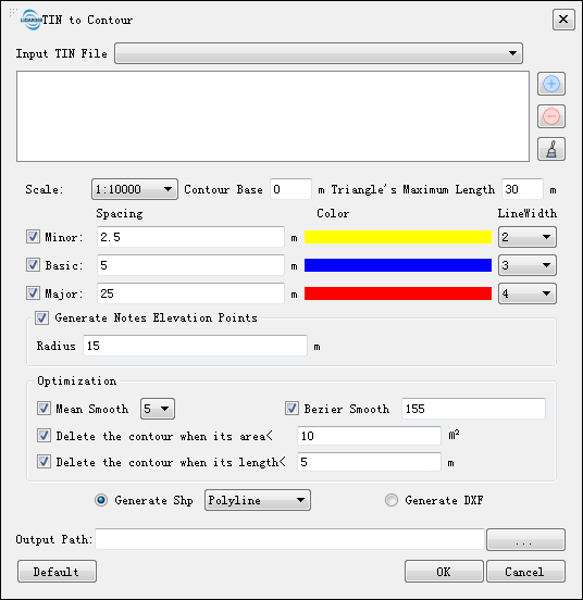
- **Input TIN File**:Input LiTin file(s). The drop-down box allows to select the LiTin data that has already been opened in the LiDAR360 software. User can also import LiTin data by clicking  . Or delete imported LiTin data by clicking
  . Or clear all the imported data by clicking
  .
- **Default Value**: Click this button to restore all default parameters.
- **The other parameters settings of the interface are the same as [Point Cloud to Contour](PointCloudtoContour.md).**
.
- **Default Value**: Click this button to restore all default parameters.
- **The other parameters settings of the interface are the same as [Point Cloud to Contour](PointCloudtoContour.md).**