

Measurement
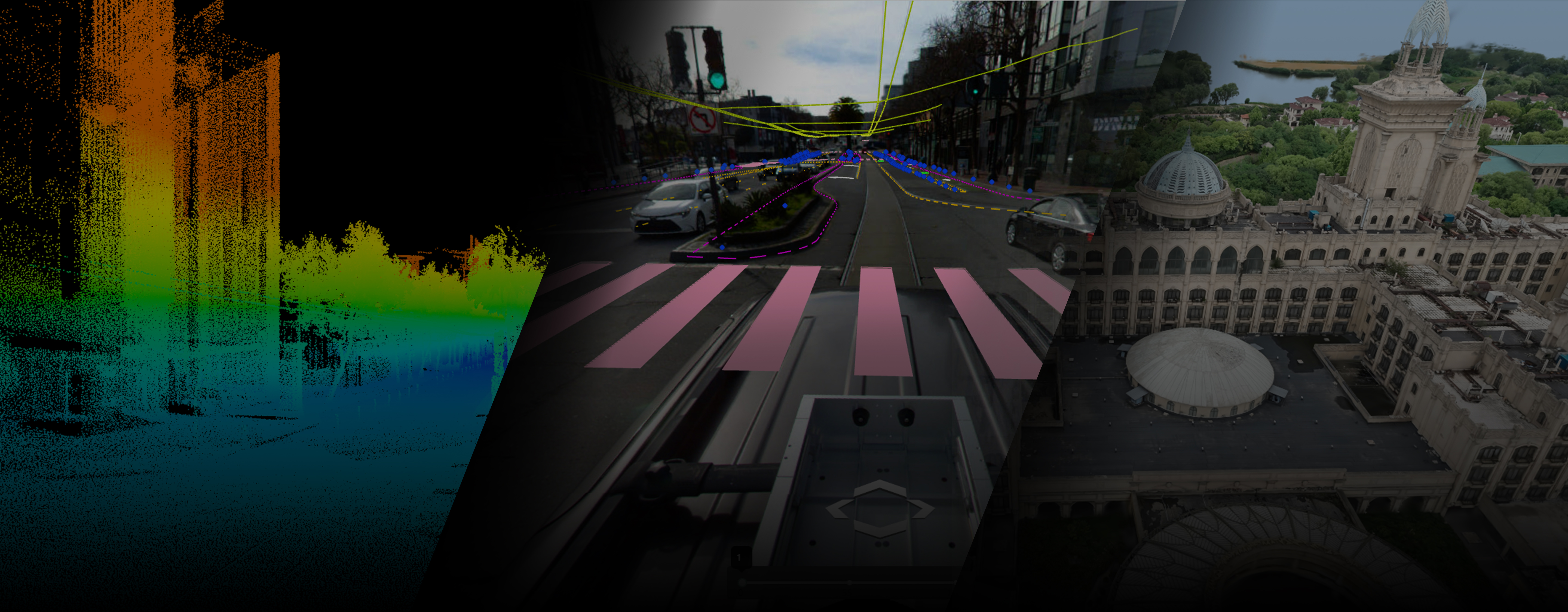
LiShare Cloud Service is a cloud-based 3D data management, analysis and visualization platform designed for architecture, engineering, surveying and mapping, cultural heritage protection and other fields. Through the platform, users can easily upload, manage, analyze, and share data such as point clouds, models, and panoramas to achieve efficient 3D scene display and collaboration.

3D Gaussian Splatting

Point Cloud

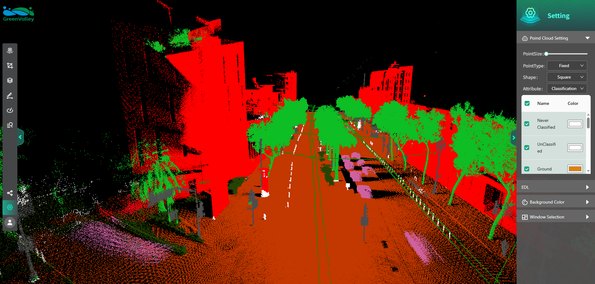
Classified Point Cloud Visualization

Panoramic Roaming

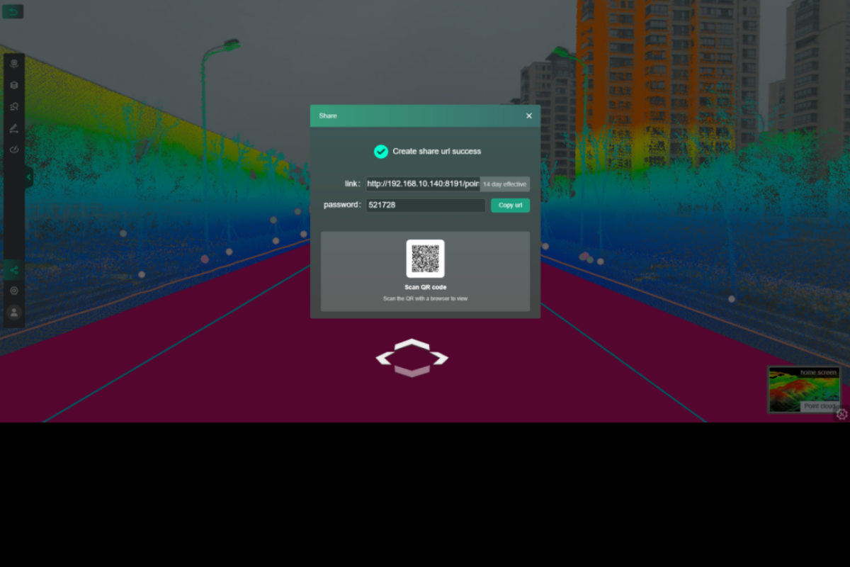
Result Sharing

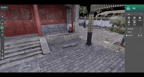
Measurement & Annotation Toolbox
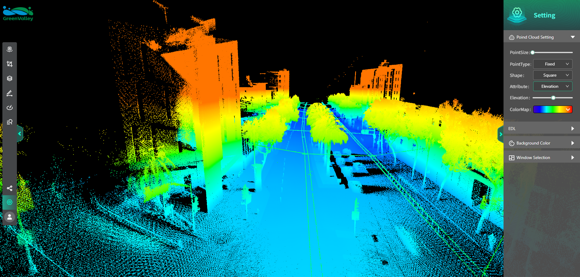
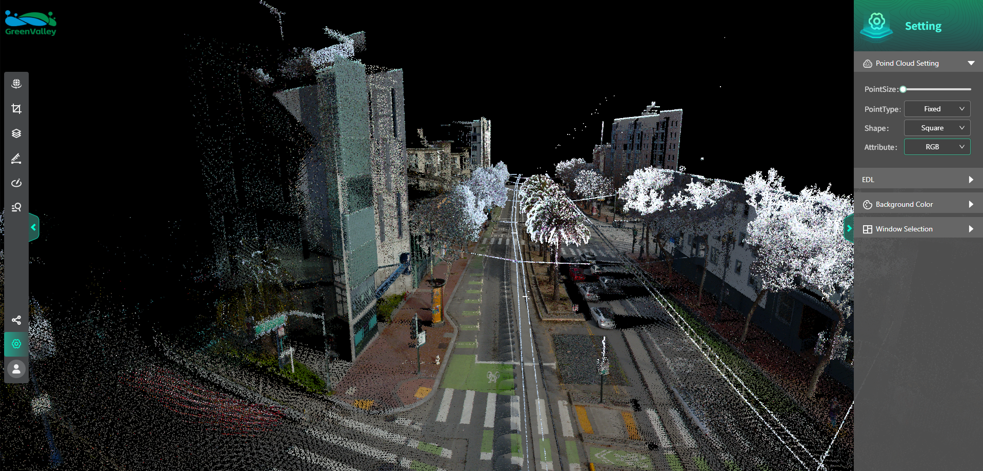
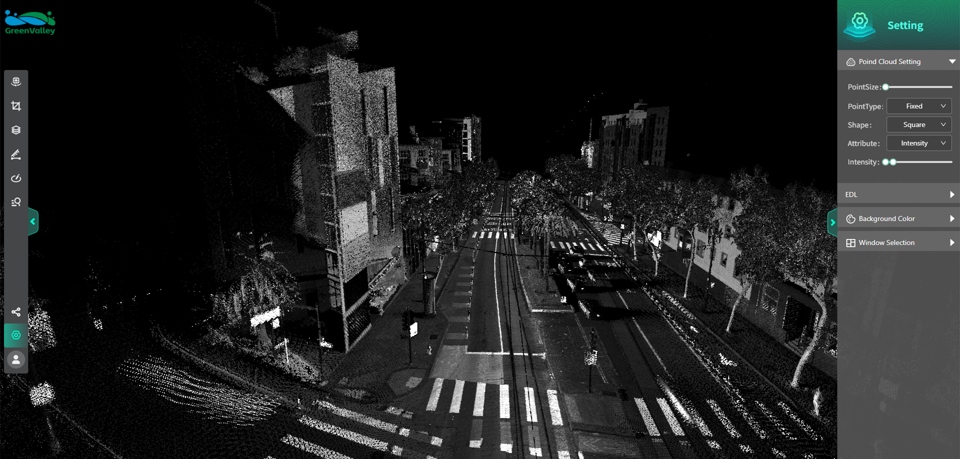
Multi-Class Rendering Settings

Split-Screen Comparison
Choose a Plan
Free
10GB / 7days
$ 0
Try it for FREE
- Result data management
- Annotation & measurement
- Result sharing
- Roaming
- 3DGS
- Rendering modes: AI classification, intensity, elevation, RGB, echo, tree ID, additional attributes
- Split-screen comparison
- Clipping
- Click-to-query
- Settings module
Subscribe
( Custom storage / custom duration )
200 GB / 3 Months
200 GB / 6 Months
200 GB / 12 Months
1 T / 3 Months
1 T / 6 Months
1 T / 12 Months
- Result data management
- Annotation & measurement
- Result sharing
- Roaming
- 3DGS
- Rendering modes: AI classification, intensity, elevation, RGB, echo, tree ID, additional attributes
- Split-screen comparison
- Clipping
- Click-to-query
- Settings module
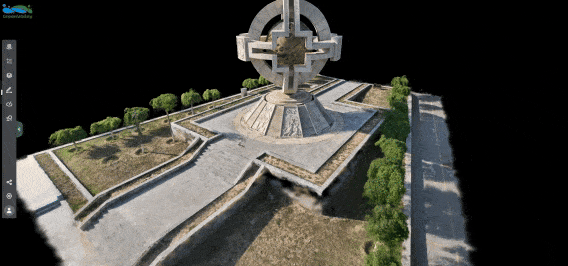
3DGS Reconstruction
LiShare allows users to upload point cloud data via desktop software for cloud-based Gaussian Splatting reconstruction. It efficiently processes large-scale scene data and incorporates dynamic LOD (Level of Detail) technology, which intelligently loads models with appropriate precision based on viewing distance. This ensures a smooth and lag-free experience whether performing online previews, scene exploration, accurate measurement, or annotation. With seamless one-click sharing of high-definition, fluid browsing results, the platform significantly enhances collaborative efficiency.
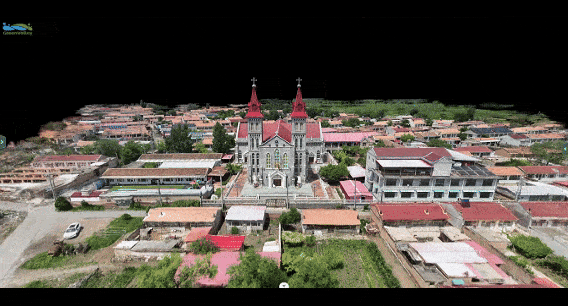
Large-scale scenes

Mobile support
LiShare: Unified 3D View
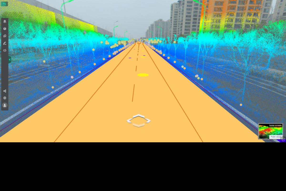
LiShare supports the upload of point cloud, vector, panorama, 3D model, and 3DGS data from desktop software for online browsing, analysis, measurement, roaming, and split-screen comparison.
 Online browsing
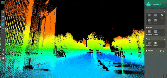 Measurement
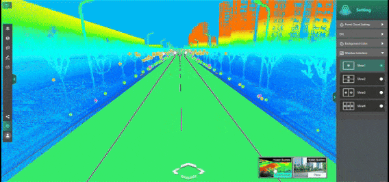 Roaming
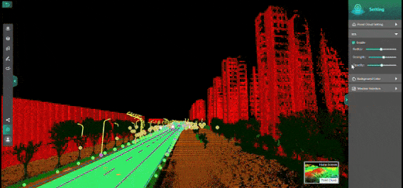 Multi-screen comparison
LiShare: Smart LiDAR Rendering
LiShare supports multiple LiDAR point cloud rendering modes, offering powerful capabilities for visualization and analysis. AI-based intelligent classification automatically identifies object types, while intensity and elevation modes reflect physical properties. RGB mode displays true color, and echo analysis reveals laser reflection characteristics. Additional attributes enable differentiated display and classification based on factors such as status and type, and Tree ID mode supports individual tree recognition and statistics.


High-end has no shortcomings
Advanced point cloud rendering enables real-time loading and smooth interaction with large-scale data.

Safety and Security
End-to-end encryption ensures strict data privacy and system security.
Somatosensory leading
It accesses PCs, tablets, and mobile phones, supports all data formats from GreenValley PC software, and features built-in multi-user collaboration.
Applications
 Surveying and mapping and geographic information
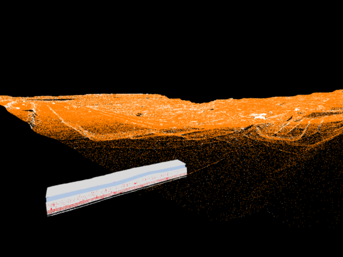 Construction & Engineering
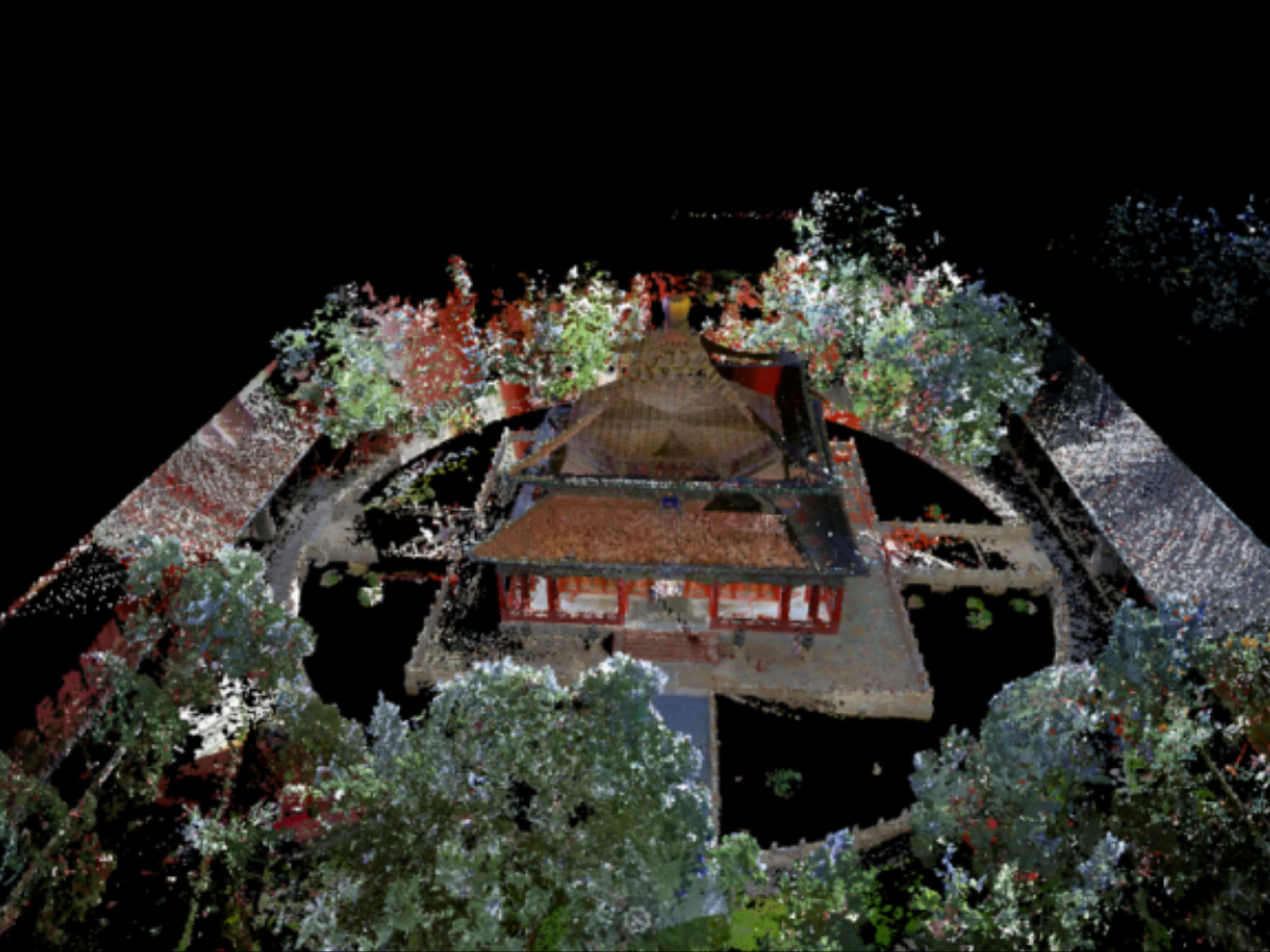
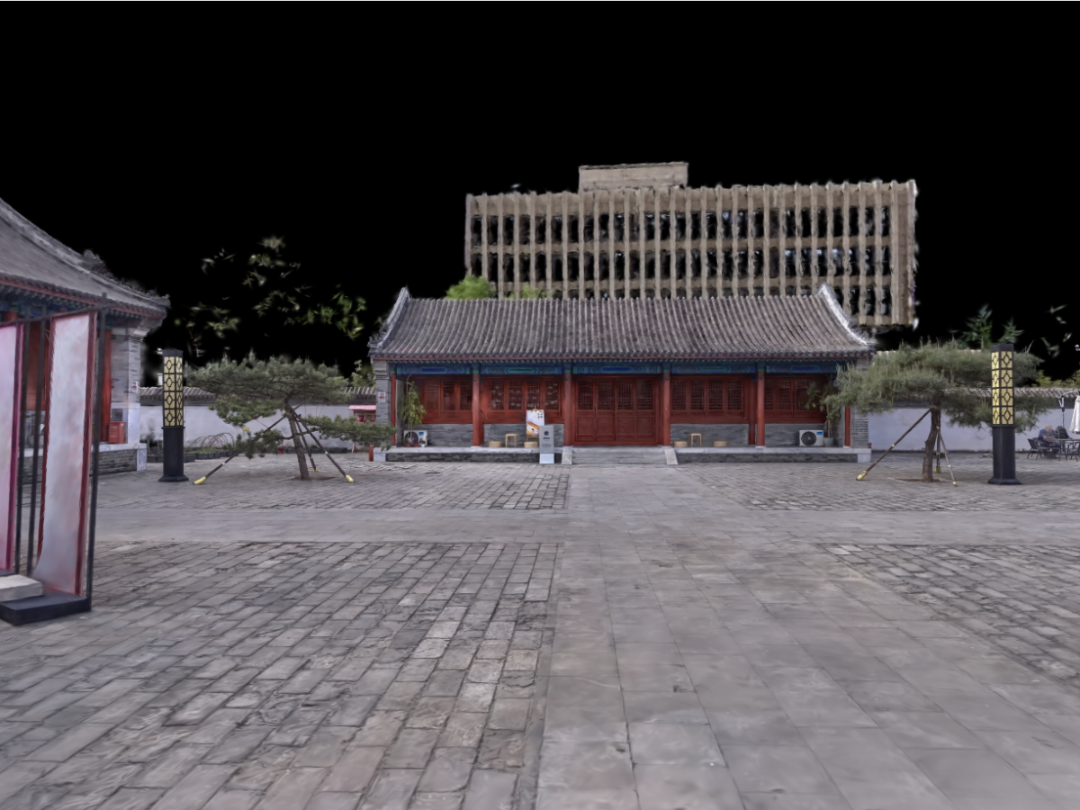 Preservation of cultural heritage
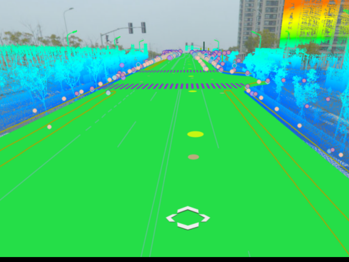 Smart Cities
Related Products
 LiDAR360Learn More
 LiDAR360MLSLearn More
 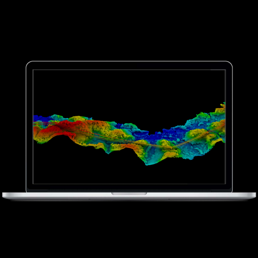 LiPowerlineLearn More
  LiGrip O2 LiteLearn More
 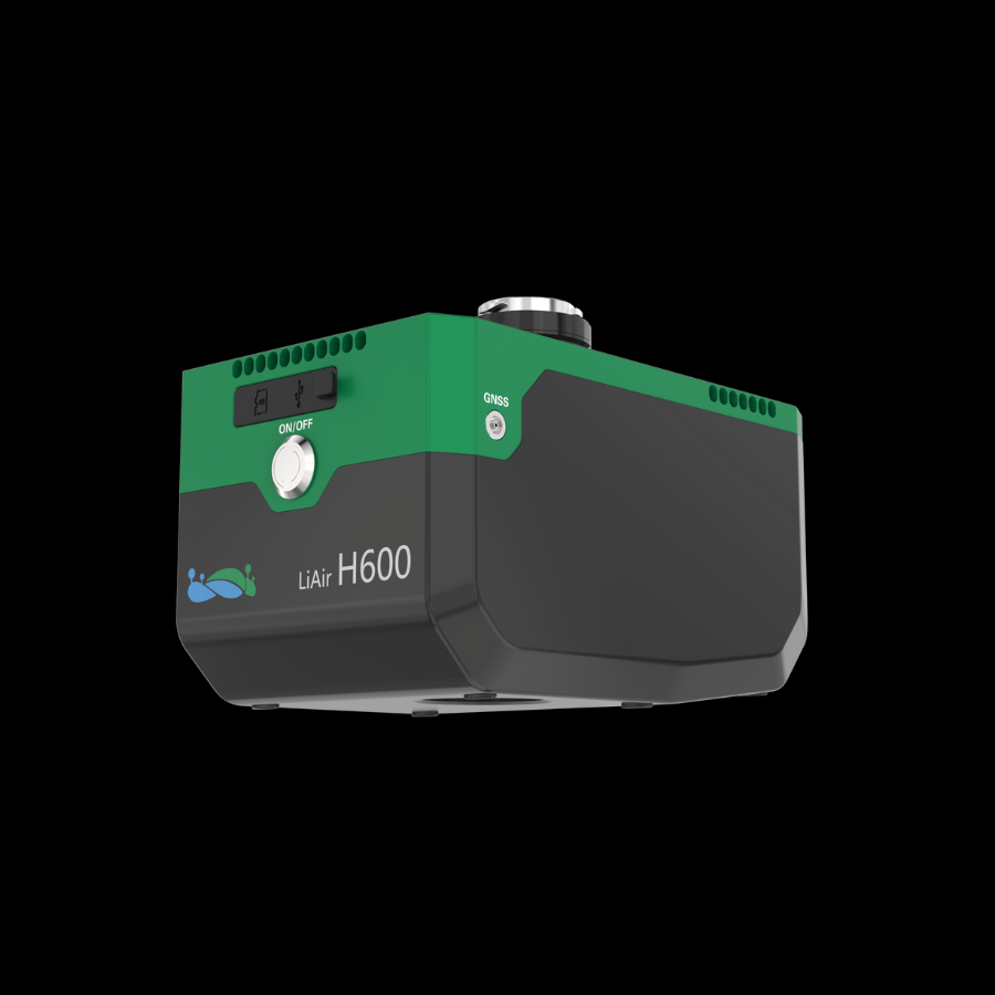 LiAir H600Learn More
 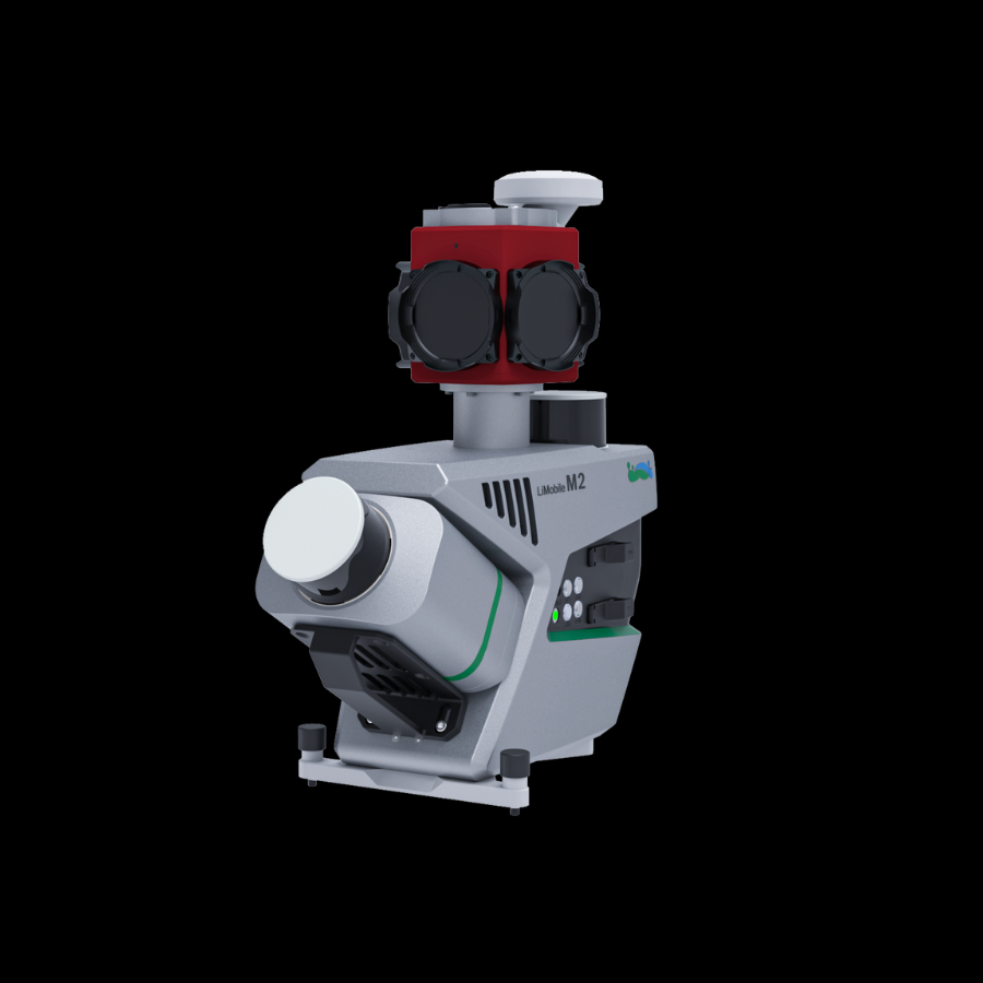 LiMobile M2Learn More
 GreenValley International Inc (GVI), headquartered in Berkeley, California, is a leading innovator of 3D mapping technologies. GVI provides a wide range of advanced aerial, terrestrial, and mobile LiDAR survey and mapping hardware systems and cutting-edge software as well as turnkey solutions. Our portfolio includes airborne, handheld, mobile, and backpack laser scanning platforms, as well as point cloud processing software such as the LiDAR360 LiDAR data processing platform. GVI focuses on LiDAR and image fusion technology, specializing in LiDAR, UAV, SLAM, Photogrammetry, and other technologies to achieve an accurate digital representation of three-dimensional space. As we continue to expand our reach and technological capabilities, GVI remains committed to driving innovation and pushing the boundaries of what's possible in the LiDAR space.
+1(510)345-2899info@greenvalleyintl.com 729 Heinz Avenue, Suite 9, Berkeley, California 94710, USA Subscribe
Copyright © 2026 GreenValley International Inc. All Rights Reserved.
