Range
300 m
Pulse Repetition Rate
Up to 1000 kHz
LiDAR Precision
1 mm
Absolute Accuracy
≤ 3 cm

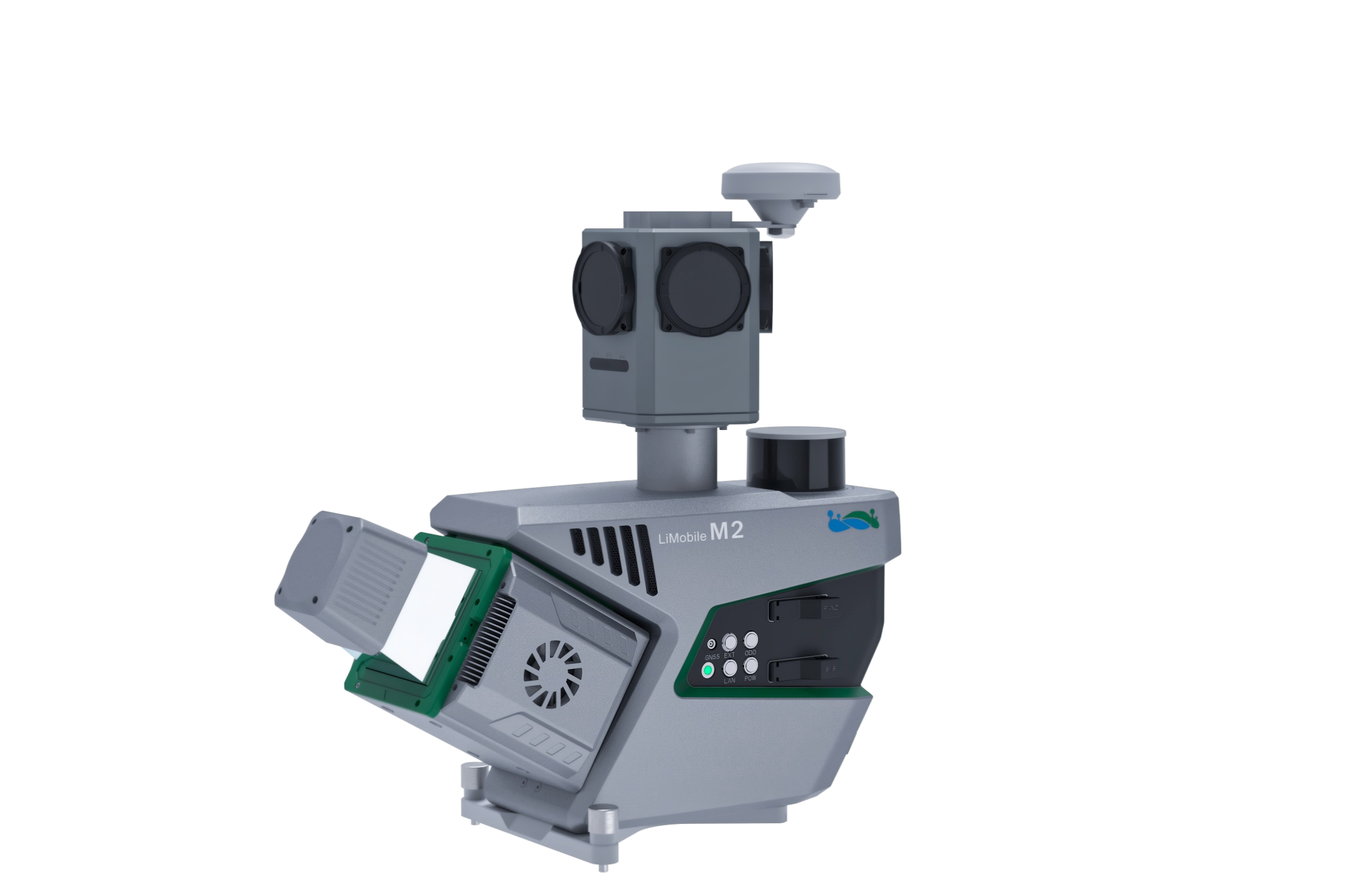
Panorama Camera

Full-Scenario SLAM

Abundant Expansion

AI Algorithm
Abundant Expansion, Customizable Combination
Compatible with optional Pavement Camera, Front Camera, Ladybug5+, Ladybug6, Distance Measurement Indicator (DMI) , and other external sensors.
Planar Camera
The pavement camera focuses on the road surface for a detailed pavement analysis. The front camera captures traffic signs at high resolution.
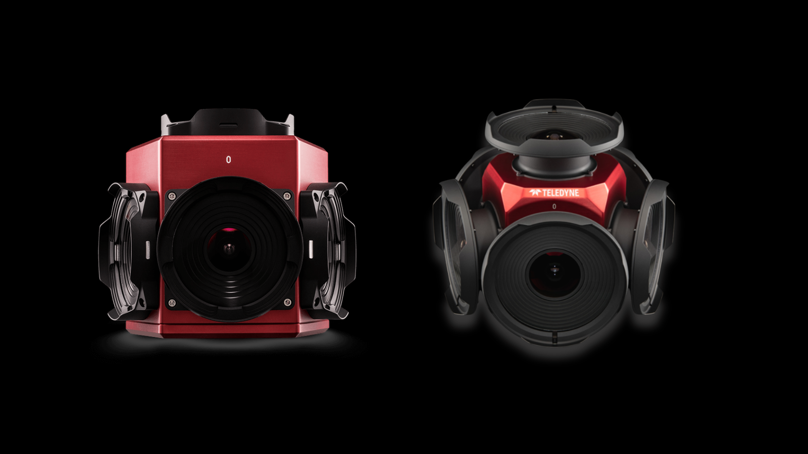
Ladybug5+/Ladybug6
Ladybug5+/Ladybug6, flexible 30 MP and 72 MP options allow you to select the right camera for your specific needs.
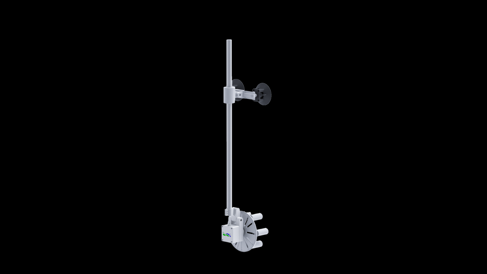
Distance Measurement Indicator
The DMI provides assistance when satellite signals are blocked or unavailable, improving system stability.
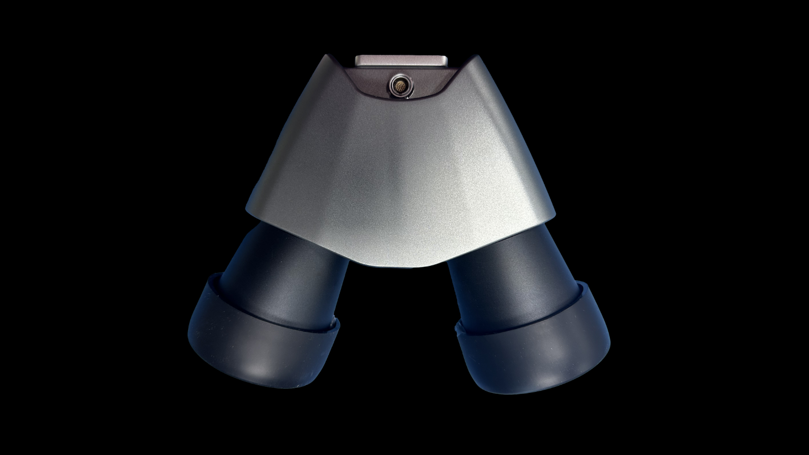
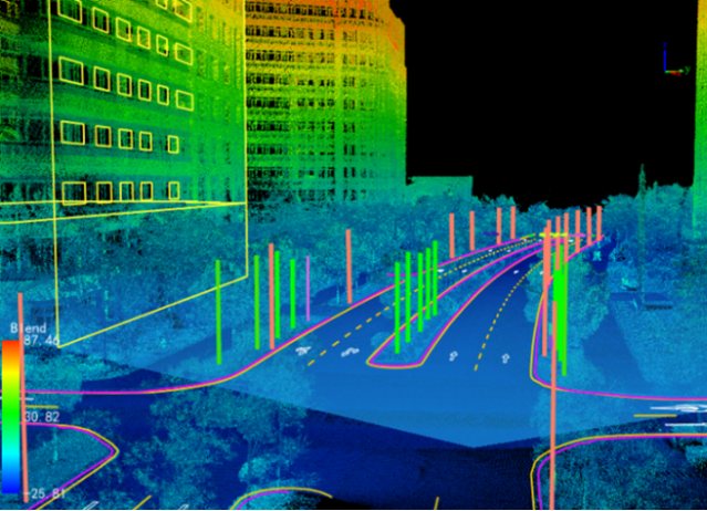
Survey-Grade LiDAR. Unmatched Detail.
Engineered for accuracy and density, the LiDAR sensor delivers precise point clouds with fine structural detail, ensuring dependable results for demanding mapping applications.
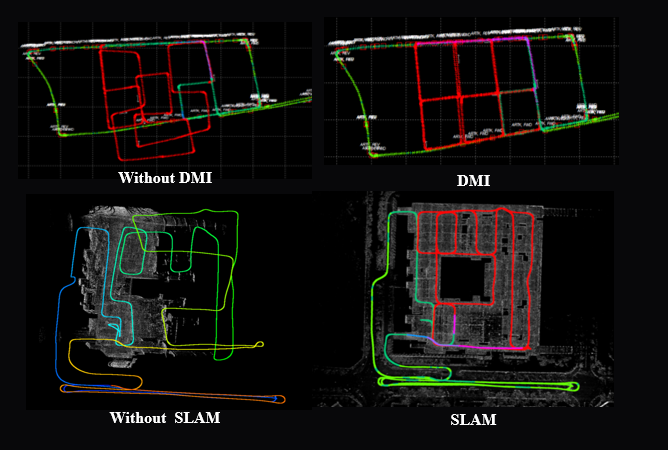
Built for Any Scenario
DMI-enhanced full-scenario SLAM ensures stable trajectory and accurate 3D mapping—anywhere, even in GNSS-denied areas.

Highly integrated, flexible installation
Integrated equipment with a quick-release design allows for rapid installation and removal. Seven predefined mounting angles (0°, ±15°, ±30°, ±45°) can be flexibly selected to meet the needs of different projects.
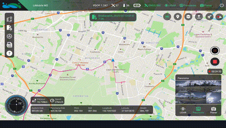
Instant Insight, Total Control
The newly designed data collection APP features a guided operational process, enabling real-time monitoring of data and location, and ensuring convenient access to all critical information.
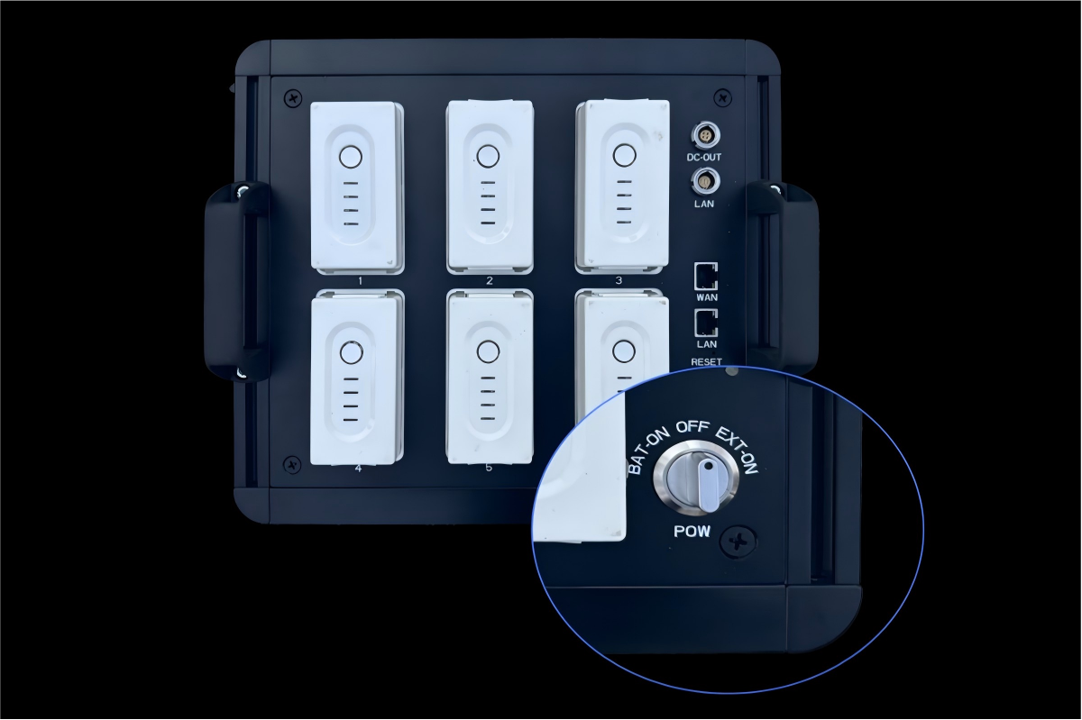
Long-lasting Power, Continuous Operation
It supports an external power supply, enabling efficient and uninterrupted operation.
Application Scenarios
 GIS Asset
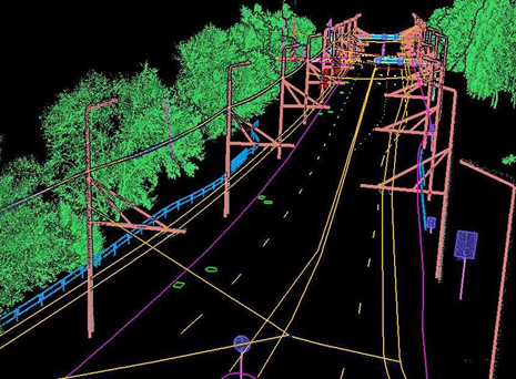 Holographic Digitalization of Road Elements
 HD Map
 Digital Twin
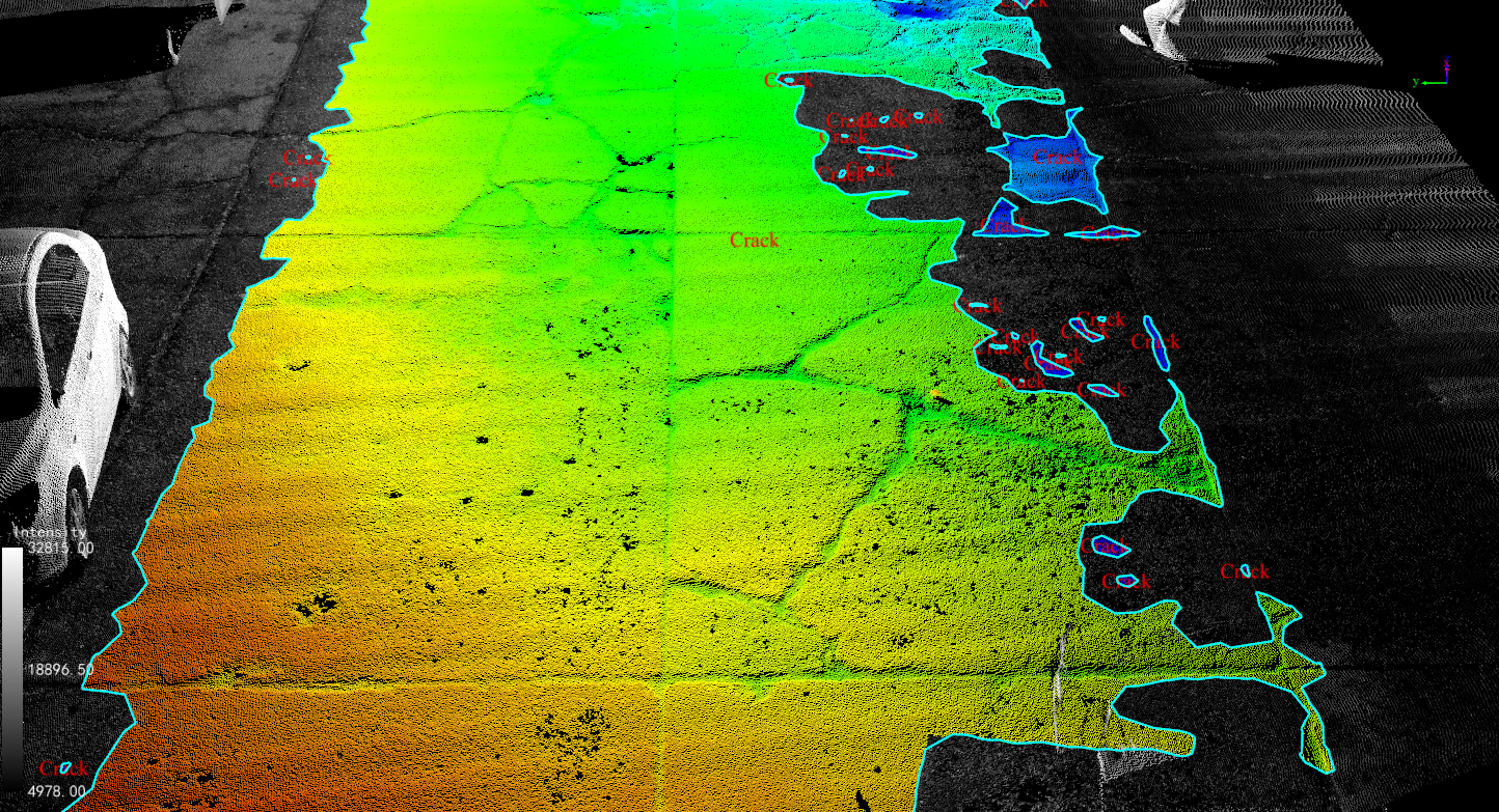 Road Maintenance Analysis
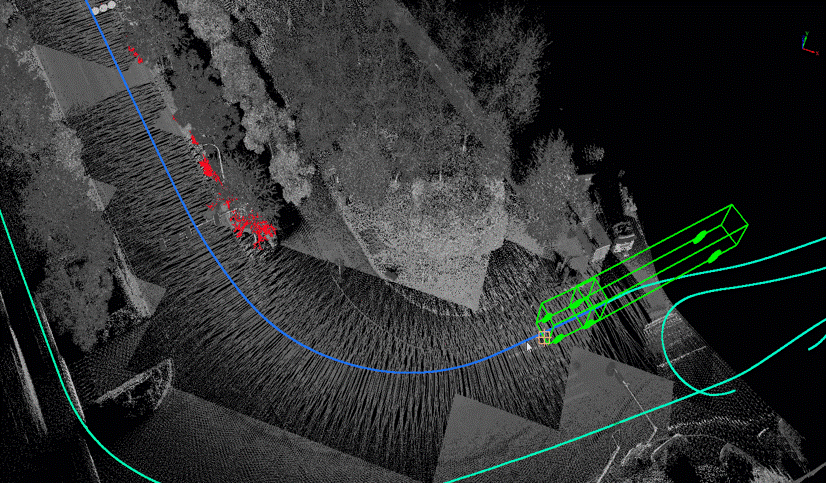 Vehicle Passability Analysis
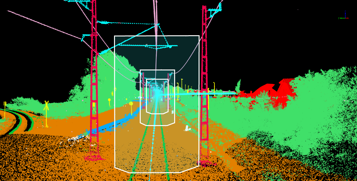 Railway Safety Analysis
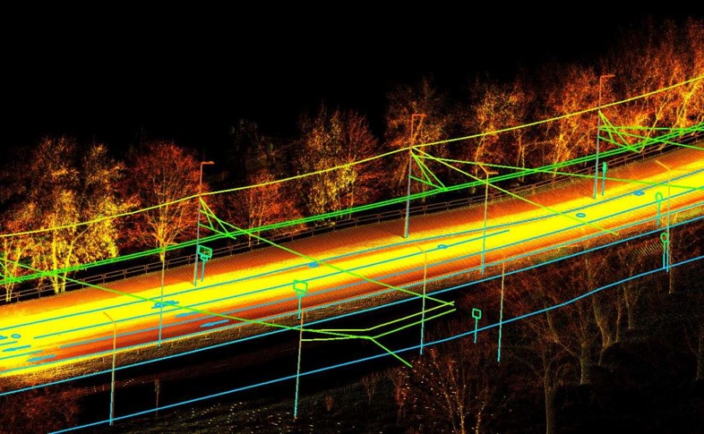 Urban Power Survey and Analysis
GreenValley International Inc (GVI), headquartered in Berkeley, California, is a leading innovator of 3D mapping technologies. GVI provides a wide range of advanced aerial, terrestrial, and mobile LiDAR survey and mapping hardware systems and cutting-edge software as well as turnkey solutions. Our portfolio includes airborne, handheld, mobile, and backpack laser scanning platforms, as well as point cloud processing software such as the LiDAR360 LiDAR data processing platform. GVI focuses on LiDAR and image fusion technology, specializing in LiDAR, UAV, SLAM, Photogrammetry, and other technologies to achieve an accurate digital representation of three-dimensional space. As we continue to expand our reach and technological capabilities, GVI remains committed to driving innovation and pushing the boundaries of what's possible in the LiDAR space.
