


Weight
1.3 kg
Absolute Accuracy
<3 cm
LiDAR Scan Rate
200,000 pts/s
Maximum Detection Range
70 m
Panoramic Camera
12 MP x 2
VSLAM
1.3 MP x 2
Storage Capacity
512 GB SSD
Horizontality/Verticality
<0.025°

- Innovatively developed MLF-SLAM algorithm.
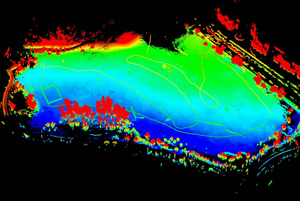
- Effortlessly captures data in weak or featureless environments such as airports, beaches, and water surfaces.
Featureless Data Acquisition

- 3 cm accuracy with precise horizontal & vertical alignment.
- Meets surveying-grade standards and streamlines fieldwork.
Precision Data, Outstanding Performance

- Dual 12 MP panoramic cameras: Microsecond-level synchronization to realistically restore scenes.
- Visual SLAM (VSLAM) and LiDAR-SLAM deep fusion algorithm: Enables precise mapping in complex environments.
High-defnition Panoramic + Visual SLAM Camera
VSLAM-Assisted Stable 3D Mapping in Feature-Deprived and Structurally Repetitive Environments (e.g. tunnels, pipelines) will be officially supported via firmware and software updates in July 2025.

- Real-time true-color point cloud mapping, ready for instant export.
- Supports diverse applications like earthwork calculation, tree segmentation, and topographic mapping.
Real-time Processing and Colorization, Exportable for Use

- Integrated solution for multi-source data collection.
- Outputs point clouds, images, 3DGS, MESH, and more—boosting efficiency and cutting costs.
One-time Data Collection, Multi-dimensional Output

- Self-developed RTK-SLAM technology.
- With a telescopic pole, enables full range high-precision RTK data collection.
- Achieves <5 cm accuracy in 1 minute, even without GNSS.
RTK-SLAM Collection Mode
Multi-form Data Collection
In addition to Handheld form, it supports various data collection configurations, including Backpack, Frontpack, and Telescopic Pole, enabling flexible adaptation to diverse customer collection scenarios.
 Backpack Kit
 Frontpack Kit
 Telescopic Pole
Supporting Software
 GreenValley APPLearn More
 LiDAR360MLSLearn More
  LiDAR360Learn More
 Application Scenarios
 Open Scene Measurement
 Topographic Surveying
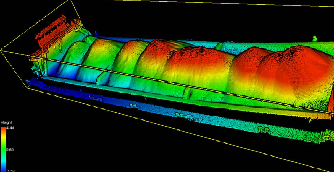 Stockpile Measurement
 Forestry Survey
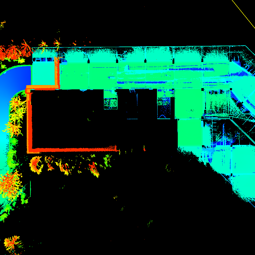 Underground Space Information Collection
 Real Estate Surveying
 Construction Surveying
 Trafic Accident Investigation
GreenValley International Inc (GVI), headquartered in Berkeley, California, is a leading innovator of 3D mapping technologies. GVI provides a wide range of advanced aerial, terrestrial, and mobile LiDAR survey and mapping hardware systems and cutting-edge software as well as turnkey solutions. Our portfolio includes airborne, handheld, mobile, and backpack laser scanning platforms, as well as point cloud processing software such as the LiDAR360 LiDAR data processing platform. GVI focuses on LiDAR and image fusion technology, specializing in LiDAR, UAV, SLAM, Photogrammetry, and other technologies to achieve an accurate digital representation of three-dimensional space. As we continue to expand our reach and technological capabilities, GVI remains committed to driving innovation and pushing the boundaries of what's possible in the LiDAR space.